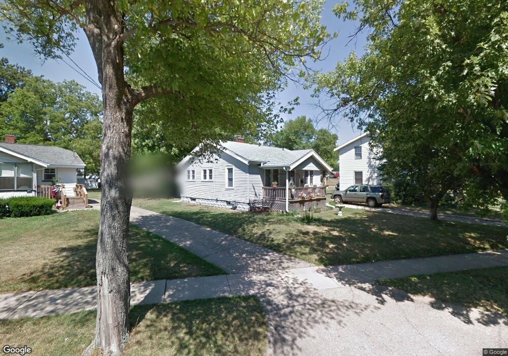
409 S 20th St Decatur, IL 62521
Lions Park NeighborhoodEstimated Value: $56,446 - $73,000
2
Beds
1
Bath
--
Sq Ft
10,454
Sq Ft Lot
About This Home
This home is located at 409 S 20th St, Decatur, IL 62521 and is currently estimated at $62,362. 409 S 20th St is a home located in Macon County with nearby schools including Muffley Elementary School, Stephen Decatur Middle School, and Robertson Charter School.
Ownership History
Date
Name
Owned For
Owner Type
Purchase Details
Closed on
Jun 1, 2014
Current Estimated Value
Purchase Details
Closed on
Jan 1, 2010
Purchase Details
Closed on
Dec 29, 2009
Sold by
Secretary Of Hud
Bought by
Myers Donald Gene
Purchase Details
Closed on
May 26, 2009
Sold by
Oldfield Clark Daniel
Bought by
Secretary Of Hud
Purchase Details
Closed on
Jan 1, 2004
Create a Home Valuation Report for This Property
The Home Valuation Report is an in-depth analysis detailing your home's value as well as a comparison with similar homes in the area
Home Values in the Area
Average Home Value in this Area
Purchase History
| Date | Buyer | Sale Price | Title Company |
|---|---|---|---|
| -- | $25,000 | -- | |
| -- | $21,500 | -- | |
| Myers Donald Gene | -- | Lakeside Titlw & Escrow Titl | |
| Secretary Of Hud | -- | None Available | |
| -- | $32,000 | -- |
Source: Public Records
Tax History Compared to Growth
Tax History
| Year | Tax Paid | Tax Assessment Tax Assessment Total Assessment is a certain percentage of the fair market value that is determined by local assessors to be the total taxable value of land and additions on the property. | Land | Improvement |
|---|---|---|---|---|
| 2024 | $1,347 | $13,917 | $3,175 | $10,742 |
| 2023 | $1,336 | $13,425 | $3,063 | $10,362 |
| 2022 | $1,251 | $12,235 | $2,834 | $9,401 |
| 2021 | $1,176 | $11,426 | $2,647 | $8,779 |
| 2020 | $1,159 | $10,895 | $2,524 | $8,371 |
| 2019 | $1,159 | $10,895 | $2,524 | $8,371 |
| 2018 | $1,224 | $11,647 | $2,537 | $9,110 |
| 2017 | $1,253 | $11,958 | $2,605 | $9,353 |
| 2016 | $1,276 | $12,080 | $2,632 | $9,448 |
| 2015 | $1,213 | $11,866 | $2,585 | $9,281 |
| 2014 | $1,126 | $11,748 | $2,559 | $9,189 |
| 2013 | $1,164 | $12,189 | $2,655 | $9,534 |
Source: Public Records
Map
Nearby Homes
- 2152 E Decatur St
- 245 S 20th St
- 2111 E Wood St
- 1764 E Johns Ave
- 2104 E Whitmer St
- 1753 E Clay St
- 2039 E Whitmer St
- 729 S 22nd St
- 1656 E Wood St
- 1645 E Wood St
- 632 S 17th St
- 1850 E Prairie St
- 1605 E Clay St
- 111 S 24th+520 E Division+870 N Union St
- 340 N 17th St
- 1644 E William St
- 425 N 18th St
- 203 S 25th St
- 1329 E Main St
- 1525 E North St
- 421 S 20th St
- 401 S 20th St
- 1973 E Johns Ave
- 431 S 20th St
- 422 S 20th St
- 414 S 20th St
- 1963 E Johns Ave
- 441 S 20th St
- 402 S 20th St
- 432 S 20th St
- 442 S 20th St
- 452 S 20th St
- 1953 E Johns Ave
- 451 S 20th St
- 1976 E Decatur St
- 1952 E Johns Ave
- 1943 E Johns Ave
- 2034 E Decatur St
- 1966 E Decatur St
- 504 S 21st St