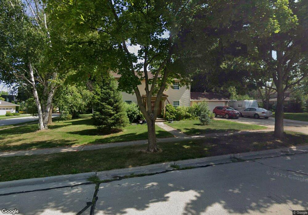
409 Wilcox Ct de Pere, WI 54115
Estimated Value: $350,000 - $434,000
12
Beds
6
Baths
4,261
Sq Ft
$88/Sq Ft
Est. Value
About This Home
This home is located at 409 Wilcox Ct, de Pere, WI 54115 and is currently estimated at $373,034, approximately $87 per square foot. 409 Wilcox Ct is a home located in Brown County with nearby schools including Susie C. Altmayer Elementary School, Foxview Intermediate School, and De Pere Middle School.
Ownership History
Date
Name
Owned For
Owner Type
Purchase Details
Closed on
Oct 5, 2020
Sold by
Byczek Ronald
Bought by
Charleston Pointe Holdings Iii Llc
Current Estimated Value
Purchase Details
Closed on
Aug 24, 2007
Sold by
Galvin Marjorie C
Bought by
Lerch John L and Lerch Judith A
Create a Home Valuation Report for This Property
The Home Valuation Report is an in-depth analysis detailing your home's value as well as a comparison with similar homes in the area
Home Values in the Area
Average Home Value in this Area
Purchase History
| Date | Buyer | Sale Price | Title Company |
|---|---|---|---|
| Charleston Pointe Holdings Iii Llc | -- | None Available | |
| Lerch John L | $150,000 | Bay Title & Abstract Inc | |
| Galvin Marjorie C | -- | Bay Title & Abstract Inc |
Source: Public Records
Tax History
| Year | Tax Paid | Tax Assessment Tax Assessment Total Assessment is a certain percentage of the fair market value that is determined by local assessors to be the total taxable value of land and additions on the property. | Land | Improvement |
|---|---|---|---|---|
| 2025 | $4,141 | $297,100 | $43,600 | $253,500 |
| 2024 | $4,106 | $270,300 | $41,500 | $228,800 |
| 2023 | $3,520 | $261,000 | $41,500 | $219,500 |
| 2022 | $3,310 | $232,800 | $41,500 | $191,300 |
| 2021 | $3,049 | $203,400 | $34,600 | $168,800 |
| 2020 | $3,136 | $190,500 | $34,600 | $155,900 |
| 2019 | $3,232 | $180,800 | $34,600 | $146,200 |
| 2018 | $3,238 | $165,100 | $34,600 | $130,500 |
| 2017 | $2,984 | $147,800 | $34,600 | $113,200 |
| 2016 | $3,024 | $147,800 | $34,600 | $113,200 |
| 2015 | $3,541 | $149,700 | $34,600 | $115,100 |
| 2014 | $3,171 | $149,700 | $34,600 | $115,100 |
| 2013 | $3,171 | $149,700 | $34,600 | $115,100 |
Source: Public Records
Map
Nearby Homes
- 814 3rd St
- 801 S Erie St
- 1208 S Erie St
- 308 S Superior St
- 1109 S 6th St
- 416 Lansdowne St
- 400 Battery Ave
- 911 S 7th St
- 555 Main Ave Unit 113
- 555 Main Ave Unit 111
- 555 Main Ave Unit 206
- 318 S Webster Ave
- 1861 Chicago St
- 115 S Washington St
- 253 Scout Way
- 735 Morning Glory Ln
- 417 Fulton St
- 621 N Huron St
- 1129 Suburban Dr
- 412 Fort Howard Ave
- 1115 Fox River Dr
- 415 Wilcox Ct
- 1207 Fox River Dr
- 400 Cook St
- 1120 Fox River Dr
- 1202 Fox River Dr
- 412 Wilcox Ct
- 1116 Fox River Dr
- 423 Wilcox Ct
- 1211 Fox River Dr
- 1208 Fox River Dr
- 416 Wilcox Ct
- 414 Cook St
- 1106 Fox River Dr
- 427 Wilcox Ct
- 422 Wilcox Ct
- 420 Cook St
- 1210 Fox River Dr
- 405 N Saint Bernard Dr Unit 407
- 411 N Saint Bernard Dr Unit 413
Your Personal Tour Guide
Ask me questions while you tour the home.