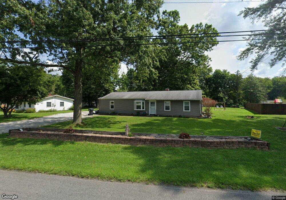
4092 Sabin Dr Rootstown, OH 44272
Estimated Value: $206,000 - $269,000
5
Beds
2
Baths
1,720
Sq Ft
$139/Sq Ft
Est. Value
About This Home
This home is located at 4092 Sabin Dr, Rootstown, OH 44272 and is currently estimated at $239,877, approximately $139 per square foot. 4092 Sabin Dr is a home located in Portage County with nearby schools including Rootstown Middle School - Schnee Building and Rootstown High School.
Ownership History
Date
Name
Owned For
Owner Type
Purchase Details
Closed on
Dec 20, 2013
Sold by
Hamrick Vera Mae
Bought by
Barthol Jason P
Current Estimated Value
Home Financials for this Owner
Home Financials are based on the most recent Mortgage that was taken out on this home.
Original Mortgage
$40,000
Outstanding Balance
$29,391
Interest Rate
4.17%
Mortgage Type
Purchase Money Mortgage
Estimated Equity
$210,486
Purchase Details
Closed on
Dec 13, 2007
Sold by
Estate Of Paul H Hamrick
Bought by
Hamrick Vera M
Purchase Details
Closed on
Jan 1, 1990
Bought by
Hamrick Paul H
Create a Home Valuation Report for This Property
The Home Valuation Report is an in-depth analysis detailing your home's value as well as a comparison with similar homes in the area
Purchase History
| Date | Buyer | Sale Price | Title Company |
|---|---|---|---|
| Barthol Jason P | $40,000 | None Available | |
| Hamrick Vera M | -- | None Available | |
| Hamrick Paul H | -- | -- |
Source: Public Records
Mortgage History
| Date | Status | Borrower | Loan Amount |
|---|---|---|---|
| Open | Barthol Jason P | $40,000 |
Source: Public Records
Tax History
| Year | Tax Paid | Tax Assessment Tax Assessment Total Assessment is a certain percentage of the fair market value that is determined by local assessors to be the total taxable value of land and additions on the property. | Land | Improvement |
|---|---|---|---|---|
| 2025 | $3,545 | $60,270 | $11,690 | $48,580 |
| 2024 | $3,390 | $60,270 | $11,690 | $48,580 |
| 2023 | $2,711 | $49,180 | $11,690 | $37,490 |
| 2022 | $3,211 | $49,180 | $11,690 | $37,490 |
| 2021 | $2,218 | $49,180 | $11,690 | $37,490 |
| 2020 | $2,324 | $44,000 | $11,690 | $32,310 |
| 2019 | $2,071 | $44,000 | $11,690 | $32,310 |
| 2018 | $1,844 | $37,100 | $11,690 | $25,410 |
| 2017 | $1,844 | $37,100 | $11,690 | $25,410 |
| 2016 | $1,810 | $37,100 | $11,690 | $25,410 |
| 2015 | $1,799 | $37,100 | $11,690 | $25,410 |
| 2014 | $1,832 | $37,100 | $11,690 | $25,410 |
| 2013 | $1,395 | $37,100 | $11,690 | $25,410 |
Source: Public Records
Map
Nearby Homes
- 4079 Siefer Dr
- 0 Lynn Rd Unit 5110102
- 3689 Cherry Hill
- 3701 State Route 44
- V/L 2 Lynn Rd
- V/L Lynn Rd
- 4415 Farmette Dr
- 4200 Hattrick Rd
- sub lot Lane Ave
- 0 Tallmadge Rd Unit 5189301
- 0 Tallmadge Rd Unit 5189314
- 4556 Rootstown Rd
- 4140 Sandy Lake Rd
- 4058 Bayberry Knoll Ln
- 3637 Old Forge Rd
- 5394 Juniper Ct
- 3021 Hartville Rd
- 3925 Summit Rd
- 2978 Sandy Lake Rd
- 1065 Shadowlawn Dr
Your Personal Tour Guide
Ask me questions while you tour the home.