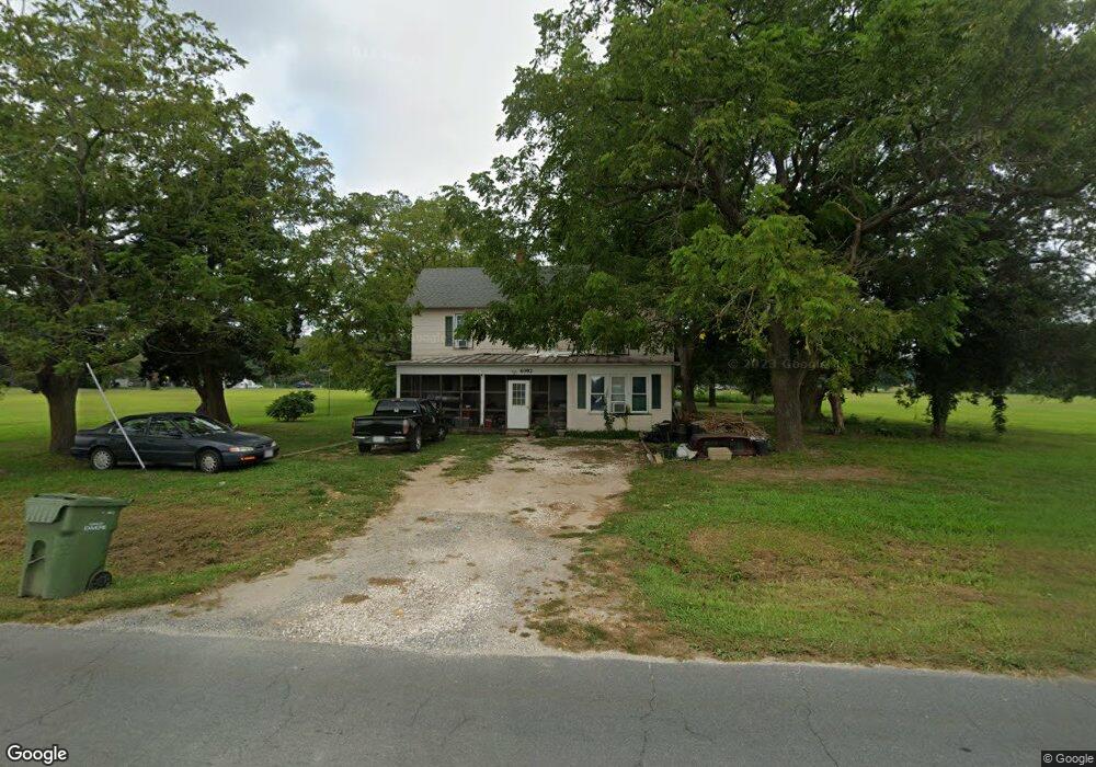
4092 Seaside Rd Exmore, VA 23350
Estimated Value: $148,000 - $221,000
3
Beds
2
Baths
1,500
Sq Ft
$121/Sq Ft
Est. Value
About This Home
This home is located at 4092 Seaside Rd, Exmore, VA 23350 and is currently estimated at $181,954, approximately $121 per square foot. 4092 Seaside Rd is a home located in Northampton County with nearby schools including Northampton High School, Shore Christian Academy, and Broadwater Academy.
Ownership History
Date
Name
Owned For
Owner Type
Purchase Details
Closed on
Apr 15, 2015
Sold by
Crockett Trustee Iris M and Iris M Crockett Revoc Tr Agree
Bought by
Tyler William W and Riptide Real Estate Llc
Current Estimated Value
Purchase Details
Closed on
Oct 19, 2004
Sold by
Bowen Arline M
Bought by
Crockett Willie C and Crockett Iris M
Home Financials for this Owner
Home Financials are based on the most recent Mortgage that was taken out on this home.
Original Mortgage
$45,000
Interest Rate
5.83%
Mortgage Type
Credit Line Revolving
Create a Home Valuation Report for This Property
The Home Valuation Report is an in-depth analysis detailing your home's value as well as a comparison with similar homes in the area
Home Values in the Area
Average Home Value in this Area
Purchase History
| Date | Buyer | Sale Price | Title Company |
|---|---|---|---|
| Tyler William W | $24,000 | -- | |
| Crockett Willie C | $35,000 | None Available |
Source: Public Records
Mortgage History
| Date | Status | Borrower | Loan Amount |
|---|---|---|---|
| Previous Owner | Crockett Willie C | $45,000 |
Source: Public Records
Tax History
| Year | Tax Paid | Tax Assessment Tax Assessment Total Assessment is a certain percentage of the fair market value that is determined by local assessors to be the total taxable value of land and additions on the property. | Land | Improvement |
|---|---|---|---|---|
| 2024 | $823 | $120,200 | $22,600 | $97,600 |
| 2023 | $440 | $57,900 | $14,600 | $43,300 |
| 2022 | $440 | $57,900 | $14,600 | $43,300 |
| 2021 | $418 | $50,100 | $13,000 | $37,100 |
| 2020 | $418 | $50,100 | $13,000 | $37,100 |
| 2019 | $415 | $50,000 | $13,000 | $37,000 |
| 2018 | $415 | $50,000 | $13,000 | $37,000 |
| 2017 | $420 | $50,000 | $13,000 | $37,000 |
| 2016 | $420 | $50,600 | $14,000 | $36,600 |
| 2015 | -- | $50,600 | $14,000 | $36,600 |
| 2011 | -- | $57,300 | $18,000 | $39,300 |
Source: Public Records
Map
Nearby Homes
- 12 ACRES Willis Wharf Rd Unit 93
- 3415 Willis Wharf Rd
- 4126 Main St
- 11505 Holly Cir
- 11522 Poplar Ave
- 4160 Hadlock Rd
- - Roosevelt Ave Unit A
- 3270 4th St
- 3264 Jackson St
- 0 Benjamin Street and Lankford Hwy Unit VANH2000036
- 3146 Monroe Ave
- 0 Lankford Hwy Unit VAAC2002166
- LOT 21, B & A Lankford Hwy
- Lot C Lankford Hwy Unit 43C
- Lot 21+ Lankford Hwy Unit 21+
- 5.75 AC Lankford Hwy
- Lot D Lankford Hwy Unit 43D
- 11 Lankford Hwy
- 12133 Crown Ave
- B-3 Ruth Wise Rd
- 4061 Willis Wharf Rd
- 4070 Willis Wharf Rd
- 4062 Willis Wharf Rd
- 00 Seaside Rd Unit 10
- 00 Seaside Rd Unit Mixed
- 38.4 AC Seaside Rd Unit 4
- 00 Seaside Rd
- 0 Seaside Rd Unit 10 26253
- 00 Seaside Rd Unit 21
- 0 Seaside Rd Unit 6 lot 24471
- 0 Seaside Rd Unit A,B 23556
- 0 Seaside Rd Unit 17422
- 0 Seaside Rd
- 10 Seaside Rd Unit 10
- 4158 Seaside Rd
- 30 Acres Willis Wharf Rd Unit 9,10+
- 36 Willis Wharf Rd Unit 36
- Lot 68 Willis Wharf Rd Unit 68
- 000 Willis Wharf Rd Unit 23
- 000 Willis Wharf Rd
Your Personal Tour Guide
Ask me questions while you tour the home.