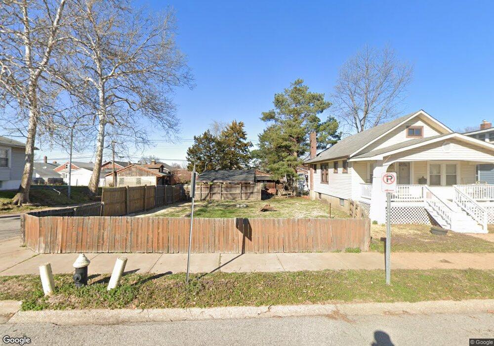
4095 Blow St Saint Louis, MO 63116
Boulevard Heights NeighborhoodEstimated Value: $108,286 - $197,000
1
Bed
1
Bath
758
Sq Ft
$205/Sq Ft
Est. Value
About This Home
This home is located at 4095 Blow St, Saint Louis, MO 63116 and is currently estimated at $155,322, approximately $204 per square foot. 4095 Blow St is a home located in St. Louis City with nearby schools including Woerner Elementary School, Long International Middle School, and Roosevelt High School.
Ownership History
Date
Name
Owned For
Owner Type
Purchase Details
Closed on
Nov 12, 2022
Sold by
Gregory Theodore Nathan
Bought by
Whitehead Caroline Rachel
Current Estimated Value
Purchase Details
Closed on
Jun 6, 2008
Sold by
Ward Randy
Bought by
Gregory Theodore N
Home Financials for this Owner
Home Financials are based on the most recent Mortgage that was taken out on this home.
Original Mortgage
$47,920
Interest Rate
6.08%
Mortgage Type
Purchase Money Mortgage
Purchase Details
Closed on
Aug 8, 2003
Sold by
Akers Elisabeth
Bought by
Brick Mark Enterprises Llc
Home Financials for this Owner
Home Financials are based on the most recent Mortgage that was taken out on this home.
Original Mortgage
$36,550
Interest Rate
5.35%
Mortgage Type
Purchase Money Mortgage
Create a Home Valuation Report for This Property
The Home Valuation Report is an in-depth analysis detailing your home's value as well as a comparison with similar homes in the area
Home Values in the Area
Average Home Value in this Area
Purchase History
| Date | Buyer | Sale Price | Title Company |
|---|---|---|---|
| Whitehead Caroline Rachel | -- | -- | |
| Gregory Theodore N | -- | None Available | |
| Brick Mark Enterprises Llc | -- | -- |
Source: Public Records
Mortgage History
| Date | Status | Borrower | Loan Amount |
|---|---|---|---|
| Previous Owner | Gregory Theodore N | $47,920 | |
| Previous Owner | Brick Mark Enterprises Llc | $36,550 |
Source: Public Records
Tax History Compared to Growth
Tax History
| Year | Tax Paid | Tax Assessment Tax Assessment Total Assessment is a certain percentage of the fair market value that is determined by local assessors to be the total taxable value of land and additions on the property. | Land | Improvement |
|---|---|---|---|---|
| 2025 | $816 | $10,260 | $3,760 | $6,500 |
| 2024 | $777 | $9,410 | $3,760 | $5,650 |
| 2023 | $777 | $9,410 | $3,760 | $5,650 |
| 2022 | $763 | $8,890 | $3,760 | $5,130 |
| 2021 | $762 | $8,890 | $3,760 | $5,130 |
| 2020 | $702 | $8,230 | $3,760 | $4,470 |
| 2019 | $700 | $8,230 | $3,760 | $4,470 |
| 2018 | $673 | $7,650 | $3,340 | $4,310 |
| 2017 | $662 | $7,660 | $3,340 | $4,310 |
| 2016 | $678 | $7,750 | $3,340 | $4,410 |
| 2015 | $616 | $7,750 | $3,340 | $4,410 |
| 2014 | $613 | $7,750 | $3,340 | $4,410 |
| 2013 | -- | $7,710 | $3,340 | $4,370 |
Source: Public Records
Map
Nearby Homes
- 4138 Loughborough Ave
- 4153 Loughborough Ave
- 4028 Quincy St
- 4311 Loughborough Ave
- 4323 Loughborough Ave
- 4102 Upton Ct
- 4114 Alma Ave
- 6815 Parkwood Place
- 6925 Wanda Ct
- 7316 Sharp Ave
- 6833 Wanda Ave
- 4317 Koeln Ave
- 4317 Alma Ave
- 4116 Koeln Ave
- 6613 Parkwood Place
- 4329 Alma Ave
- 6509 Morganford Rd
- 6522 Parkwood Place
- 7119 Trainor Place
- 7123 Trainor Place