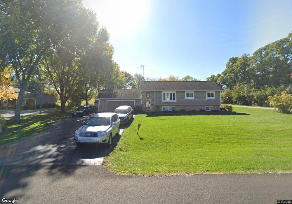
40W483 Apache Ln Huntley, IL 60142
Estimated Value: $430,000 - $517,000
--
Bed
1
Bath
2,434
Sq Ft
$188/Sq Ft
Est. Value
About This Home
This home is located at 40W483 Apache Ln, Huntley, IL 60142 and is currently estimated at $458,626, approximately $188 per square foot. 40W483 Apache Ln is a home located in Kane County with nearby schools including Gilberts Elementary School, Dundee Middle School, and Hampshire High School.
Ownership History
Date
Name
Owned For
Owner Type
Purchase Details
Closed on
Sep 6, 2014
Sold by
Carlson Darcy S and Carlson George A
Bought by
Carlson George A and Carlson Darcy S
Current Estimated Value
Purchase Details
Closed on
Jan 21, 2004
Sold by
Carlson Darcy S and Jerstad Darcy S
Bought by
Carlson George A and Carlson Darcy S
Home Financials for this Owner
Home Financials are based on the most recent Mortgage that was taken out on this home.
Original Mortgage
$176,000
Interest Rate
5.91%
Mortgage Type
New Conventional
Purchase Details
Closed on
May 26, 1999
Sold by
Jerstad Kenneth P
Bought by
Jerstad Darcy S
Purchase Details
Closed on
Nov 15, 1995
Sold by
Ritter Darcy S
Bought by
Jerstad Ken P and Ritter Darcy S
Create a Home Valuation Report for This Property
The Home Valuation Report is an in-depth analysis detailing your home's value as well as a comparison with similar homes in the area
Home Values in the Area
Average Home Value in this Area
Purchase History
| Date | Buyer | Sale Price | Title Company |
|---|---|---|---|
| Carlson George A | -- | None Available | |
| Carlson George A | -- | Chicago Title Insurance Comp | |
| Jerstad Darcy S | -- | -- | |
| Jerstad Ken P | -- | Chicago Title Insurance Co |
Source: Public Records
Mortgage History
| Date | Status | Borrower | Loan Amount |
|---|---|---|---|
| Previous Owner | Carlson George A | $176,000 |
Source: Public Records
Tax History Compared to Growth
Tax History
| Year | Tax Paid | Tax Assessment Tax Assessment Total Assessment is a certain percentage of the fair market value that is determined by local assessors to be the total taxable value of land and additions on the property. | Land | Improvement |
|---|---|---|---|---|
| 2024 | $5,913 | $107,334 | $16,486 | $90,848 |
| 2023 | $4,026 | $97,065 | $14,909 | $82,156 |
| 2022 | $5,619 | $89,494 | $13,746 | $75,748 |
| 2021 | $5,438 | $84,174 | $12,929 | $71,245 |
| 2020 | $4,727 | $82,025 | $12,599 | $69,426 |
| 2019 | $4,805 | $78,726 | $12,092 | $66,634 |
| 2018 | $5,355 | $73,887 | $11,349 | $62,538 |
| 2017 | $5,039 | $68,550 | $14,410 | $54,140 |
| 2016 | $4,989 | $65,261 | $13,719 | $51,542 |
| 2015 | -- | $61,637 | $12,957 | $48,680 |
| 2014 | -- | $56,151 | $12,957 | $43,194 |
| 2013 | -- | $57,181 | $13,195 | $43,986 |
Source: Public Records
Map
Nearby Homes
- 18N647 Ridgefield Blvd
- 946 Glacial Falls Dr
- 11061 Bayou Ct
- 10613 Rushmore Ln
- 11805 Blue Bayou Dr
- 10174 Hopkins St
- 11680 Cape Cod Ln
- 12965 Oak Grove Dr
- 12250 Songbird Ln
- 10569 Lancaster St
- 12298 Winding Creek Loop
- 11581 Beacon Ave
- Lot 277033 Galligan Rd
- Lot 480017 Galligan Rd
- Lot 499001 Galligan Rd
- 70 acres Galligan Rd
- Lot 230001 Galligan Rd
- 11536 Bethel Ave
- 12303 Fox Run Ct
- 11391 Saxony St
- 40W457 Apache Ln
- 40W480 Apache Ln Unit 1
- 40W433 Apache Ln
- 18N842 Barko Pkwy Unit 1
- 40W420 Apache Ln Unit 1
- 42 Apache Ln
- 18N839 Barko Pkwy Unit 1
- 18N862 Barko Pkwy
- 18N861 Barko Pkwy
- 18N816 Aztec Ln
- 18N884 Barko Pkwy
- 18N780 Aztec Ln
- 18N840 Aztec Ln
- 18N883 Barko Pkwy
- 18N858 Aztec Ln
- 18N908 Barko Pkwy
- 40W345 Apache Ln
- 18N900 Powers Rd
- 40W344 Apache Ln
- 18N907 Barko Pkwy Unit 1