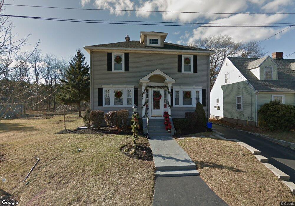
41 Adele Rd Quincy, MA 02169
Estimated Value: $718,289 - $821,000
4
Beds
3
Baths
1,576
Sq Ft
$476/Sq Ft
Est. Value
About This Home
This home is located at 41 Adele Rd, Quincy, MA 02169 and is currently estimated at $750,822, approximately $476 per square foot. 41 Adele Rd is a home located in Norfolk County with nearby schools including South West Middle School, Lincoln-Hancock Community School, and Quincy High School.
Ownership History
Date
Name
Owned For
Owner Type
Purchase Details
Closed on
Sep 28, 1992
Sold by
Qualter Lorraine
Bought by
Keaveny Michaela F and Keaveny Louann
Current Estimated Value
Home Financials for this Owner
Home Financials are based on the most recent Mortgage that was taken out on this home.
Original Mortgage
$132,000
Interest Rate
7.9%
Mortgage Type
Purchase Money Mortgage
Create a Home Valuation Report for This Property
The Home Valuation Report is an in-depth analysis detailing your home's value as well as a comparison with similar homes in the area
Purchase History
| Date | Buyer | Sale Price | Title Company |
|---|---|---|---|
| Keaveny Michaela F | $139,000 | -- |
Source: Public Records
Mortgage History
| Date | Status | Borrower | Loan Amount |
|---|---|---|---|
| Open | Keaveny Michaela F | $100,000 | |
| Closed | Keaveny Michaela F | $18,000 | |
| Closed | Keaveny Michaela F | $130,000 | |
| Closed | Keaveny Michaela F | $132,000 |
Source: Public Records
Tax History
| Year | Tax Paid | Tax Assessment Tax Assessment Total Assessment is a certain percentage of the fair market value that is determined by local assessors to be the total taxable value of land and additions on the property. | Land | Improvement |
|---|---|---|---|---|
| 2025 | $7,655 | $663,900 | $302,200 | $361,700 |
| 2024 | $7,240 | $642,400 | $287,800 | $354,600 |
| 2023 | $6,729 | $604,600 | $274,100 | $330,500 |
| 2022 | $6,367 | $531,500 | $219,300 | $312,200 |
| 2021 | $6,166 | $507,900 | $219,300 | $288,600 |
| 2020 | $6,076 | $488,800 | $219,300 | $269,500 |
| 2019 | $5,834 | $464,900 | $212,900 | $252,000 |
| 2018 | $5,740 | $430,300 | $197,100 | $233,200 |
| 2017 | $5,661 | $399,500 | $187,700 | $211,800 |
| 2016 | $5,293 | $368,600 | $170,700 | $197,900 |
| 2015 | $5,006 | $342,900 | $161,000 | $181,900 |
| 2014 | $4,883 | $328,600 | $161,000 | $167,600 |
Source: Public Records
Map
Nearby Homes
- 510 Willard St
- 459 Willard St Unit 303
- 9 Westford St
- 25 McDonald St
- 87 Village Dr
- 211 Copeland St
- 51 Branch St Unit 2
- 51 Branch St Unit 3
- 132 Centre St
- 40 Cross St Unit 1
- 39 Cross St
- 21 Totman St Unit 205
- 21 Totman St Unit 404
- 21 Totman St Unit 309
- 21 Totman St Unit 409
- 21 Totman St Unit 203
- 21 Totman St Unit 301
- 21 Totman St Unit PH-405
- 21 Totman St Unit PH-401
- 21 Totman St Unit 407
- 35 Adele Rd
- 23 Adele Rd
- 43 Adele Rd
- 49 Adele Rd
- 107 Bunker Hill Ln
- 4 Montillio St
- 115 Bunker Hill Ln
- 8 Montillio St
- 3 Montillio St
- 55 Adele Rd
- 117 Bunker Hill Ln
- 12 Montillio St
- 114 Bunker Hill Ln
- 110 Bunker Hill Ln
- 106 Bunker Hill Ln
- 62 Adele Rd
- 9 Montillio St
- 16 Montillio St
- 125 Bunker Hill Ln
- 61 Adele Rd
Your Personal Tour Guide
Ask me questions while you tour the home.