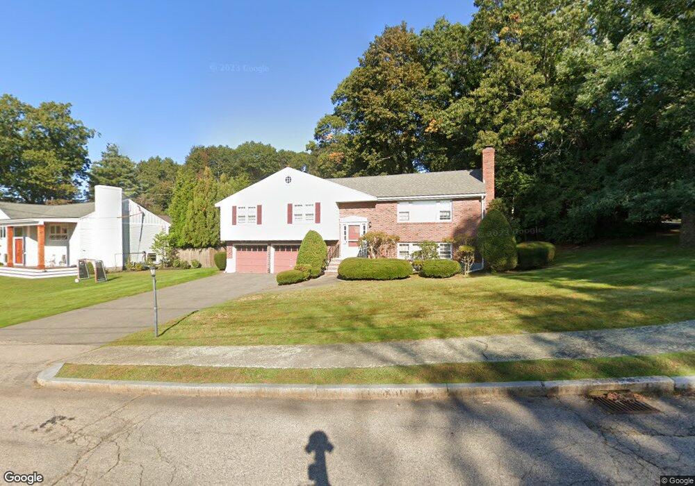
41 Arlo Rd Newton Upper Falls, MA 02464
Waban NeighborhoodEstimated Value: $1,216,000 - $1,661,000
4
Beds
3
Baths
1,538
Sq Ft
$929/Sq Ft
Est. Value
About This Home
This home is located at 41 Arlo Rd, Newton Upper Falls, MA 02464 and is currently estimated at $1,428,875, approximately $929 per square foot. 41 Arlo Rd is a home located in Middlesex County with nearby schools including Angier Elementary School, Charles E Brown Middle School, and Newton South High School.
Ownership History
Date
Name
Owned For
Owner Type
Purchase Details
Closed on
Sep 1, 1987
Sold by
Simon Murray E
Bought by
Leeman David E
Current Estimated Value
Home Financials for this Owner
Home Financials are based on the most recent Mortgage that was taken out on this home.
Original Mortgage
$280,000
Interest Rate
10.24%
Mortgage Type
Purchase Money Mortgage
Create a Home Valuation Report for This Property
The Home Valuation Report is an in-depth analysis detailing your home's value as well as a comparison with similar homes in the area
Home Values in the Area
Average Home Value in this Area
Purchase History
| Date | Buyer | Sale Price | Title Company |
|---|---|---|---|
| Leeman David E | $350,000 | -- |
Source: Public Records
Mortgage History
| Date | Status | Borrower | Loan Amount |
|---|---|---|---|
| Open | Leeman David E | $157,000 | |
| Closed | Leeman David E | $266,000 | |
| Closed | Leeman David E | $280,000 |
Source: Public Records
Tax History
| Year | Tax Paid | Tax Assessment Tax Assessment Total Assessment is a certain percentage of the fair market value that is determined by local assessors to be the total taxable value of land and additions on the property. | Land | Improvement |
|---|---|---|---|---|
| 2025 | $12,542 | $1,279,800 | $1,065,400 | $214,400 |
| 2024 | $12,127 | $1,242,500 | $1,034,400 | $208,100 |
| 2023 | $11,480 | $1,127,700 | $800,700 | $327,000 |
| 2022 | $10,985 | $1,044,200 | $741,400 | $302,800 |
| 2021 | $10,600 | $985,100 | $699,400 | $285,700 |
| 2020 | $10,284 | $985,100 | $699,400 | $285,700 |
| 2019 | $9,994 | $956,400 | $679,000 | $277,400 |
| 2018 | $9,477 | $875,900 | $609,700 | $266,200 |
| 2017 | $9,188 | $826,300 | $575,200 | $251,100 |
| 2016 | $8,788 | $772,200 | $537,600 | $234,600 |
| 2015 | $8,379 | $721,700 | $502,400 | $219,300 |
Source: Public Records
Map
Nearby Homes
- 873 Chestnut St
- 829 Chestnut St
- 5 Summer St
- 1003 Chestnut St
- 1077 Boylston St Unit 1
- 51 Pettee St Unit 31
- 180 Allen Ave
- 34 Larchmont Ave
- 12 Bemuth Rd
- 29 Cottage St Unit 29
- 304 Elliot St Carriage House S Unit 4
- 302 Elliot St Carriage House N Unit 3
- 18 Josselyn Place Unit 18
- 16-18 Josselyn Place Unit 16
- 16-18 Josselyn Place Unit 18
- 300 Elliot St Unit 2
- 27 Hamilton Place
- 126 Beethoven Ave
- 18 Annawan Rd
- 14 Pennsylvania Ave Unit 1
Your Personal Tour Guide
Ask me questions while you tour the home.