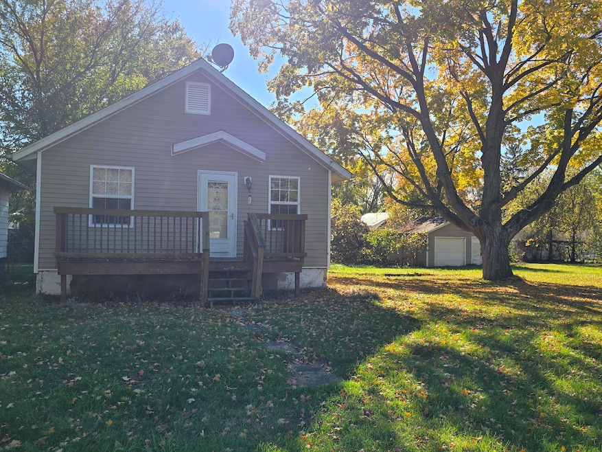
41 Avenue B Springfield, MI 49037
Estimated payment $484/month
--
Bed
1
Bath
792
Sq Ft
$100
Price per Sq Ft
Highlights
- No HOA
- Porch
- Forced Air Heating System
- 1 Car Detached Garage
- Bungalow
- High Speed Internet
About This Home
This home is located at 41 Avenue B, Springfield, MI 49037 and is currently priced at $78,900, approximately $99 per square foot. This property was built in 1920. 41 Avenue B is a home located in Calhoun County with nearby schools including Valley View Elementary School, Springfield Middle School, and Battle Creek Central High School.
Home Details
Home Type
- Single Family
Est. Annual Taxes
- $856
Year Built
- Built in 1920
Lot Details
- 7,928 Sq Ft Lot
- Lot Dimensions are 65.5 x 120.85
- Flag Lot
- Property is zoned R3, R3
Parking
- 1 Car Detached Garage
- Front Facing Garage
- Gravel Driveway
Home Design
- Bungalow
- Composition Roof
- Vinyl Siding
Interior Spaces
- 1 Full Bathroom
- 792 Sq Ft Home
- 1-Story Property
Laundry
- Laundry on main level
- Washer and Gas Dryer Hookup
Basement
- Basement Fills Entire Space Under The House
- Laundry in Basement
Outdoor Features
- Porch
Schools
- Springfield Middle Elementary School
- Springport High School
Utilities
- Forced Air Heating System
- Heating System Uses Natural Gas
- Natural Gas Water Heater
- High Speed Internet
- Internet Available
- Phone Available
- Cable TV Available
Community Details
- No Home Owners Association
- Merrill Park Subdivision
Map
Create a Home Valuation Report for This Property
The Home Valuation Report is an in-depth analysis detailing your home's value as well as a comparison with similar homes in the area
Home Values in the Area
Average Home Value in this Area
Tax History
| Year | Tax Paid | Tax Assessment Tax Assessment Total Assessment is a certain percentage of the fair market value that is determined by local assessors to be the total taxable value of land and additions on the property. | Land | Improvement |
|---|---|---|---|---|
| 2025 | $856 | $41,857 | $0 | $0 |
| 2024 | $574 | $34,385 | $0 | $0 |
| 2023 | $735 | $26,864 | $0 | $0 |
| 2022 | $520 | $24,509 | $0 | $0 |
| 2021 | $695 | $19,580 | $0 | $0 |
| 2020 | $686 | $20,205 | $0 | $0 |
| 2019 | $961 | $16,041 | $0 | $0 |
| 2018 | $0 | $13,655 | $1,821 | $11,834 |
| 2017 | $0 | $13,577 | $0 | $0 |
| 2016 | $0 | $11,465 | $0 | $0 |
| 2015 | -- | $9,972 | $0 | $0 |
| 2014 | -- | $10,481 | $0 | $0 |
Source: Public Records
Property History
| Date | Event | Price | List to Sale | Price per Sq Ft |
|---|---|---|---|---|
| 10/29/2025 10/29/25 | For Sale | $78,900 | -- | $100 / Sq Ft |
Source: MichRIC
Purchase History
| Date | Type | Sale Price | Title Company |
|---|---|---|---|
| Quit Claim Deed | -- | Attorney | |
| Quit Claim Deed | -- | Attorney | |
| Quit Claim Deed | -- | None Available | |
| Warranty Deed | $59,900 | Devon | |
| Warranty Deed | $57,100 | Chicago Title Insurance | |
| Warranty Deed | $17,000 | Chicago Title | |
| Deed | $20,000 | -- | |
| Deed | $10,500 | -- |
Source: Public Records
Mortgage History
| Date | Status | Loan Amount | Loan Type |
|---|---|---|---|
| Previous Owner | $47,920 | Unknown | |
| Previous Owner | $45,680 | New Conventional | |
| Closed | $11,420 | No Value Available |
Source: Public Records
Source: MichRIC
MLS Number: 25055508
APN: 54-110-042-10
Nearby Homes
- 0 Avenue B
- 396 & 398 N 20th St
- V/L Avenue C
- 261 Avenue C
- 690 Upton Ave
- V/L Lafayette Ave Unit 32
- 276 Lafayette Ave
- V/L Betterly Rd
- 431 22nd St N
- 636 Hamblin Ave W
- 612 Hamblin Ave W
- 17 Angell St
- 598 Hamblin Ave W
- 446 24th St N
- 228 Parrish St Unit V/L
- 294 20th St N
- 629 Van Buren St W
- 9 Thorne St
- 252 23rd St N
- 0 W Michigan 011 Ave Unit 22040285
- 180 Carl Ave
- 155 Kirkwood Ave
- 719 Avenue A
- 1317 Michigan Ave W Unit 9
- 1317 Michigan Ave W Unit 1
- 120 Riverside Dr
- 25 W Michigan Ave
- 115 West St
- 115 Wa Wee Nork Dr Unit 1A
- 511 North Ave
- 25 Sherman Rd
- 45 Stringham Rd
- 907 Capital Ave SW
- 298 Capital Ave NE
- 226 Taft Ct
- 144 Brentwood Dr
- 572 Limewood Dr
- 4201 W Dickman Rd
- 10 Wyndtree Dr
- 600 Garrison Rd

