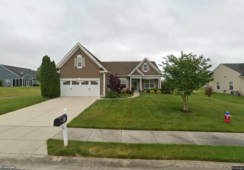
41 Blackburn St Felton, DE 19943
Estimated Value: $407,790 - $498,000
3
Beds
2
Baths
1,837
Sq Ft
$237/Sq Ft
Est. Value
About This Home
This home is located at 41 Blackburn St, Felton, DE 19943 and is currently estimated at $435,448, approximately $237 per square foot. 41 Blackburn St is a home located in Kent County with nearby schools including Lake Forest East Elementary School, Lake Forest Central Elementary School, and W.T. Chipman Middle School.
Ownership History
Date
Name
Owned For
Owner Type
Purchase Details
Closed on
Nov 30, 2010
Sold by
Hovbros Roesville Llc
Bought by
Mont Valerie R
Current Estimated Value
Home Financials for this Owner
Home Financials are based on the most recent Mortgage that was taken out on this home.
Original Mortgage
$405,000
Outstanding Balance
$267,576
Interest Rate
4.22%
Mortgage Type
Reverse Mortgage Home Equity Conversion Mortgage
Estimated Equity
$167,872
Create a Home Valuation Report for This Property
The Home Valuation Report is an in-depth analysis detailing your home's value as well as a comparison with similar homes in the area
Home Values in the Area
Average Home Value in this Area
Purchase History
| Date | Buyer | Sale Price | Title Company |
|---|---|---|---|
| Mont Valerie R | $290,496 | None Available |
Source: Public Records
Mortgage History
| Date | Status | Borrower | Loan Amount |
|---|---|---|---|
| Open | Mont Valerie R | $405,000 |
Source: Public Records
Tax History Compared to Growth
Tax History
| Year | Tax Paid | Tax Assessment Tax Assessment Total Assessment is a certain percentage of the fair market value that is determined by local assessors to be the total taxable value of land and additions on the property. | Land | Improvement |
|---|---|---|---|---|
| 2025 | $1,280 | $379,200 | $77,700 | $301,500 |
| 2024 | $1,280 | $379,200 | $77,700 | $301,500 |
| 2023 | $1,110 | $47,200 | $6,100 | $41,100 |
| 2022 | $1,011 | $47,200 | $6,100 | $41,100 |
| 2021 | $975 | $47,200 | $6,100 | $41,100 |
| 2020 | $981 | $47,200 | $6,100 | $41,100 |
| 2019 | $979 | $47,200 | $6,100 | $41,100 |
| 2018 | $972 | $47,200 | $6,100 | $41,100 |
| 2017 | $994 | $47,200 | $0 | $0 |
| 2016 | $893 | $47,200 | $0 | $0 |
| 2015 | $886 | $47,200 | $0 | $0 |
| 2014 | $874 | $47,200 | $0 | $0 |
Source: Public Records
Map
Nearby Homes
- 150 Elm Crest Ln
- 196 Elm Crest Ln
- 92 River Cliff Cir
- 910 Weatherstone Ln
- 3992 Midstate Rd
- 02 Obsidian Dr
- 83 Rolling Stone Way
- 07 Obsidian Dr
- 03 Obsidian Dr
- 06 Obsidian Dr
- 04 Obsidian Dr
- 05 Obsidian Dr
- 01 Obsidian Dr
- 51 Cliff Dr
- Brenner Plan at Coursey's Point
- Whatley Plan at Coursey's Point
- Peterman II Plan at Coursey's Point
- Reston Plan at Coursey's Point
- Cartwright Plan at Coursey's Point
- Frank Plan at Coursey's Point
- 186 Sunderland Rd
- 403 Rushden Ln
- 93 Birmingham Ct
- 389 Rushden Ln
- 89 Birmingham Ct
- 83 Blackburn St
- 375 Rushden Ln
- 161 Birmingham Ct
- 13 Tottenham Dr
- 77 Birmingham Ct
- 361 Rushden Ln
- 236 Rushden Ln
- 99 Blackburn St
- 99 Blackburn St Unit 2
- 45 Birmingham Ct
- 418 Rushden Ln
- 388 Rushden Ln
- 434 Rushden Ln
- 158 Birmingham Ct Unit 6400
- 158 Birmingham Ct