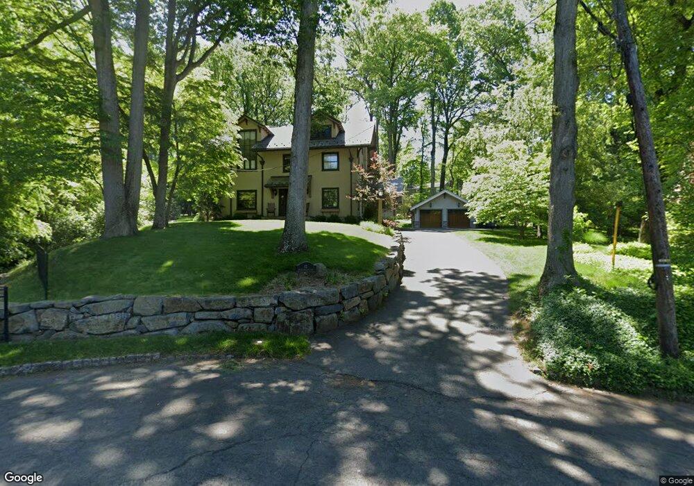
41 Brook Hollow Ln New Providence, NJ 07974
Estimated Value: $1,077,000 - $1,747,477
--
Bed
--
Bath
3,439
Sq Ft
$382/Sq Ft
Est. Value
About This Home
This home is located at 41 Brook Hollow Ln, New Providence, NJ 07974 and is currently estimated at $1,312,369, approximately $381 per square foot. 41 Brook Hollow Ln is a home located in Union County with nearby schools including New Providence High School, The Academy of Our Lady of Peace, and Oak Knoll School of the Holy Child.
Ownership History
Date
Name
Owned For
Owner Type
Purchase Details
Closed on
Oct 8, 2009
Sold by
Shaw Jerome and Shaw William F
Bought by
Shaw Jerome
Current Estimated Value
Home Financials for this Owner
Home Financials are based on the most recent Mortgage that was taken out on this home.
Original Mortgage
$417,000
Outstanding Balance
$273,127
Interest Rate
5.14%
Mortgage Type
New Conventional
Estimated Equity
$1,039,242
Purchase Details
Closed on
Jul 21, 2005
Sold by
Shaw Jerome Exr
Bought by
Bernice Shaw Credit Shelter Tr
Purchase Details
Closed on
Feb 27, 1998
Sold by
Shaw Jerome and Shaw Bernice
Bought by
Shaw Jerome and Shaw Bernice
Create a Home Valuation Report for This Property
The Home Valuation Report is an in-depth analysis detailing your home's value as well as a comparison with similar homes in the area
Home Values in the Area
Average Home Value in this Area
Purchase History
| Date | Buyer | Sale Price | Title Company |
|---|---|---|---|
| Shaw Jerome | $617,000 | Multiple | |
| Bernice Shaw Credit Shelter Tr | -- | -- | |
| Shaw Jerome | -- | -- |
Source: Public Records
Mortgage History
| Date | Status | Borrower | Loan Amount |
|---|---|---|---|
| Open | Shaw Jerome | $417,000 |
Source: Public Records
Tax History Compared to Growth
Tax History
| Year | Tax Paid | Tax Assessment Tax Assessment Total Assessment is a certain percentage of the fair market value that is determined by local assessors to be the total taxable value of land and additions on the property. | Land | Improvement |
|---|---|---|---|---|
| 2025 | $23,590 | $457,000 | $202,700 | $254,300 |
| 2024 | $17,324 | $457,000 | $202,700 | $254,300 |
| 2023 | $17,324 | $346,000 | $202,700 | $143,300 |
| 2022 | $17,085 | $346,000 | $202,700 | $143,300 |
| 2021 | $16,961 | $346,000 | $202,700 | $143,300 |
| 2020 | $16,954 | $346,000 | $202,700 | $143,300 |
| 2019 | $16,850 | $346,000 | $202,700 | $143,300 |
| 2018 | $16,764 | $346,000 | $202,700 | $143,300 |
| 2017 | $16,490 | $346,000 | $202,700 | $143,300 |
| 2016 | $16,259 | $346,000 | $202,700 | $143,300 |
| 2015 | $16,034 | $346,000 | $202,700 | $143,300 |
| 2014 | $15,791 | $346,000 | $202,700 | $143,300 |
Source: Public Records
Map
Nearby Homes
- 72 Central Ave
- 106 Stoneridge Rd
- 6 Joanna Way
- 54 Badgley Dr
- 45 the Fellsway
- 17 Valley View Ave
- 19 Division Ave
- 34 Sweetbriar Rd
- 34 Grant Ave
- 709 Springfield Ave Unit 4
- 709 Springfield Ave Unit 3
- 140 Countryside Dr
- 294 Livingston Ave
- 52 Greenwood Rd
- 50 Livingston Ave
- 149 Ashland Rd
- 183 Countryside Dr
- 43 Passaic Ave
- 32 Marion Ave
- 16 Riverbend Ct
- 35 Brook Hollow Ln
- 38 Brook Hollow Ln
- 35 Old Oak Dr
- 41 Old Oak Dr
- 32 Brook Hollow Ln
- 45 Old Oak Dr
- 29 Brook Hollow Ln
- 133 Division Ave
- 29 Old Oak Dr
- 51 Old Oak Dr
- 22 Brook Hollow Ln
- 23 Old Oak Dr
- 129 Division Ave
- 123 Division Ave
- 17 Old Oak Dr
- 139 Division Ave
- 63 Old Oak Dr
- 21 Brook Hollow Ln
- 32 Old Oak Dr
- 75 Acorn Dr