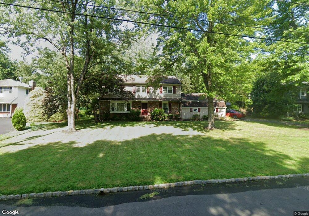
41 Colonial Way New Providence, NJ 07974
Estimated Value: $970,000 - $1,280,000
--
Bed
--
Bath
2,648
Sq Ft
$425/Sq Ft
Est. Value
About This Home
This home is located at 41 Colonial Way, New Providence, NJ 07974 and is currently estimated at $1,125,926, approximately $425 per square foot. 41 Colonial Way is a home located in Union County with nearby schools including New Providence High School and The Academy of Our Lady of Peace.
Ownership History
Date
Name
Owned For
Owner Type
Purchase Details
Closed on
Aug 14, 2007
Sold by
Kantor Philip D and Kantor Sherri P
Bought by
Connolly Sharon and Connolly Daniel
Current Estimated Value
Home Financials for this Owner
Home Financials are based on the most recent Mortgage that was taken out on this home.
Original Mortgage
$140,000
Outstanding Balance
$89,183
Interest Rate
6.78%
Mortgage Type
Purchase Money Mortgage
Estimated Equity
$1,036,743
Purchase Details
Closed on
Dec 20, 1996
Sold by
Bean John and Bean Kristine J
Bought by
Kantor Philip D and Kantor Sherri P
Home Financials for this Owner
Home Financials are based on the most recent Mortgage that was taken out on this home.
Original Mortgage
$175,000
Interest Rate
7.55%
Create a Home Valuation Report for This Property
The Home Valuation Report is an in-depth analysis detailing your home's value as well as a comparison with similar homes in the area
Home Values in the Area
Average Home Value in this Area
Purchase History
| Date | Buyer | Sale Price | Title Company |
|---|---|---|---|
| Connolly Sharon | $825,250 | None Available | |
| Kantor Philip D | $370,000 | -- |
Source: Public Records
Mortgage History
| Date | Status | Borrower | Loan Amount |
|---|---|---|---|
| Open | Connolly Sharon | $140,000 | |
| Previous Owner | Kantor Philip D | $175,000 |
Source: Public Records
Tax History Compared to Growth
Tax History
| Year | Tax Paid | Tax Assessment Tax Assessment Total Assessment is a certain percentage of the fair market value that is determined by local assessors to be the total taxable value of land and additions on the property. | Land | Improvement |
|---|---|---|---|---|
| 2025 | $21,422 | $415,000 | $142,800 | $272,200 |
| 2024 | $20,779 | $415,000 | $142,800 | $272,200 |
| 2023 | $20,779 | $415,000 | $142,800 | $272,200 |
| 2022 | $20,493 | $415,000 | $142,800 | $272,200 |
| 2021 | $20,343 | $415,000 | $142,800 | $272,200 |
| 2020 | $20,335 | $415,000 | $142,800 | $272,200 |
| 2019 | $20,211 | $415,000 | $142,800 | $272,200 |
| 2018 | $19,075 | $393,700 | $142,800 | $250,900 |
| 2017 | $18,764 | $393,700 | $142,800 | $250,900 |
| 2016 | $18,500 | $393,700 | $142,800 | $250,900 |
| 2015 | $18,244 | $393,700 | $142,800 | $250,900 |
| 2014 | $17,968 | $393,700 | $142,800 | $250,900 |
Source: Public Records
Map
Nearby Homes
- 4 Bromley Ct
- 29 Union Ave
- 41 Meadowview Ln
- 19 Guenevere Way Ondo
- 11 Earl Place
- 4 Meadowview Ln
- 24 Dogwood Ln
- 30 Robbins Ave
- 25 Green Way
- 145 Colchester Rd
- 19 Slope Dr
- 189 Lawrence Dr
- 25 Murray Hill Square
- 16 Terrace Rd
- 349 Charnwood Rd
- 47 Park Edge Unit G1G
- 36 Terrace Rd
- 93 Park Edge Unit 3H
- 96 Exeter Dr
- 23 Wren Ct