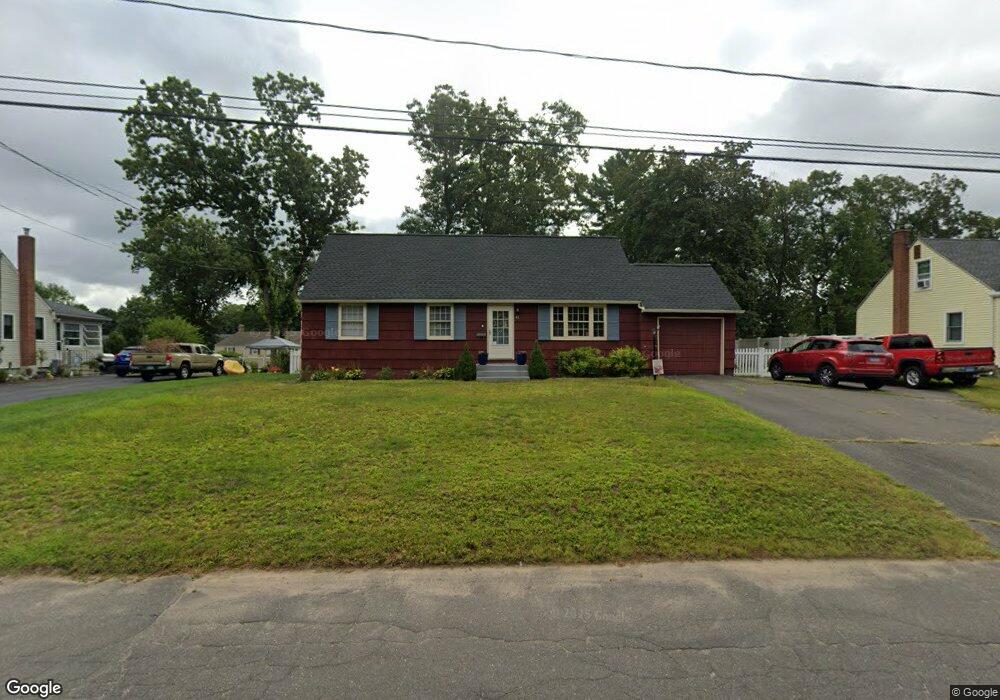
41 Conlin Dr Enfield, CT 06082
Estimated Value: $316,000 - $360,000
5
Beds
2
Baths
1,840
Sq Ft
$185/Sq Ft
Est. Value
About This Home
This home is located at 41 Conlin Dr, Enfield, CT 06082 and is currently estimated at $339,790, approximately $184 per square foot. 41 Conlin Dr is a home located in Hartford County with nearby schools including Eli Whitney Elementary School, Hazardville Memorial Elementary School, and Enfield High School.
Ownership History
Date
Name
Owned For
Owner Type
Purchase Details
Closed on
Jan 23, 2009
Sold by
Deutsche Bank Natl T C
Bought by
Dallacourt Joseph
Current Estimated Value
Home Financials for this Owner
Home Financials are based on the most recent Mortgage that was taken out on this home.
Original Mortgage
$182,500
Interest Rate
5.51%
Purchase Details
Closed on
Sep 1, 2004
Sold by
Harris Robert and Harris Yvonne
Bought by
Harris David
Create a Home Valuation Report for This Property
The Home Valuation Report is an in-depth analysis detailing your home's value as well as a comparison with similar homes in the area
Home Values in the Area
Average Home Value in this Area
Purchase History
| Date | Buyer | Sale Price | Title Company |
|---|---|---|---|
| Dallacourt Joseph | $185,000 | -- | |
| Harris David | $250,000 | -- |
Source: Public Records
Mortgage History
| Date | Status | Borrower | Loan Amount |
|---|---|---|---|
| Open | Harris David | $190,781 | |
| Closed | Harris David | $182,500 | |
| Closed | Harris David | $5,300 |
Source: Public Records
Tax History
| Year | Tax Paid | Tax Assessment Tax Assessment Total Assessment is a certain percentage of the fair market value that is determined by local assessors to be the total taxable value of land and additions on the property. | Land | Improvement |
|---|---|---|---|---|
| 2025 | $5,763 | $164,700 | $56,600 | $108,100 |
| 2024 | $5,608 | $164,700 | $56,600 | $108,100 |
| 2023 | $5,567 | $164,700 | $56,600 | $108,100 |
| 2022 | $5,055 | $164,700 | $56,600 | $108,100 |
| 2021 | $4,948 | $131,830 | $46,890 | $84,940 |
| 2020 | $4,948 | $131,830 | $46,890 | $84,940 |
| 2019 | $4,961 | $131,830 | $46,890 | $84,940 |
| 2018 | $4,878 | $131,830 | $46,890 | $84,940 |
| 2017 | $4,605 | $131,830 | $46,890 | $84,940 |
| 2016 | $4,362 | $127,130 | $48,110 | $79,020 |
| 2015 | $4,226 | $127,130 | $48,110 | $79,020 |
| 2014 | $4,116 | $127,130 | $48,110 | $79,020 |
Source: Public Records
Map
Nearby Homes