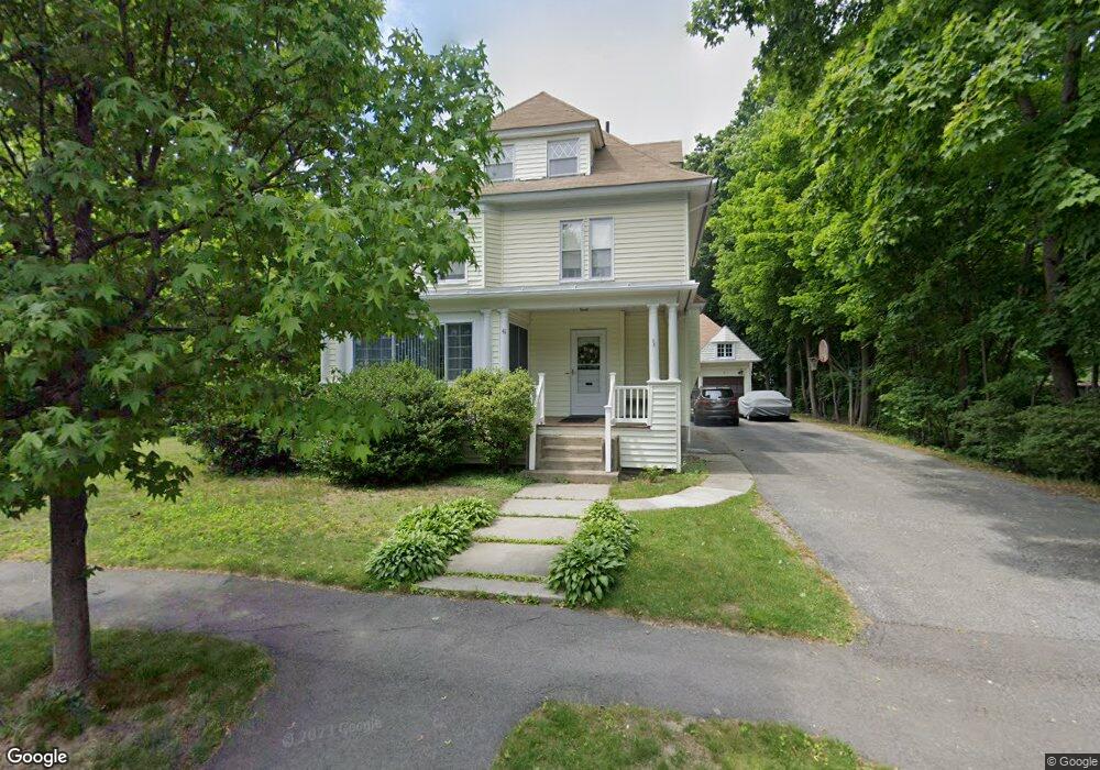
41 Davidson Rd Worcester, MA 01605
North Lincoln Street NeighborhoodEstimated Value: $540,154 - $600,000
5
Beds
3
Baths
2,591
Sq Ft
$223/Sq Ft
Est. Value
About This Home
This home is located at 41 Davidson Rd, Worcester, MA 01605 and is currently estimated at $577,789, approximately $222 per square foot. 41 Davidson Rd is a home located in Worcester County with nearby schools including Jacob Hiatt Magnet School, Chandler Magnet, and Wawecus Road School.
Create a Home Valuation Report for This Property
The Home Valuation Report is an in-depth analysis detailing your home's value as well as a comparison with similar homes in the area
Home Values in the Area
Average Home Value in this Area
Tax History
| Year | Tax Paid | Tax Assessment Tax Assessment Total Assessment is a certain percentage of the fair market value that is determined by local assessors to be the total taxable value of land and additions on the property. | Land | Improvement |
|---|---|---|---|---|
| 2025 | $6,140 | $465,500 | $119,500 | $346,000 |
| 2024 | $6,007 | $436,900 | $119,500 | $317,400 |
| 2023 | $5,786 | $403,500 | $103,900 | $299,600 |
| 2022 | $5,358 | $352,300 | $83,100 | $269,200 |
| 2021 | $5,382 | $330,600 | $66,500 | $264,100 |
| 2020 | $5,207 | $306,300 | $66,400 | $239,900 |
| 2019 | $5,027 | $279,300 | $60,100 | $219,200 |
| 2018 | $4,983 | $263,500 | $60,100 | $203,400 |
| 2017 | $4,863 | $253,000 | $60,100 | $192,900 |
| 2016 | $4,905 | $238,000 | $45,600 | $192,400 |
| 2015 | $4,777 | $238,000 | $45,600 | $192,400 |
| 2014 | $4,651 | $238,000 | $45,600 | $192,400 |
Source: Public Records
Map
Nearby Homes
- 30 Melrose St
- 45 Goldthwaite Rd
- 2 Selden St
- 15 Ericsson St
- 33 Denmark St
- 3205 Halcyon Dr Unit 3205
- 169 Whitmarsh Ave
- 25 Mckinley Rd
- 27 Harlow St
- 17 Goucher Ave
- 58 Osceola Ave
- 39 Whitmarsh Ave
- 55 Clark St
- 44 Boardman St
- 31 Boardman St
- 323 Burncoat St
- 12 Erie Ave
- 331 Burncoat St
- 78 Green Hill Pkwy
- 74 Green Hill Pkwy
Your Personal Tour Guide
Ask me questions while you tour the home.