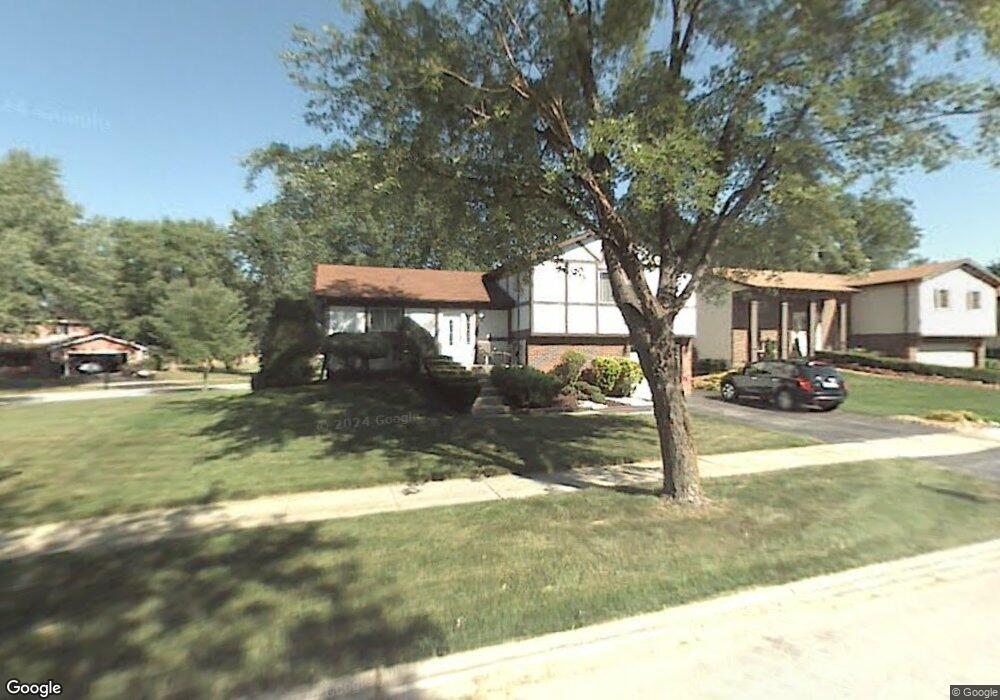
41 Deerpath Rd Matteson, IL 60443
West Matteson NeighborhoodEstimated Value: $223,000 - $233,000
3
Beds
2
Baths
1,259
Sq Ft
$180/Sq Ft
Est. Value
About This Home
This home is located at 41 Deerpath Rd, Matteson, IL 60443 and is currently estimated at $226,375, approximately $179 per square foot. 41 Deerpath Rd is a home located in Cook County with nearby schools including Colin Powell Middle School.
Ownership History
Date
Name
Owned For
Owner Type
Purchase Details
Closed on
May 8, 2017
Sold by
Dudley Eric and Dudley Yvette
Bought by
Dudley Eric
Current Estimated Value
Home Financials for this Owner
Home Financials are based on the most recent Mortgage that was taken out on this home.
Original Mortgage
$101,750
Interest Rate
4.1%
Mortgage Type
FHA
Purchase Details
Closed on
Sep 16, 2014
Sold by
Dudley Yvette
Bought by
Dudley Eric and Dudley Yvette
Create a Home Valuation Report for This Property
The Home Valuation Report is an in-depth analysis detailing your home's value as well as a comparison with similar homes in the area
Home Values in the Area
Average Home Value in this Area
Purchase History
| Date | Buyer | Sale Price | Title Company |
|---|---|---|---|
| Dudley Eric | -- | Old Republic Title | |
| Dudley Eric | -- | None Available |
Source: Public Records
Mortgage History
| Date | Status | Borrower | Loan Amount |
|---|---|---|---|
| Closed | Dudley Eric | $101,750 |
Source: Public Records
Tax History
| Year | Tax Paid | Tax Assessment Tax Assessment Total Assessment is a certain percentage of the fair market value that is determined by local assessors to be the total taxable value of land and additions on the property. | Land | Improvement |
|---|---|---|---|---|
| 2025 | $6,087 | $18,000 | $5,365 | $12,635 |
| 2024 | $6,087 | $18,000 | $5,365 | $12,635 |
| 2023 | $5,895 | $18,000 | $5,365 | $12,635 |
| 2022 | $5,895 | $14,432 | $4,694 | $9,738 |
| 2021 | $7,799 | $14,431 | $4,694 | $9,737 |
| 2020 | $7,536 | $14,431 | $4,694 | $9,737 |
| 2019 | $6,792 | $12,431 | $4,358 | $8,073 |
| 2018 | $6,693 | $12,431 | $4,358 | $8,073 |
| 2017 | $6,508 | $12,431 | $4,358 | $8,073 |
| 2016 | $6,483 | $12,527 | $4,023 | $8,504 |
| 2015 | $6,365 | $12,527 | $4,023 | $8,504 |
| 2014 | $6,193 | $12,527 | $4,023 | $8,504 |
| 2013 | $5,227 | $11,363 | $4,023 | $7,340 |
Source: Public Records
Map
Nearby Homes
- 5742 Woodgate Dr
- 5911 Timberlane Rd
- 5838 Woodgate Dr
- 13 Oakview Rd
- 25 Pheasant Rd
- 156 Cloverleaf Rd
- 5943 Woodgate Dr
- 123 Oriole Rd
- 42 Pheasant Rd
- 152 Oakhurst Rd
- 5628 Crestwood Rd
- 5808 Allemong Dr
- 5804 Kathryn Ln
- 10 Wedgewood Rd
- 34 Wedgewood Rd
- 255 Central Ave
- 322 Central Ave
- 51 Manor Dr
- 6021 Spring Ln
- 6037 Spring Ln
- 49 Deerpath Rd
- 5740 Timberlane Rd
- 42 Deerpath Rd
- 46 Deerpath Rd
- 38 Deerpath Rd
- 5746 Timberlane Rd
- 48 Cloverleaf Rd
- 48 Deerpath Rd
- 51 Deerpath Rd
- 5750 Timberlane Rd
- 5715 Woodgate Dr
- 50 Cloverleaf Rd
- 50 Deerpath Rd
- 39 Huntingwood Rd
- 43 Cloverleaf Rd
- 5719 Woodgate Dr
- 5801 Timberlane Rd
- 43 Huntingwood Rd
- 35 Huntingwood Rd
- 53 Deerpath Rd
Your Personal Tour Guide
Ask me questions while you tour the home.