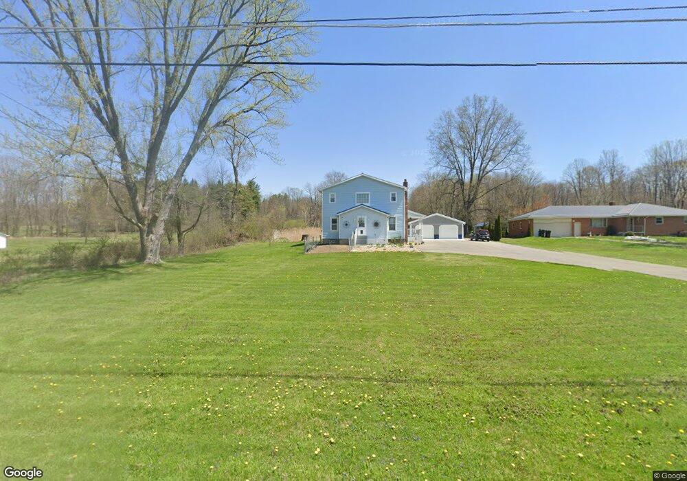
41 Dermond Rd Hermitage, PA 16148
Estimated Value: $129,825 - $289,000
Studio
--
Bath
--
Sq Ft
155,945
Sq Ft Lot
About This Home
This home is located at 41 Dermond Rd, Hermitage, PA 16148 and is currently estimated at $217,706. 41 Dermond Rd is a home located in Mercer County with nearby schools including Ionta Elementary School, Artman Elementary School, and Delahunty Middle School.
Ownership History
Date
Name
Owned For
Owner Type
Purchase Details
Closed on
Dec 20, 2017
Sold by
Hallas Stephen J and Hallas Nichole S
Bought by
Hallas Stephen J and Hallas Nichole S
Current Estimated Value
Purchase Details
Closed on
Oct 18, 2017
Sold by
Misinay Jonathan M
Bought by
Hallas Stephen J
Home Financials for this Owner
Home Financials are based on the most recent Mortgage that was taken out on this home.
Original Mortgage
$133,000
Outstanding Balance
$111,122
Interest Rate
3.83%
Mortgage Type
New Conventional
Estimated Equity
$106,584
Purchase Details
Closed on
Nov 22, 2016
Sold by
Spohn Nicholas W and Spohn Nicole
Bought by
Misinay Jonathan M
Purchase Details
Closed on
Apr 4, 2016
Sold by
Carpenter Feddra
Bought by
Spohn Nicholas W
Create a Home Valuation Report for This Property
The Home Valuation Report is an in-depth analysis detailing your home's value as well as a comparison with similar homes in the area
Home Values in the Area
Average Home Value in this Area
Purchase History
| Date | Buyer | Sale Price | Title Company |
|---|---|---|---|
| Hallas Stephen J | -- | None Available | |
| Hallas Stephen J | $140,000 | None Available | |
| Misinay Jonathan M | $72,000 | None Available | |
| Spohn Nicholas W | -- | Attorney |
Source: Public Records
Mortgage History
| Date | Status | Borrower | Loan Amount |
|---|---|---|---|
| Open | Hallas Stephen J | $133,000 |
Source: Public Records
Tax History
| Year | Tax Paid | Tax Assessment Tax Assessment Total Assessment is a certain percentage of the fair market value that is determined by local assessors to be the total taxable value of land and additions on the property. | Land | Improvement |
|---|---|---|---|---|
| 2025 | $1,116 | $11,700 | $2,750 | $8,950 |
| 2024 | $1,116 | $11,700 | $2,750 | $8,950 |
| 2023 | $1,116 | $11,700 | $2,750 | $8,950 |
| 2022 | $1,083 | $11,700 | $2,750 | $8,950 |
| 2021 | $1,083 | $11,700 | $2,750 | $8,950 |
| 2020 | $1,083 | $11,700 | $2,750 | $8,950 |
| 2019 | $1,083 | $11,700 | $2,750 | $8,950 |
| 2018 | $1,061 | $11,700 | $2,750 | $8,950 |
| 2017 | $1,067 | $11,700 | $2,750 | $8,950 |
| 2016 | -- | $11,650 | $2,700 | $8,950 |
| 2015 | -- | $11,650 | $2,700 | $8,950 |
| 2014 | -- | $11,650 | $2,700 | $8,950 |
Source: Public Records
Map
Nearby Homes
- 395 Dermond Rd
- 6964 Dermond Rd
- 6958 Dermond Rd
- 94 N Darby Rd
- 5400 E State St
- 626 Lorenwood Dr
- 745 Robertson Rd
- 795 Robertson Rd
- 00 Miller Rd
- 76 Stone Ridge Blvd
- 860 S Keel Ridge Rd
- 4506 Whippoorwill Dr
- 723 Rollinson Rd
- 0 Roman Dr
- 7376 Sharon Mercer Rd
- Lot 44 Pierce Bluffs Dr
- 2019 Mercer West Middlesex Rd
- 1039 N Keel Ridge Rd
- 1109 Mercer West Middlesex Rd
- 3025 S Keel Ridge Rd
Your Personal Tour Guide
Ask me questions while you tour the home.