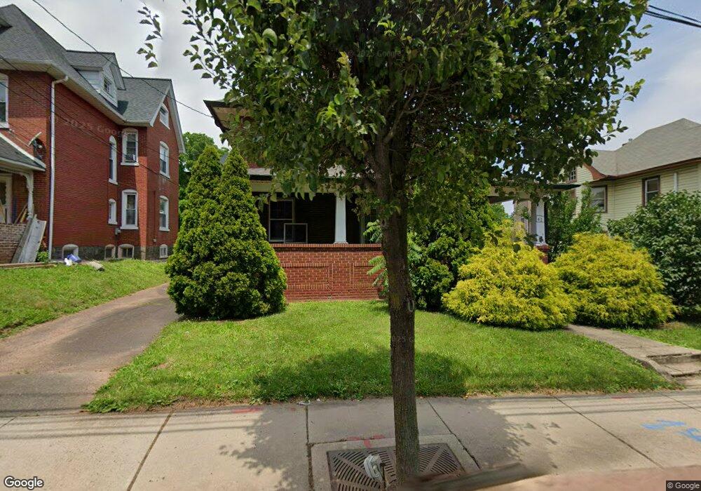
41 E Broad St Hatfield, PA 19440
Estimated Value: $486,458 - $621,000
4
Beds
2
Baths
3,639
Sq Ft
$149/Sq Ft
Est. Value
About This Home
This home is located at 41 E Broad St, Hatfield, PA 19440 and is currently estimated at $542,115, approximately $148 per square foot. 41 E Broad St is a home located in Montgomery County with nearby schools including Hatfield Elementary School, Pennfield Middle School, and North Penn Senior High School.
Ownership History
Date
Name
Owned For
Owner Type
Purchase Details
Closed on
Jan 29, 2008
Sold by
Kaler Donna E and Kaler Robert L
Bought by
Rahman Abm Sidur
Current Estimated Value
Home Financials for this Owner
Home Financials are based on the most recent Mortgage that was taken out on this home.
Original Mortgage
$294,500
Outstanding Balance
$186,538
Interest Rate
6.14%
Estimated Equity
$355,577
Purchase Details
Closed on
Jun 15, 2005
Sold by
Kaler Robert L
Bought by
Kaler Robert L and Kaler Donna E
Home Financials for this Owner
Home Financials are based on the most recent Mortgage that was taken out on this home.
Original Mortgage
$215,000
Interest Rate
5.73%
Mortgage Type
New Conventional
Purchase Details
Closed on
Jun 26, 1998
Sold by
Kaler Robert L and Kaler Linda A
Bought by
Kaler Robert L
Purchase Details
Closed on
Aug 12, 1996
Sold by
Kaler Robert L and Kaler Linda A
Bought by
Kaler Robert L and Kaler Linda A
Create a Home Valuation Report for This Property
The Home Valuation Report is an in-depth analysis detailing your home's value as well as a comparison with similar homes in the area
Home Values in the Area
Average Home Value in this Area
Purchase History
| Date | Buyer | Sale Price | Title Company |
|---|---|---|---|
| Rahman Abm Sidur | $310,000 | None Available | |
| Kaler Robert L | -- | First American Title Ins Co | |
| Kaler Robert L | -- | -- | |
| Kaler Robert L | -- | -- |
Source: Public Records
Mortgage History
| Date | Status | Borrower | Loan Amount |
|---|---|---|---|
| Open | Rahman Abm Sidur | $294,500 | |
| Previous Owner | Kaler Robert L | $215,000 |
Source: Public Records
Tax History
| Year | Tax Paid | Tax Assessment Tax Assessment Total Assessment is a certain percentage of the fair market value that is determined by local assessors to be the total taxable value of land and additions on the property. | Land | Improvement |
|---|---|---|---|---|
| 2025 | $6,001 | $157,670 | $41,040 | $116,630 |
| 2024 | $6,001 | $157,670 | $41,040 | $116,630 |
| 2023 | $5,730 | $157,670 | $41,040 | $116,630 |
| 2022 | $5,534 | $157,670 | $41,040 | $116,630 |
| 2021 | $5,210 | $157,670 | $41,040 | $116,630 |
| 2020 | $5,037 | $157,670 | $41,040 | $116,630 |
| 2019 | $4,944 | $157,670 | $41,040 | $116,630 |
Source: Public Records
Map
Nearby Homes
- 105 S Main St
- 138 Diamond St Unit 31
- 36 N Maple Ave
- 113 E Vine St
- 2801 Denbeigh Dr
- 369 Wheatfield Cir
- 2331 Cambridge Cir
- 1520 Fairgrounds Rd
- 2092 Hawthorne Ln
- 113 Hickory Dr
- 109 Hickory Dr
- 1695 Latch String Ln
- 14 Holiday Ave
- 0 Fairmount St
- 1524 Tarrington Way
- 2296 Bramble Gate Dr
- 1309 W Orvilla Rd
- 700 Alexander Dr
- 2805 N Ford Dr
- 2848 Grant Ave
Your Personal Tour Guide
Ask me questions while you tour the home.