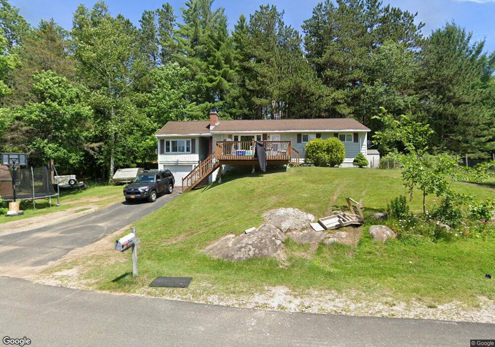
41 Isabelle Ave Tupper Lake, NY 12986
Estimated Value: $178,532 - $255,000
4
Beds
1
Bath
1,300
Sq Ft
$163/Sq Ft
Est. Value
About This Home
This home is located at 41 Isabelle Ave, Tupper Lake, NY 12986 and is currently estimated at $211,383, approximately $162 per square foot. 41 Isabelle Ave is a home located in Franklin County with nearby schools including L.P. Quinn Elementary School and Tupper Lake Middle/High School.
Ownership History
Date
Name
Owned For
Owner Type
Purchase Details
Closed on
Mar 25, 2011
Sold by
Kinney Guy
Bought by
Schofield Brian
Current Estimated Value
Home Financials for this Owner
Home Financials are based on the most recent Mortgage that was taken out on this home.
Original Mortgage
$90,770
Outstanding Balance
$63,329
Interest Rate
5.12%
Mortgage Type
FHA
Estimated Equity
$148,054
Purchase Details
Closed on
Nov 13, 2001
Sold by
Sapp Ingeborg B
Bought by
Kinney Guy H
Create a Home Valuation Report for This Property
The Home Valuation Report is an in-depth analysis detailing your home's value as well as a comparison with similar homes in the area
Home Values in the Area
Average Home Value in this Area
Purchase History
| Date | Buyer | Sale Price | Title Company |
|---|---|---|---|
| Schofield Brian | $100,000 | Michael P Langey | |
| Kinney Guy H | $75,000 | Jeremiah M. Hayes |
Source: Public Records
Mortgage History
| Date | Status | Borrower | Loan Amount |
|---|---|---|---|
| Open | Schofield Brian | $90,770 |
Source: Public Records
Tax History Compared to Growth
Tax History
| Year | Tax Paid | Tax Assessment Tax Assessment Total Assessment is a certain percentage of the fair market value that is determined by local assessors to be the total taxable value of land and additions on the property. | Land | Improvement |
|---|---|---|---|---|
| 2024 | $2,945 | $101,000 | $14,200 | $86,800 |
| 2023 | $3,217 | $101,000 | $14,200 | $86,800 |
| 2022 | $3,065 | $101,000 | $14,200 | $86,800 |
| 2021 | $2,998 | $101,000 | $14,200 | $86,800 |
| 2020 | $2,423 | $101,000 | $14,200 | $86,800 |
| 2019 | $2,379 | $101,000 | $14,200 | $86,800 |
| 2018 | $2,430 | $101,000 | $14,200 | $86,800 |
| 2017 | $2,310 | $101,000 | $14,200 | $86,800 |
| 2016 | $2,339 | $101,000 | $19,400 | $81,600 |
| 2015 | -- | $101,000 | $19,400 | $81,600 |
| 2014 | -- | $101,000 | $19,400 | $81,600 |
Source: Public Records
Map
Nearby Homes
- 171 Raquette River Dr
- 189 Raquette River Dr
- 196 Raquette River Dr
- 2026 State Route 30
- 46 Church St
- 1 Off Church St
- 19 1st St
- 19 Marion St
- 20 Broad St
- 80 Sunset Ave
- 37 Broad St
- 23 Front St
- 52 High St
- 57 Stetson Rd
- 44 Lakeview Ave
- 21 Mclaughlin Ave
- 26 Lakeview Ave
- 79 Lake Simond Rd
- 171 Park St
- 39 Lake Simond Rd
- 1 Dorothy Ave
- 36 Isabelle Ave
- 61 Isabelle Ave
- 32 Isabelle Ave
- 45 Isabelle Ave
- 65 Isabelle Ave
- 50 Isabelle Ave
- 155 Raquette River Dr
- 23 Isabelle Ave
- 24 Dorothy St
- 14 Dorothy St
- 1466 Raquette River Dr
- 0 Raquette River Dr
- 147 Raquette River Dr
- 1978 State Route 30
- 1982 State Route 30
- 156 Raquette River Dr
- 1980 State Route 30
- 138 River Rd Unit RAQ
- 1986 State Route 30