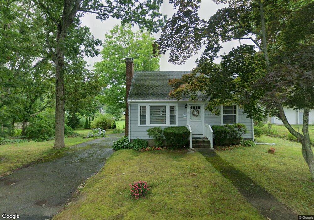
41 King Phillip Rd Pocasset, MA 02559
Pocasset NeighborhoodEstimated Value: $587,000 - $703,000
3
Beds
1
Bath
1,008
Sq Ft
$627/Sq Ft
Est. Value
About This Home
This home is located at 41 King Phillip Rd, Pocasset, MA 02559 and is currently estimated at $631,523, approximately $626 per square foot. 41 King Phillip Rd is a home located in Barnstable County with nearby schools including Bourne High School, Cadence Academy Preschool - Bourne, and St Margaret Regional School.
Create a Home Valuation Report for This Property
The Home Valuation Report is an in-depth analysis detailing your home's value as well as a comparison with similar homes in the area
Home Values in the Area
Average Home Value in this Area
Tax History Compared to Growth
Tax History
| Year | Tax Paid | Tax Assessment Tax Assessment Total Assessment is a certain percentage of the fair market value that is determined by local assessors to be the total taxable value of land and additions on the property. | Land | Improvement |
|---|---|---|---|---|
| 2025 | $3,844 | $492,200 | $294,000 | $198,200 |
| 2024 | $3,760 | $468,800 | $280,000 | $188,800 |
| 2023 | $3,655 | $414,900 | $247,800 | $167,100 |
| 2022 | $3,344 | $331,400 | $198,700 | $132,700 |
| 2021 | $3,250 | $301,800 | $180,900 | $120,900 |
| 2020 | $3,102 | $288,800 | $179,100 | $109,700 |
| 2019 | $2,971 | $282,700 | $179,100 | $103,600 |
| 2018 | $2,838 | $269,300 | $170,600 | $98,700 |
| 2017 | $2,747 | $266,700 | $169,000 | $97,700 |
| 2016 | $2,664 | $262,200 | $169,000 | $93,200 |
| 2015 | $2,640 | $262,200 | $169,000 | $93,200 |
Source: Public Records
Map
Nearby Homes
- 49 King Phillip Rd
- 46 King Phillip Rd
- 14 Pocahontas Rd
- 33 King Phillip Rd
- 42 King Phillip Rd
- 58 King Phillip Rd
- 50 King Phillip Rd
- 22 Pocahontas Rd
- 29 King Phillip Rd
- 6 Pocahontas Rd
- 62 King Phillip Rd
- 26 Pocahontas Rd
- 53 King Phillip Rd
- 25 King Phillip Rd
- 30 Pocahontas Rd
- 19 Pocahontas Rd
- 19 Pocahontas Rd
- 19 Pocahontas Rd
- 66 King Phillip Rd
- 15 Pocahontas Rd