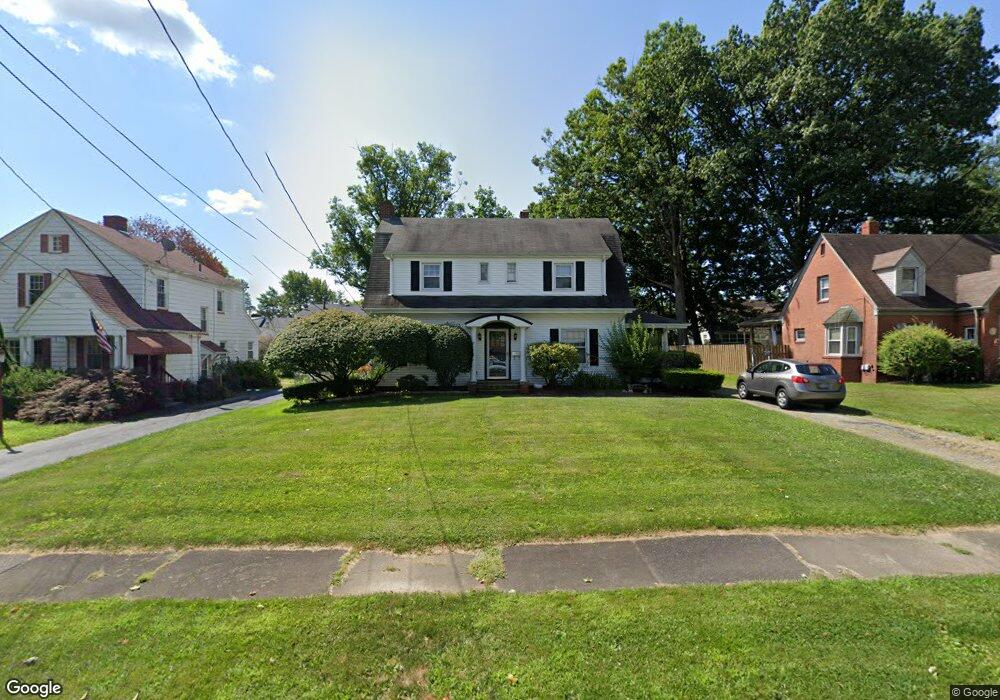
41 Maple Dr Youngstown, OH 44512
Estimated Value: $135,883 - $161,000
3
Beds
2
Baths
1,904
Sq Ft
$75/Sq Ft
Est. Value
About This Home
This home is located at 41 Maple Dr, Youngstown, OH 44512 and is currently estimated at $143,721, approximately $75 per square foot. 41 Maple Dr is a home located in Mahoning County with nearby schools including Boardman Glenwood Junior High School, Boardman High School, and Horizon Science Academy - Youngstown.
Ownership History
Date
Name
Owned For
Owner Type
Purchase Details
Closed on
May 13, 2014
Sold by
Petrello Annette D and Hinrichs Jason J
Bought by
Hinrichs Annette D and Hinrichs Jason J
Current Estimated Value
Home Financials for this Owner
Home Financials are based on the most recent Mortgage that was taken out on this home.
Original Mortgage
$85,000
Outstanding Balance
$23,918
Interest Rate
4.34%
Mortgage Type
New Conventional
Estimated Equity
$119,803
Purchase Details
Closed on
Jul 25, 2000
Sold by
Kadilak Jacquelyn C
Bought by
Petrello Annette D and Hinrichs Jason H
Home Financials for this Owner
Home Financials are based on the most recent Mortgage that was taken out on this home.
Original Mortgage
$88,270
Interest Rate
7.16%
Purchase Details
Closed on
Apr 23, 1990
Bought by
Kadilak Jacquelyn C
Create a Home Valuation Report for This Property
The Home Valuation Report is an in-depth analysis detailing your home's value as well as a comparison with similar homes in the area
Home Values in the Area
Average Home Value in this Area
Purchase History
| Date | Buyer | Sale Price | Title Company |
|---|---|---|---|
| Hinrichs Annette D | -- | Attorney | |
| Petrello Annette D | $91,000 | -- | |
| Kadilak Jacquelyn C | $65,000 | -- |
Source: Public Records
Mortgage History
| Date | Status | Borrower | Loan Amount |
|---|---|---|---|
| Open | Hinrichs Annette D | $85,000 | |
| Closed | Petrello Annette D | $88,270 |
Source: Public Records
Tax History
| Year | Tax Paid | Tax Assessment Tax Assessment Total Assessment is a certain percentage of the fair market value that is determined by local assessors to be the total taxable value of land and additions on the property. | Land | Improvement |
|---|---|---|---|---|
| 2025 | $1,906 | $38,220 | $2,910 | $35,310 |
| 2024 | $1,950 | $38,220 | $2,910 | $35,310 |
| 2023 | $1,924 | $38,220 | $2,910 | $35,310 |
| 2022 | $1,458 | $22,010 | $2,880 | $19,130 |
| 2021 | $1,459 | $22,010 | $2,880 | $19,130 |
| 2020 | $1,466 | $22,010 | $2,880 | $19,130 |
| 2019 | $1,472 | $19,480 | $2,550 | $16,930 |
| 2018 | $1,238 | $19,480 | $2,550 | $16,930 |
| 2017 | $1,235 | $19,480 | $2,550 | $16,930 |
| 2016 | $1,300 | $20,320 | $2,770 | $17,550 |
| 2015 | $1,274 | $20,320 | $2,770 | $17,550 |
| 2014 | $1,278 | $20,320 | $2,770 | $17,550 |
| 2013 | $1,262 | $20,320 | $2,770 | $17,550 |
Source: Public Records
Map
Nearby Homes
- 4717 Market St
- 63 Clifton Dr
- 28 Jennette Dr
- 4441 Southern Blvd
- 28 Terrace Dr
- 86 Terrace Dr
- 4941 Market St
- 94 Jennette Dr
- 4833 Oak Knoll Dr
- 4144 Helena Ave
- 132 Jennette Dr
- 144 Mill Creek Dr
- 4250 Oak Knoll Dr
- 4127 Southern Blvd
- 189 Beechwood Dr
- 196 Maywood Dr
- 4225 Stratford Rd
- 153 Overhill Rd
- 4141 Windsor Rd
- 3916 Howard St
Your Personal Tour Guide
Ask me questions while you tour the home.