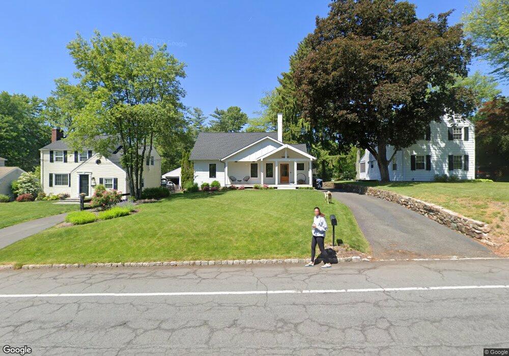
41 Maple St New Providence, NJ 07974
Estimated Value: $1,014,000 - $1,191,000
Studio
--
Bath
2,454
Sq Ft
$450/Sq Ft
Est. Value
About This Home
This home is located at 41 Maple St, New Providence, NJ 07974 and is currently estimated at $1,103,158, approximately $449 per square foot. 41 Maple St is a home located in Union County with nearby schools including New Providence High School, The Academy of Our Lady of Peace, and Oak Knoll School of the Holy Child.
Ownership History
Date
Name
Owned For
Owner Type
Purchase Details
Closed on
Jul 18, 2011
Sold by
Thornton Arthur P and Thornton Jeanne S
Bought by
Riccio Michael R and Riccio Jennifer R
Current Estimated Value
Home Financials for this Owner
Home Financials are based on the most recent Mortgage that was taken out on this home.
Original Mortgage
$372,000
Interest Rate
4.33%
Mortgage Type
Stand Alone First
Purchase Details
Closed on
Sep 11, 2009
Sold by
Dams Dennis R and Teugels Godelieve M
Bought by
Thornton Arthur P and Thornton Jeanne S
Home Financials for this Owner
Home Financials are based on the most recent Mortgage that was taken out on this home.
Original Mortgage
$364,000
Interest Rate
5.28%
Mortgage Type
New Conventional
Purchase Details
Closed on
Aug 30, 2002
Sold by
Johnson Ryan
Bought by
Dams Dennis and Teugels Lieve
Home Financials for this Owner
Home Financials are based on the most recent Mortgage that was taken out on this home.
Original Mortgage
$300,000
Interest Rate
6.55%
Purchase Details
Closed on
Jun 28, 2000
Sold by
Shine Peter A and Comeau Janet E
Bought by
Johnson Ryan T and Johnson Bonnie L
Home Financials for this Owner
Home Financials are based on the most recent Mortgage that was taken out on this home.
Original Mortgage
$249,600
Interest Rate
8.55%
Create a Home Valuation Report for This Property
The Home Valuation Report is an in-depth analysis detailing your home's value as well as a comparison with similar homes in the area
Home Values in the Area
Average Home Value in this Area
Purchase History
| Date | Buyer | Sale Price | Title Company |
|---|---|---|---|
| Riccio Michael R | $465,000 | None Available | |
| Thornton Arthur P | $455,000 | Fidelity Natl Title Ins Co | |
| Dams Dennis | $382,000 | -- | |
| Johnson Ryan T | $312,000 | -- |
Source: Public Records
Mortgage History
| Date | Status | Borrower | Loan Amount |
|---|---|---|---|
| Previous Owner | Riccio Michael R | $372,000 | |
| Previous Owner | Thornton Arthur P | $364,000 | |
| Previous Owner | Dams Dennis | $300,000 | |
| Previous Owner | Johnson Ryan T | $249,600 |
Source: Public Records
Tax History
| Year | Tax Paid | Tax Assessment Tax Assessment Total Assessment is a certain percentage of the fair market value that is determined by local assessors to be the total taxable value of land and additions on the property. | Land | Improvement |
|---|---|---|---|---|
| 2025 | $17,737 | $343,600 | $132,500 | $211,100 |
| 2024 | $17,204 | $343,600 | $132,500 | $211,100 |
| 2023 | $17,204 | $343,600 | $132,500 | $211,100 |
| 2022 | $16,967 | $343,600 | $132,500 | $211,100 |
| 2021 | $16,843 | $343,600 | $132,500 | $211,100 |
| 2020 | $16,836 | $343,600 | $132,500 | $211,100 |
| 2019 | $11,021 | $226,300 | $132,500 | $93,800 |
| 2018 | $10,964 | $226,300 | $132,500 | $93,800 |
| 2017 | $10,785 | $226,300 | $132,500 | $93,800 |
| 2016 | $10,634 | $226,300 | $132,500 | $93,800 |
| 2015 | $10,487 | $226,300 | $132,500 | $93,800 |
| 2014 | $10,328 | $226,300 | $132,500 | $93,800 |
Source: Public Records
Map
Nearby Homes
- 17 Badgley Dr
- 20 Pittsford Way
- 25 Division Ave
- 157 Grant Ave
- 50 Livingston Ave
- 47 Clinton Ave
- 15 Alison Ct
- 34 Grant Ave
- 65 Seven Oaks Dr
- 100 Commonwealth Ave
- 32 Marion Ave
- 299 Riveredge Dr
- 709 Springfield Ave Unit One
- 709 Springfield Ave Unit 4
- 709 Springfield Ave Unit 2
- 709 Springfield Ave Unit 3
- 139 Riveredge Dr
- 105 Riveredge Dr
- 10C Heritage Dr Unit C
- 5G Terrace Dr
Your Personal Tour Guide
Ask me questions while you tour the home.