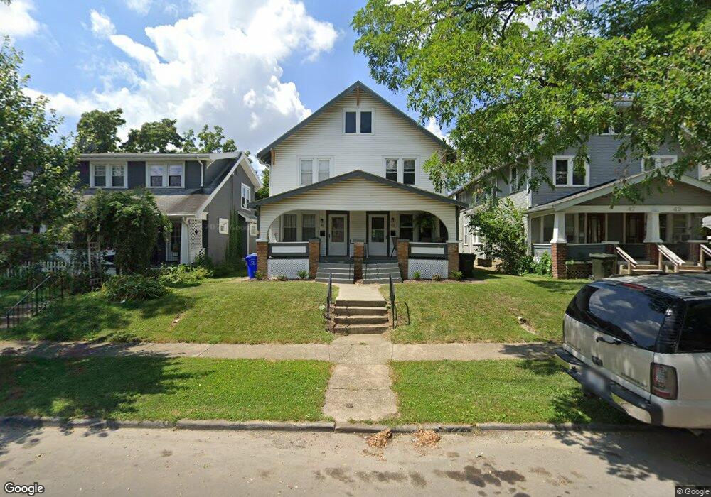
41 N Roys Ave Unit 43 Columbus, OH 43204
North Hilltop NeighborhoodEstimated Value: $235,000 - $268,773
6
Beds
2
Baths
2,448
Sq Ft
$102/Sq Ft
Est. Value
About This Home
This home is located at 41 N Roys Ave Unit 43, Columbus, OH 43204 and is currently estimated at $249,693, approximately $101 per square foot. 41 N Roys Ave Unit 43 is a home located in Franklin County with nearby schools including West Broad Elementary School, Westmoor Middle School, and West High School.
Ownership History
Date
Name
Owned For
Owner Type
Purchase Details
Closed on
Feb 1, 2023
Sold by
Elizabeth L Graham Trust
Bought by
West Sara Marie
Current Estimated Value
Purchase Details
Closed on
Jun 6, 2002
Sold by
Graham Elizabeth L and Clay Mary H
Bought by
The Elizabeth L Graham Trust
Purchase Details
Closed on
Mar 16, 2002
Sold by
Graham Betty L and Graham Elizabeth L
Bought by
Graham Elizabeth L and Clay Mary H
Purchase Details
Closed on
Dec 6, 1994
Sold by
Graham Betty L
Bought by
Betty L Graham
Purchase Details
Closed on
Feb 2, 1994
Purchase Details
Closed on
Sep 10, 1993
Create a Home Valuation Report for This Property
The Home Valuation Report is an in-depth analysis detailing your home's value as well as a comparison with similar homes in the area
Home Values in the Area
Average Home Value in this Area
Purchase History
| Date | Buyer | Sale Price | Title Company |
|---|---|---|---|
| West Sara Marie | $148,000 | Landsel Title Agency | |
| The Elizabeth L Graham Trust | -- | -- | |
| Graham Elizabeth L | $34,600 | Chicago Title | |
| Betty L Graham | $30,750 | -- | |
| -- | $61,500 | -- | |
| -- | $40,000 | -- |
Source: Public Records
Tax History Compared to Growth
Tax History
| Year | Tax Paid | Tax Assessment Tax Assessment Total Assessment is a certain percentage of the fair market value that is determined by local assessors to be the total taxable value of land and additions on the property. | Land | Improvement |
|---|---|---|---|---|
| 2024 | $3,494 | $76,240 | $8,510 | $67,730 |
| 2023 | $2,874 | $63,500 | $8,510 | $54,990 |
| 2022 | $2,843 | $53,490 | $10,890 | $42,600 |
| 2021 | $2,848 | $53,490 | $10,890 | $42,600 |
| 2020 | $2,852 | $53,490 | $10,890 | $42,600 |
| 2019 | $2,771 | $44,560 | $9,070 | $35,490 |
| 2018 | $2,211 | $44,560 | $9,070 | $35,490 |
| 2017 | $2,295 | $44,560 | $9,070 | $35,490 |
| 2016 | $1,819 | $26,780 | $5,810 | $20,970 |
| 2015 | $1,656 | $26,780 | $5,810 | $20,970 |
| 2014 | $1,660 | $26,780 | $5,810 | $20,970 |
| 2013 | $909 | $29,715 | $6,440 | $23,275 |
Source: Public Records
Map
Nearby Homes
- 65 N Chase Ave
- 58 Binns Blvd
- 162 S Roys Ave
- 75 N Huron Ave
- 184 N Roys Ave
- 104-106 N Hague Ave
- 65 S Hague Ave
- 154-156 N Huron Ave
- 87 N Warren Ave
- 3096 Ellis Place
- 166 N Harris Ave
- 119 N Westgate Ave
- 200-202 N Harris Ave
- 85 S Warren Ave
- 66 N Brinker Ave
- 3100 Steele Ave
- 118 N Ogden Ave
- 113 N Brinker Ave Unit 115
- 36-38 Orel Ave
- 32 Orel Ave
- 47-49 N Roys Ave
- 47 N Roys Ave Unit 49
- 47 N Roys Ave Unit 9
- 37 N Roys Ave
- 53 N Roys Ave
- 33 N Roys Ave
- 59 N Roys Ave
- 25 N Roys Ave
- 65 N Roys Ave
- 40 N Roys Ave Unit 42
- 48 N Roys Ave
- 58 N Roys Ave
- 52 N Roys Ave
- 46-48 Haldy Ave
- 69 N Roys Ave
- 36 N Roys Ave
- 46 Haldy Ave Unit 48
- 32-34 Haldy Ave
- 11 N Roys Ave Unit 17
- 32 Haldy Ave Unit 34