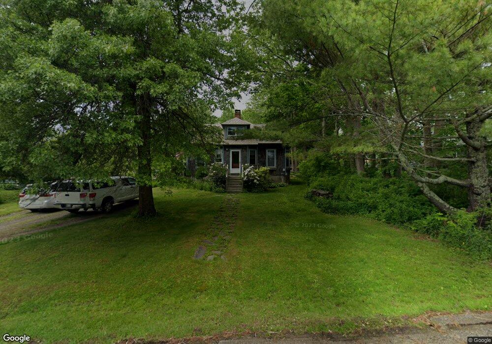
41 Northport Ave Belfast, ME 04915
Estimated Value: $441,822 - $465,000
3
Beds
2
Baths
1,250
Sq Ft
$361/Sq Ft
Est. Value
About This Home
This home is located at 41 Northport Ave, Belfast, ME 04915 and is currently estimated at $451,706, approximately $361 per square foot. 41 Northport Ave is a home located in Waldo County with nearby schools including Cornerspring Children's House and The School At Sweetser - Belfast.
Ownership History
Date
Name
Owned For
Owner Type
Purchase Details
Closed on
Aug 27, 2013
Sold by
Arnett Amy E and Arnett Hall C
Bought by
Martin Jeremy P
Current Estimated Value
Home Financials for this Owner
Home Financials are based on the most recent Mortgage that was taken out on this home.
Original Mortgage
$180,000
Outstanding Balance
$134,904
Interest Rate
4.51%
Mortgage Type
Commercial
Estimated Equity
$316,802
Create a Home Valuation Report for This Property
The Home Valuation Report is an in-depth analysis detailing your home's value as well as a comparison with similar homes in the area
Home Values in the Area
Average Home Value in this Area
Purchase History
| Date | Buyer | Sale Price | Title Company |
|---|---|---|---|
| Martin Jeremy P | -- | -- |
Source: Public Records
Mortgage History
| Date | Status | Borrower | Loan Amount |
|---|---|---|---|
| Open | Martin Jeremy P | $180,000 |
Source: Public Records
Tax History Compared to Growth
Tax History
| Year | Tax Paid | Tax Assessment Tax Assessment Total Assessment is a certain percentage of the fair market value that is determined by local assessors to be the total taxable value of land and additions on the property. | Land | Improvement |
|---|---|---|---|---|
| 2024 | $4,224 | $274,300 | $104,400 | $169,900 |
| 2023 | $4,456 | $221,700 | $86,000 | $135,700 |
| 2022 | $4,567 | $213,400 | $86,000 | $127,400 |
| 2021 | $4,695 | $213,400 | $86,000 | $127,400 |
| 2020 | $4,455 | $191,200 | $80,600 | $110,600 |
| 2019 | $4,028 | $175,900 | $80,600 | $95,300 |
| 2018 | $3,993 | $175,900 | $80,600 | $95,300 |
| 2017 | $3,852 | $175,900 | $80,600 | $95,300 |
| 2016 | $3,902 | $170,400 | $63,200 | $107,200 |
| 2015 | $3,817 | $170,400 | $63,200 | $107,200 |
| 2014 | $3,689 | $170,400 | $63,200 | $107,200 |
| 2013 | $3,532 | $169,800 | $63,200 | $106,600 |
Source: Public Records
Map
Nearby Homes
- 22 Salmond St
- 124 Union St
- 75 Northport Ave
- 153 Cedar St
- 98 Bayview St
- 16 Cottage St
- 48 Ocean
- Lot 3 Congress St
- 92 Cedar St
- L3,4,5,6,7 Final Subd Plan Sanderson Subd
- 102 Congress St
- Lot 7 Priscilla Ln
- 58 Church St
- 19 Glenview Ln
- 208 Congress St
- 139 Northport Ave
- 86 High St
- 13 R W MacLeod Ln
- 4 R W MacLeod Ln
- Lot 6 School St
- 45 Northport Ave
- 37 Northport Ave
- 47 Northport Ave
- 8 Durham St
- 47 Northport Ave Unit R
- 47 Northport Ave Unit R
- 12 Durham St
- 51 Northport Ave
- 6 Durham Cir
- 44 Northport Ave
- 40 Northport Ave
- 31 Northport Ave
- 7 Durham St
- 18 Durham St
- 34 Northport Ave
- 50 Northport Ave
- 27 Northport Ave
- 30 Northport Ave
- 8 Race St
- 11 Durham St