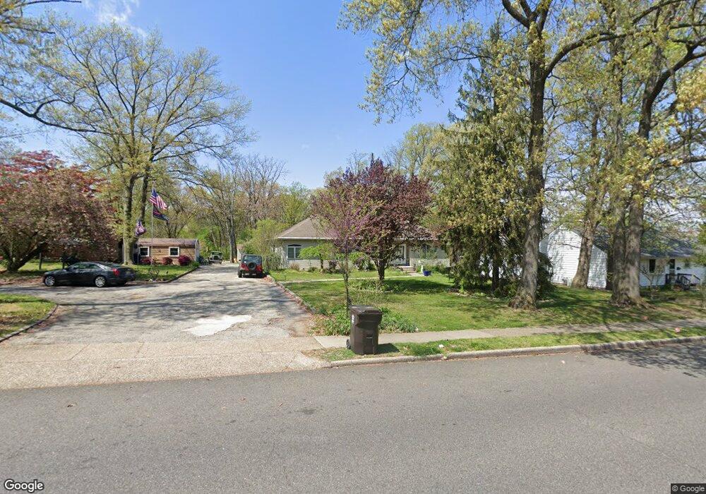
41 Pancoast Blvd Delran, NJ 08075
Estimated Value: $492,000 - $612,000
--
Bed
--
Bath
2,324
Sq Ft
$230/Sq Ft
Est. Value
About This Home
This home is located at 41 Pancoast Blvd, Delran, NJ 08075 and is currently estimated at $533,595, approximately $229 per square foot. 41 Pancoast Blvd is a home located in Burlington County with nearby schools including Millbridge Elementary School, Delran Intermediate School, and Delran Middle School.
Ownership History
Date
Name
Owned For
Owner Type
Purchase Details
Closed on
Nov 30, 1999
Sold by
Lisiewski Richard A and Lisiewski Pauline A
Bought by
Anderson Vincent L and Anderson Traci L
Current Estimated Value
Purchase Details
Closed on
May 21, 1999
Sold by
Lisiewski Richard A and Lisiewski Pauline A
Bought by
Lisiewski Richard A and Lisiewski Pauline A
Purchase Details
Closed on
Feb 26, 1998
Sold by
Zebrowski Constance M
Bought by
Zebrowski Sharon and Altadonna Peter S
Create a Home Valuation Report for This Property
The Home Valuation Report is an in-depth analysis detailing your home's value as well as a comparison with similar homes in the area
Home Values in the Area
Average Home Value in this Area
Purchase History
| Date | Buyer | Sale Price | Title Company |
|---|---|---|---|
| Anderson Vincent L | $131,000 | -- | |
| Lisiewski Richard A | -- | Ctl Title Insurance Agency | |
| Zebrowski Sharon | -- | -- |
Source: Public Records
Tax History Compared to Growth
Tax History
| Year | Tax Paid | Tax Assessment Tax Assessment Total Assessment is a certain percentage of the fair market value that is determined by local assessors to be the total taxable value of land and additions on the property. | Land | Improvement |
|---|---|---|---|---|
| 2025 | $11,479 | $288,700 | $52,900 | $235,800 |
| 2024 | $11,375 | $288,700 | $52,900 | $235,800 |
| 2023 | $11,375 | $288,700 | $52,900 | $235,800 |
| 2022 | $11,228 | $288,700 | $52,900 | $235,800 |
| 2021 | $10,689 | $288,700 | $52,900 | $235,800 |
| 2020 | $11,210 | $288,700 | $52,900 | $235,800 |
| 2019 | $11,106 | $288,700 | $52,900 | $235,800 |
| 2018 | $10,922 | $288,700 | $52,900 | $235,800 |
| 2017 | $10,748 | $288,700 | $52,900 | $235,800 |
| 2016 | $10,590 | $288,700 | $52,900 | $235,800 |
| 2015 | $10,413 | $288,700 | $52,900 | $235,800 |
| 2014 | $9,960 | $288,700 | $52,900 | $235,800 |
Source: Public Records
Map
Nearby Homes
- 1122 S Fairview St
- 1062 S Fairview St
- 7016 Route 130
- 224 Progress St
- 14 Montclair Dr
- 327 Whittaker St
- 9000 Route 130
- 9002 Route 130
- 910 S Fairview St
- 649 Bridgeboro St
- 404 Greenwood Ave
- 705 Arndt Ave
- 14 Grant St
- 702 Delaware Ave
- 514 Bridgeboro St
- 506 Bridgeboro St
- 528 S Fairview St
- 224 E Washington St
- 0 Delaware Ave Unit NJBL2090486
- 423 Delaware Ave
- 43 Pancoast Blvd
- 39 Pancoast Blvd
- 884 Faunce St
- 886 Faunce St
- 37 Pancoast Blvd
- 45 Pancoast Blvd
- 882 Faunce St
- 44 Pancoast Blvd
- 48 Pancoast Blvd
- 40 Pancoast Blvd
- 50 Pancoast Blvd
- 35 Pancoast Blvd
- 61 Pancoast Blvd
- 38 Pancoast Blvd
- 878 Faunce St
- 56 Pancoast Blvd
- 885 Faunce St
- 33 Pancoast Blvd
- 883 Faunce St
- 900 Faunce St