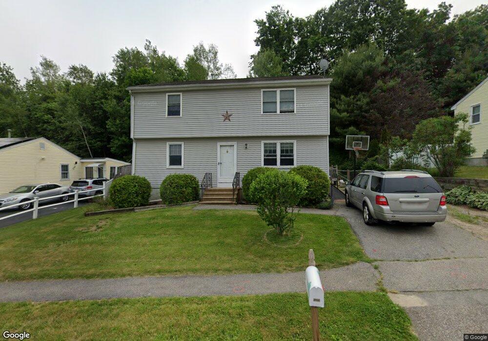
41 Parsons Hill Dr Worcester, MA 01603
Webster Square NeighborhoodEstimated Value: $386,000 - $503,000
4
Beds
3
Baths
1,700
Sq Ft
$256/Sq Ft
Est. Value
About This Home
This home is located at 41 Parsons Hill Dr, Worcester, MA 01603 and is currently estimated at $435,074, approximately $255 per square foot. 41 Parsons Hill Dr is a home located in Worcester County with nearby schools including Jacob Hiatt Magnet School, Chandler Magnet, and Heard Street Discovery Academy.
Ownership History
Date
Name
Owned For
Owner Type
Purchase Details
Closed on
Dec 2, 1992
Sold by
Joyce John M and Joyce Maryann
Bought by
Hartigan Kevin P and Bergin Lynne
Current Estimated Value
Home Financials for this Owner
Home Financials are based on the most recent Mortgage that was taken out on this home.
Original Mortgage
$75,900
Interest Rate
8.22%
Mortgage Type
Purchase Money Mortgage
Create a Home Valuation Report for This Property
The Home Valuation Report is an in-depth analysis detailing your home's value as well as a comparison with similar homes in the area
Home Values in the Area
Average Home Value in this Area
Purchase History
| Date | Buyer | Sale Price | Title Company |
|---|---|---|---|
| Hartigan Kevin P | $76,000 | -- |
Source: Public Records
Mortgage History
| Date | Status | Borrower | Loan Amount |
|---|---|---|---|
| Open | Hartigan Kevin P | $84,849 | |
| Closed | Hartigan Kevin P | $75,900 | |
| Previous Owner | Hartigan Kevin P | $15,000 |
Source: Public Records
Tax History
| Year | Tax Paid | Tax Assessment Tax Assessment Total Assessment is a certain percentage of the fair market value that is determined by local assessors to be the total taxable value of land and additions on the property. | Land | Improvement |
|---|---|---|---|---|
| 2025 | $5,428 | $411,500 | $98,100 | $313,400 |
| 2024 | $5,349 | $389,000 | $98,100 | $290,900 |
| 2023 | $5,160 | $359,800 | $85,300 | $274,500 |
| 2022 | $4,790 | $314,900 | $68,300 | $246,600 |
| 2021 | $4,671 | $286,900 | $54,600 | $232,300 |
| 2020 | $4,510 | $265,300 | $54,200 | $211,100 |
| 2019 | $4,320 | $240,000 | $47,400 | $192,600 |
| 2018 | $4,283 | $226,500 | $47,400 | $179,100 |
| 2017 | $4,109 | $213,800 | $47,400 | $166,400 |
| 2016 | $4,116 | $199,700 | $33,700 | $166,000 |
| 2015 | $4,008 | $199,700 | $33,700 | $166,000 |
| 2014 | $3,887 | $198,900 | $33,700 | $165,200 |
Source: Public Records
Map
Nearby Homes
- 11 Timrod Dr
- 56 Goddard Memorial Dr
- 66 Ledgecrest Dr
- 32 Goddard Memorial Dr
- 13 Merchant St
- 34 Scandinavia Ave
- 57 1st St
- 1511 Main St Unit C405
- 55 Grandview Ave
- 215 Mill St Unit 113
- 215 Mill St Unit 115
- 37 Gates Rd
- 103 Henshaw St
- 27 Montague St
- 5 Swan Ave
- 35 Genessee St Unit E
- 11 Hulbert Rd Unit 13
- 23 Lakewood St
- 34 Rosslare Dr Unit 108
- 415 Mill St
- 43 Parsons Hill Dr
- 39 Parsons Hill Dr
- 37A Parsons Hill Dr
- 45 Parsons Hill Dr
- 21B Timrod Dr
- 21B Timrod Dr Unit 21 B
- 42 Parsons Hill Dr
- 37B Parsons Hill Dr
- 40 Parsons Hill Dr
- 25B Timrod Dr
- 25A Timrod Dr
- 23A Timrod Dr
- 47B Parsons Hill Dr
- 19B Timrod Dr
- 47A Parsons Hill Dr
- 27 Timrod Dr
- 38B Parsons Hill Dr
- 38A Parsons Hill Dr
- 38A Parsons Hill Dr Unit A
- 38 Parsons Hill Dr Unit A
Your Personal Tour Guide
Ask me questions while you tour the home.