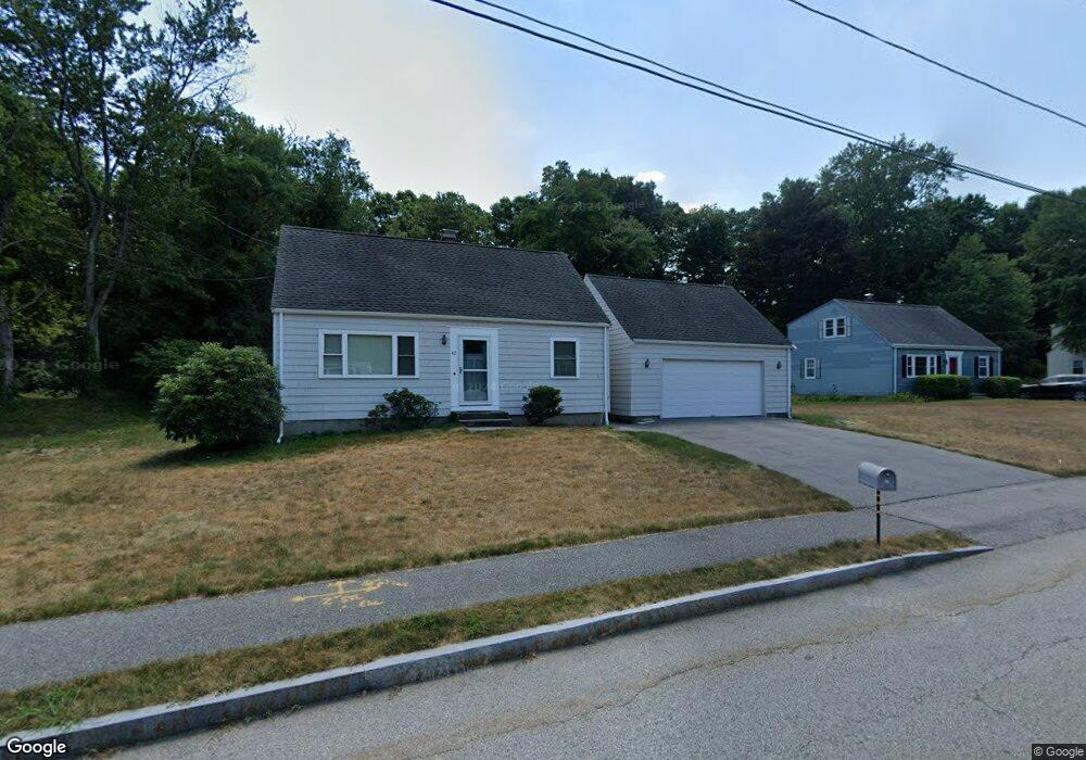
41 Robin Rd Westborough, MA 01581
Estimated Value: $591,000 - $629,000
2
Beds
2
Baths
1,344
Sq Ft
$451/Sq Ft
Est. Value
About This Home
This home is located at 41 Robin Rd, Westborough, MA 01581 and is currently estimated at $605,835, approximately $450 per square foot. 41 Robin Rd is a home located in Worcester County with nearby schools including Westborough High School, Ebridge Montessori School, and Westboro Knowledge Beginnings.
Create a Home Valuation Report for This Property
The Home Valuation Report is an in-depth analysis detailing your home's value as well as a comparison with similar homes in the area
Home Values in the Area
Average Home Value in this Area
Tax History
| Year | Tax Paid | Tax Assessment Tax Assessment Total Assessment is a certain percentage of the fair market value that is determined by local assessors to be the total taxable value of land and additions on the property. | Land | Improvement |
|---|---|---|---|---|
| 2025 | $8,573 | $526,300 | $323,500 | $202,800 |
| 2024 | $7,915 | $482,300 | $287,600 | $194,700 |
| 2023 | $7,475 | $443,900 | $271,200 | $172,700 |
| 2022 | $7,185 | $388,600 | $229,300 | $159,300 |
| 2021 | $6,956 | $375,200 | $219,400 | $155,800 |
| 2020 | $6,544 | $357,200 | $201,400 | $155,800 |
| 2019 | $6,478 | $353,400 | $203,400 | $150,000 |
| 2018 | $6,011 | $325,600 | $195,500 | $130,100 |
| 2017 | $5,796 | $325,600 | $195,500 | $130,100 |
| 2016 | $5,317 | $299,200 | $179,500 | $119,700 |
| 2015 | $4,848 | $260,800 | $159,600 | $101,200 |
Source: Public Records
Map
Nearby Homes
- 19 Treetop Park Unit 19
- 4203 Peters Farm Way Unit 4203
- 18 Fairview Rd
- 22 Park St
- 5 Wessonville Village Way Unit 5
- 155 Milk St Unit 27
- 155 Milk St Unit 5
- 23 Water St
- 196 -198 Turnpike Rd
- 165 Turnpike Rd Unit 7
- 44 South St
- 37 Oneil Dr
- 34 Harvey Ln
- 192 W Main St
- 26 Mount Pleasant St
- 2306 Talbot Way Unit 2306
- 5 Peters Farm Way Unit 209
- 5 Peters Farm Way Unit 111
- 5 Peters Farm Way Unit 206
- 5 Peters Farm Way Unit 107
Your Personal Tour Guide
Ask me questions while you tour the home.