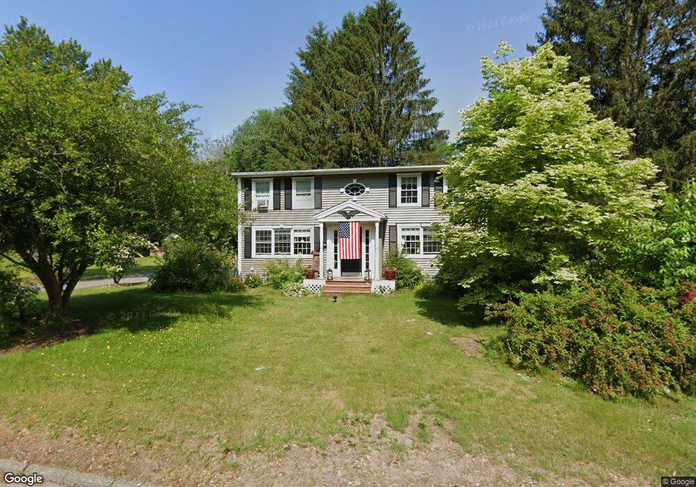
41 Rockland Rd Auburn, MA 01501
Stoneville NeighborhoodEstimated Value: $424,000 - $565,000
4
Beds
4
Baths
1,728
Sq Ft
$278/Sq Ft
Est. Value
About This Home
This home is located at 41 Rockland Rd, Auburn, MA 01501 and is currently estimated at $480,939, approximately $278 per square foot. 41 Rockland Rd is a home located in Worcester County with nearby schools including Auburn Senior High School and Shrewsbury Montessori School - Auburn Campus.
Ownership History
Date
Name
Owned For
Owner Type
Purchase Details
Closed on
Oct 30, 1990
Sold by
Maher Kevin J
Bought by
Giacobbi Michael N
Current Estimated Value
Home Financials for this Owner
Home Financials are based on the most recent Mortgage that was taken out on this home.
Original Mortgage
$105,000
Interest Rate
10.08%
Mortgage Type
Purchase Money Mortgage
Create a Home Valuation Report for This Property
The Home Valuation Report is an in-depth analysis detailing your home's value as well as a comparison with similar homes in the area
Home Values in the Area
Average Home Value in this Area
Purchase History
| Date | Buyer | Sale Price | Title Company |
|---|---|---|---|
| Giacobbi Michael N | $117,500 | -- |
Source: Public Records
Mortgage History
| Date | Status | Borrower | Loan Amount |
|---|---|---|---|
| Open | Giacobbi Michael N | $58,500 | |
| Closed | Giacobbi Michael N | $39,300 | |
| Closed | Giacobbi Michael N | $105,000 |
Source: Public Records
Tax History Compared to Growth
Tax History
| Year | Tax Paid | Tax Assessment Tax Assessment Total Assessment is a certain percentage of the fair market value that is determined by local assessors to be the total taxable value of land and additions on the property. | Land | Improvement |
|---|---|---|---|---|
| 2025 | $54 | $376,500 | $127,800 | $248,700 |
| 2024 | $5,578 | $373,600 | $122,500 | $251,100 |
| 2023 | $5,333 | $335,800 | $111,400 | $224,400 |
| 2022 | $4,974 | $295,700 | $111,400 | $184,300 |
| 2021 | $10,205 | $255,900 | $98,400 | $157,500 |
| 2020 | $4,542 | $252,600 | $98,400 | $154,200 |
| 2019 | $4,194 | $227,700 | $97,400 | $130,300 |
| 2018 | $3,966 | $215,100 | $91,100 | $124,000 |
| 2017 | $3,791 | $206,700 | $82,700 | $124,000 |
| 2016 | $3,634 | $200,900 | $85,800 | $115,100 |
| 2015 | $3,364 | $194,900 | $85,800 | $109,100 |
| 2014 | $3,251 | $188,000 | $81,800 | $106,200 |
Source: Public Records
Map
Nearby Homes
- 34 Rockland Rd
- 25 Vinal St Unit 26
- 25 Vinal St Unit 29
- 25 Vinal St Unit 30
- 177 Oxford St N
- 33 Walsh Ave
- 31-33 Walsh Ave
- 31 Walsh Ave
- 5 Commonwealth Ave
- 177 Boyce St
- 19-20 Williams St
- 8 Shirley St
- 326 Pakachoag St
- 52 Harrison Ave
- 7 Carroll St
- 35 Pinehurst Ave
- 1-9 Helens Way
- 88 Vine St
- 28 Lorna Dr
- 20 Alpine Trail