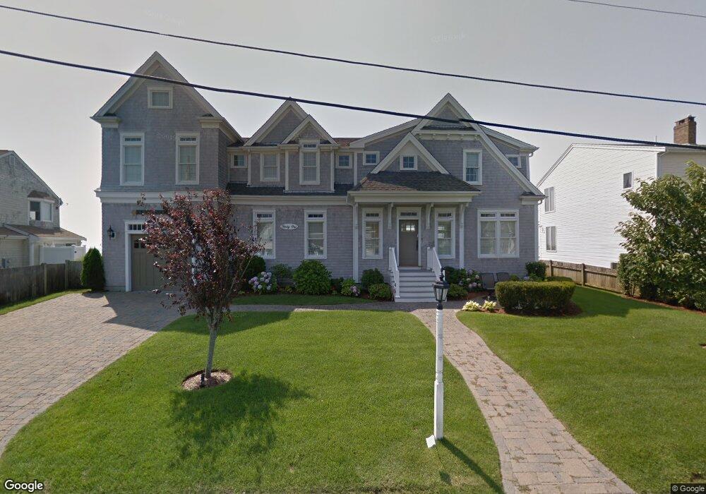
41 Shoreside Dr South Yarmouth, MA 02664
Estimated Value: $1,374,000 - $2,332,885
5
Beds
5
Baths
2,908
Sq Ft
$622/Sq Ft
Est. Value
About This Home
This home is located at 41 Shoreside Dr, South Yarmouth, MA 02664 and is currently estimated at $1,809,971, approximately $622 per square foot. 41 Shoreside Dr is a home located in Barnstable County with nearby schools including Dennis-Yarmouth Regional High School and St. Pius X. School.
Ownership History
Date
Name
Owned For
Owner Type
Purchase Details
Closed on
Jul 18, 2007
Sold by
Caruso John A and Caruso Susan L
Bought by
Caruso Ft
Current Estimated Value
Purchase Details
Closed on
Sep 5, 1995
Sold by
Chiminiello Henry P
Bought by
Caruso John A and Caruso Susan L
Home Financials for this Owner
Home Financials are based on the most recent Mortgage that was taken out on this home.
Original Mortgage
$150,000
Interest Rate
7.61%
Mortgage Type
Purchase Money Mortgage
Create a Home Valuation Report for This Property
The Home Valuation Report is an in-depth analysis detailing your home's value as well as a comparison with similar homes in the area
Home Values in the Area
Average Home Value in this Area
Purchase History
| Date | Buyer | Sale Price | Title Company |
|---|---|---|---|
| Caruso Ft | -- | -- | |
| Caruso John A | $330,000 | -- |
Source: Public Records
Mortgage History
| Date | Status | Borrower | Loan Amount |
|---|---|---|---|
| Previous Owner | Caruso John A | $150,000 |
Source: Public Records
Tax History Compared to Growth
Tax History
| Year | Tax Paid | Tax Assessment Tax Assessment Total Assessment is a certain percentage of the fair market value that is determined by local assessors to be the total taxable value of land and additions on the property. | Land | Improvement |
|---|---|---|---|---|
| 2025 | $13,977 | $1,974,200 | $1,152,600 | $821,600 |
| 2024 | $13,573 | $1,839,100 | $1,102,600 | $736,500 |
| 2023 | $14,189 | $1,749,600 | $1,055,500 | $694,100 |
| 2022 | $12,734 | $1,387,200 | $842,800 | $544,400 |
| 2021 | $12,907 | $1,350,100 | $906,700 | $443,400 |
| 2020 | $13,827 | $1,382,700 | $969,200 | $413,500 |
| 2019 | $13,625 | $1,349,000 | $969,200 | $379,800 |
| 2018 | $13,438 | $1,305,900 | $926,100 | $379,800 |
| 2017 | $12,965 | $1,293,900 | $926,100 | $367,800 |
| 2016 | $12,913 | $1,293,900 | $926,100 | $367,800 |
| 2015 | $13,418 | $1,336,500 | $926,100 | $410,400 |
Source: Public Records
Map
Nearby Homes
- 21 Lyndale Rd
- 16 Peregrine Ln
- 27 Wilfin Rd
- 135 S Shore Dr Unit 17
- 135 S South Shore Dr Unit 17
- 8 Holly Ln
- 4 Braddock St
- 9 Cedar St
- 109 Seaview Ave Unit 11
- 8 Rogers Ave
- 26 Howes Rd
- 55 Pawkannawkut Dr
- 844 Route 28 Unit 9B
- 745 Willow St
- 30 Nauset Ln
- 17 South St
- 89 Acres Ave
- 68 Bob-O-link Ln
- 2 Sachem Path
- 47 Shoreside Dr
- 45 Shoreside Dr
- 45 Shoreside Dr Unit U1
- 37 Shoreside Dr
- 17 Judan Way
- 15 Judan Way
- 15 Judan Way Unit 15
- 15 Judan Way Unit 1-2
- 51 Shoreside Dr
- 40 Shoreside Dr
- 33 Shoreside Dr
- 36 Shoreside Dr
- 243 S Shore Dr
- 241 S Shore Dr
- 243 S Shore Dr Unit 1
- 241 S Shore Dr Unit 1
- 241 S Shore Dr Unit 241
- 49 Shoreside Dr
- 18 Beachwood Rd
- 57 Judan Way