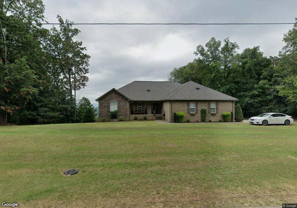
41 Signal Point Rd Laceys Spring, AL 35754
Estimated Value: $348,000 - $477,000
--
Bed
--
Bath
2,119
Sq Ft
$190/Sq Ft
Est. Value
About This Home
This home is located at 41 Signal Point Rd, Laceys Spring, AL 35754 and is currently estimated at $403,243, approximately $190 per square foot. 41 Signal Point Rd is a home located in Morgan County with nearby schools including Union Hill School and Albert P. Brewer High School.
Ownership History
Date
Name
Owned For
Owner Type
Purchase Details
Closed on
Dec 16, 2016
Sold by
Durham Philip and Durham Jennifer M
Bought by
Durham Philip V and Durham Jennifer M
Current Estimated Value
Home Financials for this Owner
Home Financials are based on the most recent Mortgage that was taken out on this home.
Original Mortgage
$280,000
Outstanding Balance
$137,393
Interest Rate
4.03%
Mortgage Type
New Conventional
Estimated Equity
$265,850
Purchase Details
Closed on
May 22, 2008
Sold by
Treece James H
Bought by
Durham Philip
Purchase Details
Closed on
Apr 16, 2008
Sold by
Smith Randle and Witt Jeron
Bought by
Treece James H
Create a Home Valuation Report for This Property
The Home Valuation Report is an in-depth analysis detailing your home's value as well as a comparison with similar homes in the area
Home Values in the Area
Average Home Value in this Area
Purchase History
| Date | Buyer | Sale Price | Title Company |
|---|---|---|---|
| Durham Philip V | $231,500 | None Available | |
| Durham Philip | $30,000 | None Available | |
| Treece James H | -- | None Available |
Source: Public Records
Mortgage History
| Date | Status | Borrower | Loan Amount |
|---|---|---|---|
| Open | Durham Philip V | $280,000 |
Source: Public Records
Tax History Compared to Growth
Tax History
| Year | Tax Paid | Tax Assessment Tax Assessment Total Assessment is a certain percentage of the fair market value that is determined by local assessors to be the total taxable value of land and additions on the property. | Land | Improvement |
|---|---|---|---|---|
| 2024 | $1,242 | $34,620 | $5,450 | $29,170 |
| 2023 | $1,242 | $33,500 | $5,040 | $28,460 |
| 2022 | $1,125 | $31,510 | $4,580 | $26,930 |
| 2021 | $893 | $25,710 | $2,980 | $22,730 |
| 2020 | $893 | $47,160 | $2,980 | $44,180 |
| 2019 | $893 | $25,320 | $0 | $0 |
| 2015 | $811 | $23,120 | $0 | $0 |
| 2014 | $811 | $23,120 | $0 | $0 |
| 2013 | -- | $22,240 | $0 | $0 |
Source: Public Records
Map
Nearby Homes
- 426 Telephone Tower Rd
- 536 Dry Creek Cove Rd
- 84 Black Ground Rd
- N OF HWY 36-E O Settlement Dr
- 107 Lower Dry Creek Rd
- 583 Bell Point Rd
- 479 Bell Point Rd
- 1 Union Hill Rd
- 227 Kay Rd
- 250 Dunn Rd
- 591 Farm Supply Rd
- 1467 Apple Grove Rd
- Lot 0 Huskey Mountain Rd
- 175 Matkin Cove Rd
- 475 Brooks Rd
- Maple Plan at Watermill Preserve
- Russell Plan at Watermill Preserve
- Jodeco Plan at Watermill Preserve
- Sierra Plan at Watermill Preserve
- Winfield Plan at Watermill Preserve
- 29 Signal Point Rd
- 75 Signal Point Rd
- 72 Signal Point Rd
- 7 Signal Point Rd
- 79 Signal Point Rd
- 1084 Telephone Tower Rd
- 1620 Telephone Tower Rd
- 1245 Telephone Tower Rd
- 1245 Telephone Tower Rd
- 7 Southwind Pvt Dr
- 987 Telephone Tower Rd
- 1194 Telephone Tower Rd
- 981 Telephone Tower Rd
- 1259 Telephone Tower Rd
- 988 Telephone Tower Rd
- 197 Northside Dr
- 940 Telephone Tower Rd
- 937 Telephone Tower Rd
- 985 Telephone Tower Rd
- 0 N Side Private Dr Unit 1062628