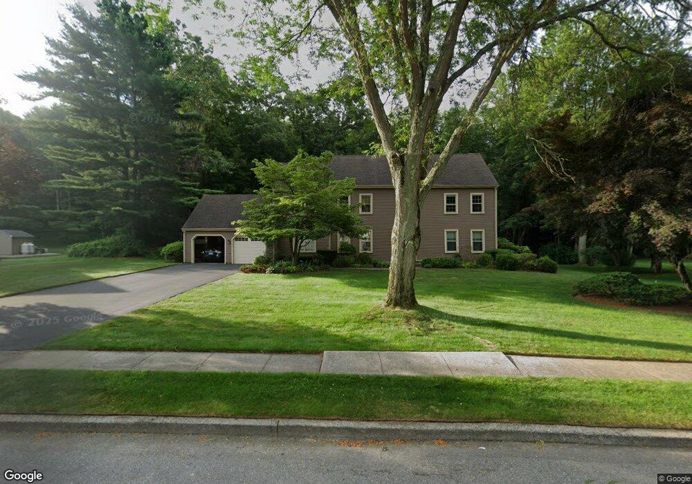
41 Trout Brook Rd Cheshire, CT 06410
Estimated Value: $718,000 - $771,000
4
Beds
3
Baths
3,022
Sq Ft
$245/Sq Ft
Est. Value
About This Home
This home is located at 41 Trout Brook Rd, Cheshire, CT 06410 and is currently estimated at $741,091, approximately $245 per square foot. 41 Trout Brook Rd is a home located in New Haven County with nearby schools including Darcey School, Chapman School, and Dodd Middle School.
Ownership History
Date
Name
Owned For
Owner Type
Purchase Details
Closed on
Sep 20, 1993
Sold by
Brooks Paul V and Brooks Barbara
Bought by
Ranando Paul S and Ranando Darcy A
Current Estimated Value
Home Financials for this Owner
Home Financials are based on the most recent Mortgage that was taken out on this home.
Original Mortgage
$100,000
Interest Rate
7.16%
Mortgage Type
Unknown
Purchase Details
Closed on
May 20, 1988
Sold by
Walker Paul
Bought by
Brooks Paul
Home Financials for this Owner
Home Financials are based on the most recent Mortgage that was taken out on this home.
Original Mortgage
$250,000
Interest Rate
10.13%
Mortgage Type
Purchase Money Mortgage
Purchase Details
Closed on
Jul 29, 1987
Sold by
Heritage Hills Inc
Bought by
Walker Paul
Home Financials for this Owner
Home Financials are based on the most recent Mortgage that was taken out on this home.
Original Mortgage
$150,000
Interest Rate
10.43%
Mortgage Type
Purchase Money Mortgage
Create a Home Valuation Report for This Property
The Home Valuation Report is an in-depth analysis detailing your home's value as well as a comparison with similar homes in the area
Home Values in the Area
Average Home Value in this Area
Purchase History
| Date | Buyer | Sale Price | Title Company |
|---|---|---|---|
| Ranando Paul S | $289,000 | -- | |
| Ranando Paul S | $289,000 | -- | |
| Brooks Paul | $380,000 | -- | |
| Walker Paul | $299,075 | -- |
Source: Public Records
Mortgage History
| Date | Status | Borrower | Loan Amount |
|---|---|---|---|
| Closed | Walker Paul | $100,000 | |
| Previous Owner | Walker Paul | $250,000 | |
| Previous Owner | Walker Paul | $150,000 |
Source: Public Records
Tax History Compared to Growth
Tax History
| Year | Tax Paid | Tax Assessment Tax Assessment Total Assessment is a certain percentage of the fair market value that is determined by local assessors to be the total taxable value of land and additions on the property. | Land | Improvement |
|---|---|---|---|---|
| 2025 | $11,362 | $382,060 | $88,690 | $293,370 |
| 2024 | $10,491 | $382,060 | $88,690 | $293,370 |
| 2023 | $9,737 | $277,500 | $88,710 | $188,790 |
| 2022 | $9,524 | $277,500 | $88,710 | $188,790 |
| 2021 | $9,357 | $277,500 | $88,710 | $188,790 |
| 2020 | $9,219 | $277,500 | $88,710 | $188,790 |
| 2019 | $9,219 | $277,500 | $88,710 | $188,790 |
| 2018 | $9,796 | $300,300 | $89,380 | $210,920 |
| 2017 | $9,592 | $300,300 | $89,380 | $210,920 |
| 2016 | $9,216 | $300,300 | $89,380 | $210,920 |
| 2015 | $9,216 | $300,300 | $89,380 | $210,920 |
| 2014 | $9,084 | $300,300 | $89,380 | $210,920 |
Source: Public Records
Map
Nearby Homes
- 39 Trout Brook Rd
- 43 Trout Brook Rd
- 50 Trout Brook Rd
- 48 Trout Brook Rd
- 52 Trout Brook Rd
- 37 Trout Brook Rd
- 45 Trout Brook Rd
- 46 Trout Brook Rd
- 54 Trout Brook Rd
- 47 Trout Brook Rd
- 764 Allen Ave
- 44 Trout Brook Rd
- 49 Trout Brook Rd
- 56 Trout Brook Rd
- 762 Allen Ave
- 51 Trout Brook Rd
- 58 Trout Brook Rd
- 1459 Allen Ct
- 42 Trout Brook Rd
- 25 Smith Place