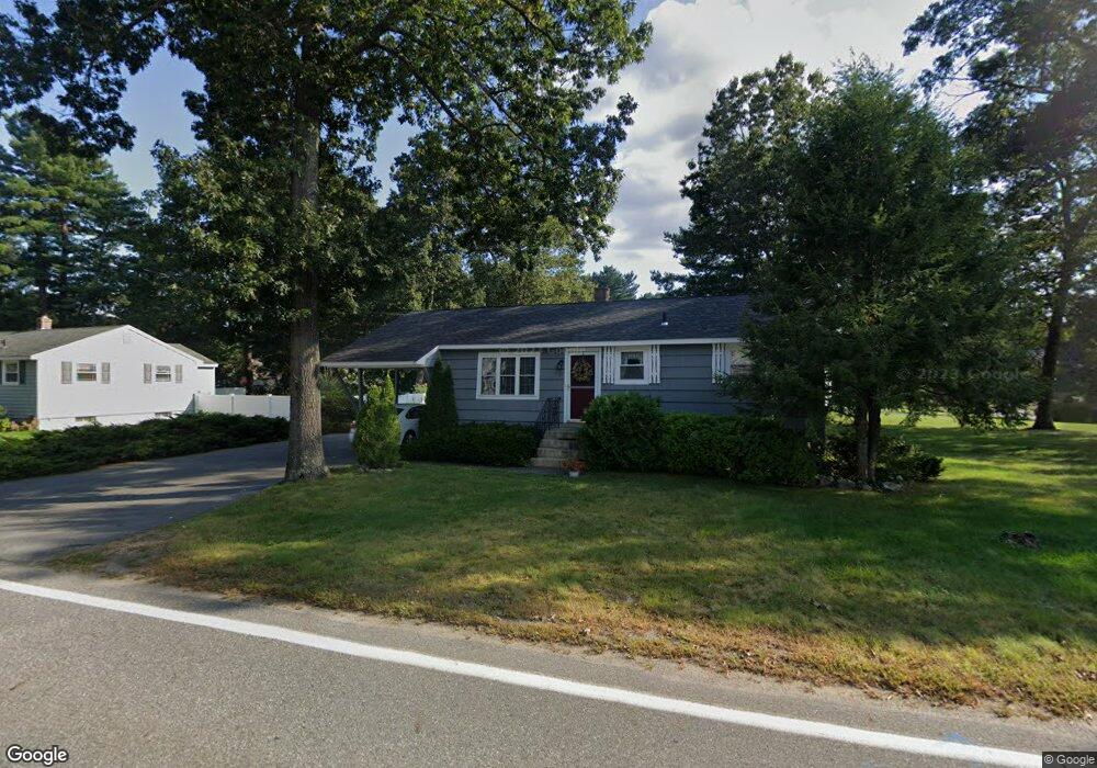
41 Vale St Tewksbury, MA 01876
Estimated Value: $571,000 - $624,000
3
Beds
2
Baths
952
Sq Ft
$627/Sq Ft
Est. Value
About This Home
This home is located at 41 Vale St, Tewksbury, MA 01876 and is currently estimated at $596,534, approximately $626 per square foot. 41 Vale St is a home located in Middlesex County with nearby schools including Heath-Brook Elementary School, John F. Ryan Elementary School, and John W. Wynn Middle School.
Create a Home Valuation Report for This Property
The Home Valuation Report is an in-depth analysis detailing your home's value as well as a comparison with similar homes in the area
Home Values in the Area
Average Home Value in this Area
Tax History Compared to Growth
Tax History
| Year | Tax Paid | Tax Assessment Tax Assessment Total Assessment is a certain percentage of the fair market value that is determined by local assessors to be the total taxable value of land and additions on the property. | Land | Improvement |
|---|---|---|---|---|
| 2025 | $6,291 | $475,900 | $269,700 | $206,200 |
| 2024 | $6,074 | $453,600 | $256,800 | $196,800 |
| 2023 | $5,964 | $423,000 | $233,600 | $189,400 |
| 2022 | $5,692 | $374,500 | $203,100 | $171,400 |
| 2021 | $19,214 | $341,000 | $184,600 | $156,400 |
| 2020 | $18,534 | $332,800 | $175,800 | $157,000 |
| 2019 | $17,551 | $315,200 | $167,400 | $147,800 |
| 2018 | $4,547 | $281,900 | $167,400 | $114,500 |
| 2017 | $4,322 | $265,000 | $167,400 | $97,600 |
| 2016 | $4,187 | $256,100 | $167,400 | $88,700 |
| 2015 | $3,966 | $242,300 | $162,500 | $79,800 |
| 2014 | $3,696 | $229,400 | $162,500 | $66,900 |
Source: Public Records
Map
Nearby Homes
- 93 Vale St
- 5 Kensington Way Unit 5
- 110 Royal Crest Cir
- 120 Judique Rd
- 109 Apache Way
- 71 Apache Way Unit 71
- 261 Apache Way
- 58 Blanchard St
- 906 Old Shawsheen St
- 14 Blanchard St
- 51 Nolan Ct Unit 51
- 837 Livingston St
- 18 Dale St Unit 4G
- 127 Caddy Ct
- 93 Fairway Dr
- 12 Taylor Cove Dr Unit 6
- 7 Stouffer Cir
- 7 Wamesit Rd
- 4 Alonesos Way
- 16 Eagle Dr