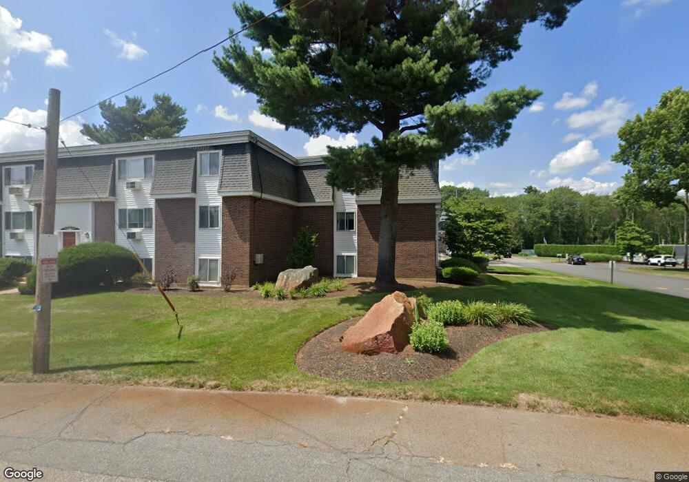
41 Will Dr Unit 21 Canton, MA 02021
Estimated Value: $318,832 - $399,000
2
Beds
1
Bath
881
Sq Ft
$391/Sq Ft
Est. Value
About This Home
This home is located at 41 Will Dr Unit 21, Canton, MA 02021 and is currently estimated at $344,458, approximately $390 per square foot. 41 Will Dr Unit 21 is a home located in Norfolk County with nearby schools including Canton High School and St. John the Evangelist School.
Ownership History
Date
Name
Owned For
Owner Type
Purchase Details
Closed on
Aug 30, 1999
Sold by
Ingram John F
Bought by
Downey Frances A
Current Estimated Value
Home Financials for this Owner
Home Financials are based on the most recent Mortgage that was taken out on this home.
Original Mortgage
$96,900
Interest Rate
7.53%
Mortgage Type
Purchase Money Mortgage
Purchase Details
Closed on
Jul 21, 1987
Sold by
Jmullen Michael
Bought by
Ingram John F
Create a Home Valuation Report for This Property
The Home Valuation Report is an in-depth analysis detailing your home's value as well as a comparison with similar homes in the area
Home Values in the Area
Average Home Value in this Area
Purchase History
| Date | Buyer | Sale Price | Title Company |
|---|---|---|---|
| Downey Frances A | $102,000 | -- | |
| Ingram John F | $111,000 | -- |
Source: Public Records
Mortgage History
| Date | Status | Borrower | Loan Amount |
|---|---|---|---|
| Open | Ingram John F | $25,000 | |
| Open | Ingram John F | $111,500 | |
| Closed | Ingram John F | $10,396 | |
| Closed | Ingram John F | $96,900 |
Source: Public Records
Tax History
| Year | Tax Paid | Tax Assessment Tax Assessment Total Assessment is a certain percentage of the fair market value that is determined by local assessors to be the total taxable value of land and additions on the property. | Land | Improvement |
|---|---|---|---|---|
| 2025 | $2,840 | $287,200 | $0 | $287,200 |
| 2024 | $2,754 | $276,200 | $0 | $276,200 |
| 2023 | $2,679 | $253,500 | $0 | $253,500 |
| 2022 | $2,498 | $220,100 | $0 | $220,100 |
| 2021 | $2,511 | $205,800 | $0 | $205,800 |
| 2020 | $2,448 | $200,200 | $0 | $200,200 |
| 2019 | $2,052 | $165,500 | $0 | $165,500 |
| 2018 | $1,905 | $153,400 | $0 | $153,400 |
| 2017 | $1,761 | $137,700 | $0 | $137,700 |
| 2016 | $1,718 | $134,300 | $0 | $134,300 |
| 2015 | $1,676 | $130,700 | $0 | $130,700 |
Source: Public Records
Map
Nearby Homes
- 55 Will Dr Unit 152
- 42 Will Dr Unit 49
- 5 Trudy Terrace
- 23 Pine St Unit K
- 19 Pine St Unit K
- 4 Jeffrey Rd
- 859 Pleasant St
- 16 Meadowood Dr
- 60 Coppersmith Way Unit 304
- 34 Rosewood Dr Unit 34
- 97 Marjorie Rd
- 64 Laurelwood Dr
- 55 Rosewood Dr
- 468 Island St Unit 468
- 52 Rosewood Dr
- 171 Carey Cir
- 85 Rosewood Dr Unit 28-1
- 49 Elderwood Dr Unit 49
- 12 Greenbrook Dr
- 109 Greenbrook Dr Unit 109
- 43 Will Dr Unit 29
- 43 Will Dr Unit 28
- 43 Will Dr Unit 27
- 43 Will Dr Unit 26
- 43 Will Dr Unit 25
- 41 Will Dr Unit 24
- 41 Will Dr Unit 23
- 41 Will Dr Unit 20
- 41 Will Dr Unit 19
- 41 Will Dr
- 41 Will Dr Unit 19 41
- 43 Will Dr Unit 27-43
- 43 Will Dr Unit 30 43
- 41 Will Dr
- 43 Will Dr Unit 25-43
- 53 Will Dr Unit 150
- 53 Will Dr Unit 149
- 53 Will Dr Unit 148
- 53 Will Dr Unit 147
- 53 Will Dr Unit 146
Your Personal Tour Guide
Ask me questions while you tour the home.