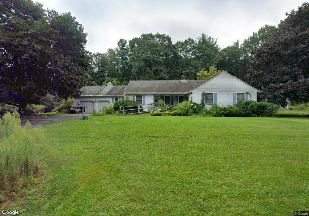
410 Bailey Rd Holden, MA 01520
Estimated Value: $612,000 - $682,000
3
Beds
2
Baths
1,957
Sq Ft
$328/Sq Ft
Est. Value
About This Home
This home is located at 410 Bailey Rd, Holden, MA 01520 and is currently estimated at $641,199, approximately $327 per square foot. 410 Bailey Rd is a home located in Worcester County with nearby schools including Wachusett Regional High School, Holden Christian Academy, and Notre Dame Academy.
Ownership History
Date
Name
Owned For
Owner Type
Purchase Details
Closed on
Aug 6, 2015
Sold by
Est Nielsen Anker J Jr and Forts Brian R
Bought by
Ferguson Ryan
Current Estimated Value
Home Financials for this Owner
Home Financials are based on the most recent Mortgage that was taken out on this home.
Original Mortgage
$471,000
Outstanding Balance
$370,439
Interest Rate
4.03%
Mortgage Type
Purchase Money Mortgage
Estimated Equity
$270,760
Purchase Details
Closed on
Dec 5, 2003
Sold by
Downer Susan
Bought by
Leblanc Karen A and Leblanc Mark S
Create a Home Valuation Report for This Property
The Home Valuation Report is an in-depth analysis detailing your home's value as well as a comparison with similar homes in the area
Home Values in the Area
Average Home Value in this Area
Purchase History
| Date | Buyer | Sale Price | Title Company |
|---|---|---|---|
| Ferguson Ryan | $342,000 | -- | |
| Leblanc Karen A | $30,833 | -- |
Source: Public Records
Mortgage History
| Date | Status | Borrower | Loan Amount |
|---|---|---|---|
| Open | Ferguson Ryan | $471,000 |
Source: Public Records
Tax History
| Year | Tax Paid | Tax Assessment Tax Assessment Total Assessment is a certain percentage of the fair market value that is determined by local assessors to be the total taxable value of land and additions on the property. | Land | Improvement |
|---|---|---|---|---|
| 2025 | $8,312 | $599,700 | $223,400 | $376,300 |
| 2024 | $8,211 | $580,300 | $217,200 | $363,100 |
| 2023 | $7,946 | $530,100 | $188,600 | $341,500 |
| 2022 | $7,760 | $468,600 | $148,600 | $320,000 |
| 2021 | $7,510 | $431,600 | $141,800 | $289,800 |
| 2020 | $6,938 | $408,100 | $135,600 | $272,500 |
| 2019 | $6,821 | $390,900 | $135,600 | $255,300 |
| 2018 | $6,438 | $365,600 | $129,300 | $236,300 |
| 2017 | $6,278 | $356,900 | $129,300 | $227,600 |
| 2016 | $5,908 | $342,500 | $123,600 | $218,900 |
| 2015 | $5,889 | $325,000 | $123,600 | $201,400 |
| 2014 | $5,769 | $325,000 | $123,600 | $201,400 |
Source: Public Records
Map
Nearby Homes
- 0 Chapin Rd
- 289 Bailey Rd
- 131 Twinbrooke Dr
- 168 Twinbrooke Dr
- 576 Reservoir St
- 216 Reservoir St Unit 107
- 216 Reservoir St Unit 208
- 216 Reservoir St Unit 202
- 218 Reservoir St Unit 326
- 527 Salisbury St
- 8 (Lot 1) Holmes Dr
- 23 Gail Dr
- 288 Fisher Rd
- 63 Walnut St
- 136 Winthrop Ln
- 135 Highland Ave
- 64 Kendall Rd
- 56 Highland Ave
- 3 Torrey Ln
- 81 Deanna Dr
Your Personal Tour Guide
Ask me questions while you tour the home.