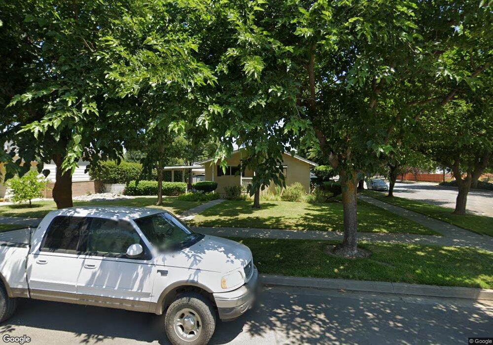
410 Carson St Colusa, CA 95932
Estimated Value: $382,000 - $421,369
3
Beds
2
Baths
1,855
Sq Ft
$220/Sq Ft
Est. Value
About This Home
This home is located at 410 Carson St, Colusa, CA 95932 and is currently estimated at $407,592, approximately $219 per square foot. 410 Carson St is a home located in Colusa County with nearby schools including James M. Burchfield Primary School, George T. Egling Middle School, and Colusa High School.
Ownership History
Date
Name
Owned For
Owner Type
Purchase Details
Closed on
May 5, 2023
Sold by
Prasad Narendra and Prasad Mary A
Bought by
Dennis And Lura Fusaro Revocable Living Trust and Fusaro
Current Estimated Value
Purchase Details
Closed on
Apr 5, 2007
Sold by
Prasad Narenda and Prasad Mary Ann
Bought by
Prasad Tom and Prasad Mary Ann
Purchase Details
Closed on
May 4, 2004
Sold by
Herrick Laura Wilbur
Bought by
Prasad Narendra and Prasad Mary Ann
Home Financials for this Owner
Home Financials are based on the most recent Mortgage that was taken out on this home.
Original Mortgage
$120,000
Interest Rate
5.5%
Mortgage Type
Purchase Money Mortgage
Create a Home Valuation Report for This Property
The Home Valuation Report is an in-depth analysis detailing your home's value as well as a comparison with similar homes in the area
Home Values in the Area
Average Home Value in this Area
Purchase History
| Date | Buyer | Sale Price | Title Company |
|---|---|---|---|
| Dennis And Lura Fusaro Revocable Living Trust | $385,000 | None Listed On Document | |
| Prasad Tom | -- | None Available | |
| Prasad Narendra | $150,000 | North State Title Company |
Source: Public Records
Mortgage History
| Date | Status | Borrower | Loan Amount |
|---|---|---|---|
| Previous Owner | Prasad Narendra | $120,000 |
Source: Public Records
Tax History
| Year | Tax Paid | Tax Assessment Tax Assessment Total Assessment is a certain percentage of the fair market value that is determined by local assessors to be the total taxable value of land and additions on the property. | Land | Improvement |
|---|---|---|---|---|
| 2025 | $4,365 | $400,554 | $78,030 | $322,524 |
| 2024 | $4,365 | $392,700 | $76,500 | $316,200 |
| 2023 | $2,320 | $204,972 | $81,987 | $122,985 |
| 2022 | $2,317 | $200,954 | $80,380 | $120,574 |
| 2021 | $2,221 | $197,014 | $78,804 | $118,210 |
| 2020 | $2,196 | $194,994 | $77,996 | $116,998 |
| 2019 | $2,148 | $191,171 | $76,467 | $114,704 |
| 2018 | $2,142 | $187,423 | $74,968 | $112,455 |
| 2017 | $2,118 | $183,749 | $73,499 | $110,250 |
| 2016 | $2,008 | $180,147 | $72,058 | $108,089 |
| 2015 | $1,975 | $177,442 | $70,976 | $106,466 |
| 2014 | $1,878 | $173,967 | $69,586 | $104,381 |
Source: Public Records
Map
Nearby Homes
Your Personal Tour Guide
Ask me questions while you tour the home.