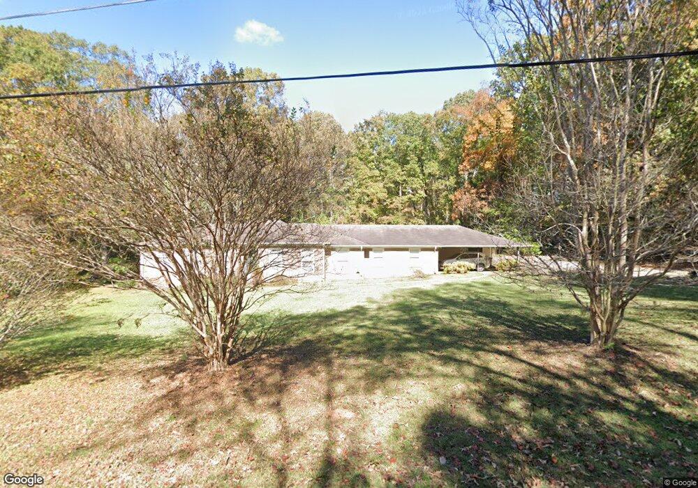
410 Ginger Cir Lagrange, GA 30240
Estimated Value: $277,611 - $310,000
3
Beds
3
Baths
2,489
Sq Ft
$116/Sq Ft
Est. Value
About This Home
This home is located at 410 Ginger Cir, Lagrange, GA 30240 and is currently estimated at $287,653, approximately $115 per square foot. 410 Ginger Cir is a home located in Troup County with nearby schools including Berta Weathersbee Elementary School, Long Cane Elementary School, and Whitesville Road Elementary School.
Ownership History
Date
Name
Owned For
Owner Type
Purchase Details
Closed on
Mar 1, 2025
Sold by
Bell Hursey Mae
Bought by
Andrews Candance L and Andrews Steven
Current Estimated Value
Purchase Details
Closed on
Sep 14, 2017
Sold by
Hursey Sheldon Winslow
Bought by
Hursey Mae Bell
Purchase Details
Closed on
Oct 10, 2007
Sold by
Bailey Alton B
Bought by
Hursey Sheldon W and Bailey Florence E
Purchase Details
Closed on
Mar 11, 2002
Sold by
Alton B Bailey
Bought by
Bailey Alton and Bailey Florence
Purchase Details
Closed on
Aug 7, 1996
Sold by
Roy Petway Roberts
Bought by
Alton B Bailey
Purchase Details
Closed on
May 3, 1995
Sold by
Beth D White
Bought by
Roy Petway Roberts
Purchase Details
Closed on
Apr 27, 1995
Sold by
Keith Lindsey White
Bought by
Beth D White
Purchase Details
Closed on
Mar 8, 1993
Sold by
White Keith Lindsey
Bought by
Keith Lindsey White
Purchase Details
Closed on
Feb 5, 1990
Bought by
White Keith Lindsey
Purchase Details
Closed on
Mar 2, 1984
Sold by
Kelley
Purchase Details
Closed on
Jan 1, 1981
Sold by
Mccarty
Bought by
Kelley
Purchase Details
Closed on
Aug 12, 1977
Sold by
Cotton
Bought by
Mccarty
Purchase Details
Closed on
Jan 1, 1971
Sold by
Arnold
Bought by
Cotton
Purchase Details
Closed on
Jan 1, 1968
Bought by
Arnold
Create a Home Valuation Report for This Property
The Home Valuation Report is an in-depth analysis detailing your home's value as well as a comparison with similar homes in the area
Home Values in the Area
Average Home Value in this Area
Purchase History
| Date | Buyer | Sale Price | Title Company |
|---|---|---|---|
| Andrews Candance L | -- | -- | |
| Hursey Mae Bell | -- | -- | |
| Hursey Sheldon W | $130,000 | -- | |
| Bailey Alton | -- | -- | |
| Alton B Bailey | $90,000 | -- | |
| Roy Petway Roberts | $84,000 | -- | |
| Beth D White | -- | -- | |
| Keith Lindsey White | -- | -- | |
| White Keith Lindsey | -- | -- | |
| -- | $71,000 | -- | |
| Kelley | -- | -- | |
| Mccarty | $49,500 | -- | |
| Cotton | -- | -- | |
| Arnold | -- | -- |
Source: Public Records
Tax History Compared to Growth
Tax History
| Year | Tax Paid | Tax Assessment Tax Assessment Total Assessment is a certain percentage of the fair market value that is determined by local assessors to be the total taxable value of land and additions on the property. | Land | Improvement |
|---|---|---|---|---|
| 2024 | $1,725 | $92,292 | $15,000 | $77,292 |
| 2023 | $1,604 | $87,868 | $12,000 | $75,868 |
| 2022 | $1,515 | $82,908 | $12,000 | $70,908 |
| 2021 | $1,020 | $62,528 | $12,000 | $50,528 |
| 2020 | $1,302 | $62,528 | $12,000 | $50,528 |
| 2019 | $1,294 | $52,876 | $7,920 | $44,956 |
| 2018 | $1,171 | $48,804 | $7,920 | $40,884 |
| 2017 | $1,360 | $45,084 | $4,200 | $40,884 |
| 2016 | $1,319 | $43,742 | $4,200 | $39,542 |
| 2015 | $1,321 | $43,742 | $4,200 | $39,542 |
| 2014 | $1,261 | $41,660 | $4,200 | $37,460 |
| 2013 | -- | $44,388 | $4,200 | $40,188 |
Source: Public Records
Map
Nearby Homes
- 509 Connie Dr
- 37 Overbrook Dr
- 190 Hill Rd
- 0 Bradfield Dr Unit 10568803
- 808 S Fling Rd
- 146 Whitaker Rd
- 124 Foxdale Dr
- 110 Hawthorne Cir
- 141 Avery Dr
- 100 Huntcliff Ct
- 103 Hawthorne Cir
- 105 Hawthorne Cir
- 117 Brookwood Dr
- 223 Pinehaven Dr
- LOT 4 Angela Dr
- E Angela Dr
- 135 Planters Ridge Dr
- 104 Spring Valley Dr
- 200 Cheyenne Dr
- 0 Unit 10514554
- 408 Ginger Cir
- 405 Ginger Cir
- 403 Ginger Cir
- 407 Ginger Cir
- 404 Ginger Cir
- 402 Debra Dr
- 401 Ginger Cir
- 57 Rice Rd
- 402 Ginger Cir
- 416 Ginger Cir
- 99 Rice Rd
- 409 Ginger Cir
- 404 Debra Dr
- 0 Debra Dr Unit 7397408
- 0 Debra Dr Unit 7355496
- 0 Debra Dr Unit 7132414
- 400 Ginger Cir
- 411 Ginger Cir
- 403 Debra Dr
- 294 Fling Rd