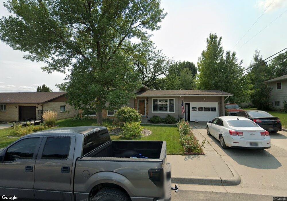
410 Laurmac Ln Laurel, MT 59044
Estimated Value: $345,625 - $361,000
4
Beds
2
Baths
1,839
Sq Ft
$193/Sq Ft
Est. Value
About This Home
This home is located at 410 Laurmac Ln, Laurel, MT 59044 and is currently estimated at $355,406, approximately $193 per square foot. 410 Laurmac Ln is a home located in Yellowstone County with nearby schools including West School, Fred W. Graff School, and Laurel Middle School.
Ownership History
Date
Name
Owned For
Owner Type
Purchase Details
Closed on
Mar 12, 2020
Sold by
Arnold Ryan and Arnold Jamie
Bought by
Hirschi James E
Current Estimated Value
Home Financials for this Owner
Home Financials are based on the most recent Mortgage that was taken out on this home.
Original Mortgage
$227,061
Outstanding Balance
$197,220
Interest Rate
2.76%
Mortgage Type
FHA
Estimated Equity
$158,186
Purchase Details
Closed on
Nov 18, 2014
Sold by
Schoepp Randy and Schoepp Debbie
Bought by
Arnold Ryan and Arnold Jamie
Home Financials for this Owner
Home Financials are based on the most recent Mortgage that was taken out on this home.
Original Mortgage
$218,265
Interest Rate
4.1%
Mortgage Type
New Conventional
Create a Home Valuation Report for This Property
The Home Valuation Report is an in-depth analysis detailing your home's value as well as a comparison with similar homes in the area
Home Values in the Area
Average Home Value in this Area
Purchase History
| Date | Buyer | Sale Price | Title Company |
|---|---|---|---|
| Hirschi James E | -- | First American Title Company | |
| Arnold Ryan | -- | Amercian Title & Escrow |
Source: Public Records
Mortgage History
| Date | Status | Borrower | Loan Amount |
|---|---|---|---|
| Open | Hirschi James E | $227,061 | |
| Previous Owner | Arnold Ryan | $218,265 |
Source: Public Records
Tax History Compared to Growth
Tax History
| Year | Tax Paid | Tax Assessment Tax Assessment Total Assessment is a certain percentage of the fair market value that is determined by local assessors to be the total taxable value of land and additions on the property. | Land | Improvement |
|---|---|---|---|---|
| 2025 | $2,856 | $338,200 | $59,594 | $278,606 |
| 2024 | $2,856 | $295,100 | $38,779 | $256,321 |
| 2023 | $2,629 | $295,100 | $38,779 | $256,321 |
| 2022 | $1,905 | $228,300 | $0 | $0 |
| 2021 | $2,184 | $228,300 | $0 | $0 |
| 2020 | $2,032 | $207,400 | $0 | $0 |
| 2019 | $2,013 | $207,400 | $0 | $0 |
| 2018 | $1,926 | $187,700 | $0 | $0 |
| 2017 | $1,786 | $187,700 | $0 | $0 |
| 2016 | $1,782 | $189,800 | $0 | $0 |
| 2015 | $1,761 | $189,800 | $0 | $0 |
| 2014 | $1,599 | $89,888 | $0 | $0 |
Source: Public Records
Map
Nearby Homes
- 403 Grandview Blvd
- 109 E 12th St
- 512 W 14th St
- 1036 9th Ave
- 1109 10th Ave
- 1003 Montana Ave
- 1013 W 12th St
- 1106 W 12th St
- 1336 Pennsylvania Ave
- 110 E 5th St
- 516 Pennsylvania Ave
- 1013 Rochelle Dr
- TBD Block 3 Lot 9
- TBD Block 3 Lot 1
- 1014 Rochelle Ln
- TBD Block 1 Lot 3
- TBD Block 1 Lot 2
- TBD Block 3 Lot 4
- TBD Block 3 Lot 6
- 116 4th Ave