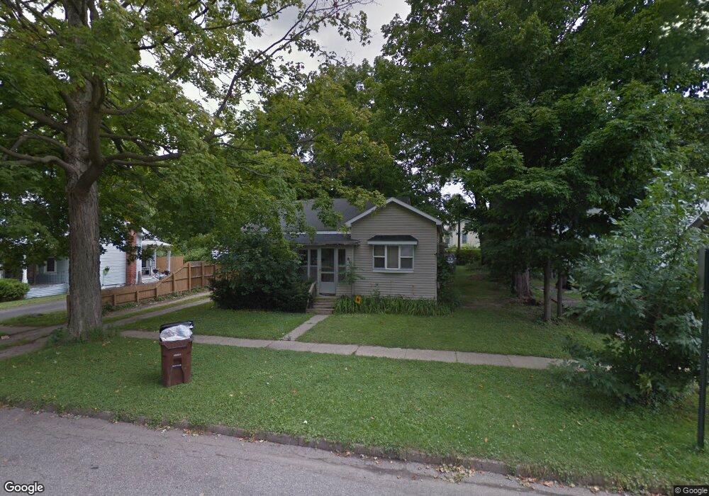
410 Minerva St Eaton Rapids, MI 48827
Estimated Value: $147,000 - $183,000
3
Beds
1
Bath
1,406
Sq Ft
$117/Sq Ft
Est. Value
About This Home
This home is located at 410 Minerva St, Eaton Rapids, MI 48827 and is currently estimated at $164,285, approximately $116 per square foot. 410 Minerva St is a home located in Eaton County with nearby schools including Lockwood Elementary School, Greyhound Intermediate School, and Eaton Rapids Middle School.
Ownership History
Date
Name
Owned For
Owner Type
Purchase Details
Closed on
Apr 16, 2015
Sold by
Williams Keith D and Williams Carol A
Bought by
Keith D & Carol A Williams Trust
Current Estimated Value
Purchase Details
Closed on
Oct 8, 2007
Sold by
Mortgage Electronic Registration Systems
Bought by
U S Bank Na
Purchase Details
Closed on
Aug 16, 2007
Sold by
Washburn Raymond Lloyd and Washburn Mystel S
Bought by
Mortgage Electronic Registration Systems
Purchase Details
Closed on
Nov 17, 2005
Sold by
Washburn Raymond Lee and Washburn Darlene Kay
Bought by
Washburn Raymond Lloyd and Washburn Mystel S
Home Financials for this Owner
Home Financials are based on the most recent Mortgage that was taken out on this home.
Original Mortgage
$72,350
Interest Rate
7.25%
Mortgage Type
Fannie Mae Freddie Mac
Create a Home Valuation Report for This Property
The Home Valuation Report is an in-depth analysis detailing your home's value as well as a comparison with similar homes in the area
Home Values in the Area
Average Home Value in this Area
Purchase History
| Date | Buyer | Sale Price | Title Company |
|---|---|---|---|
| Keith D & Carol A Williams Trust | -- | None Available | |
| U S Bank Na | -- | E Title Agency | |
| Mortgage Electronic Registration Systems | $75,966 | None Available | |
| Washburn Raymond Lloyd | $60,000 | First Amer |
Source: Public Records
Mortgage History
| Date | Status | Borrower | Loan Amount |
|---|---|---|---|
| Previous Owner | Washburn Raymond Lloyd | $72,350 |
Source: Public Records
Tax History Compared to Growth
Tax History
| Year | Tax Paid | Tax Assessment Tax Assessment Total Assessment is a certain percentage of the fair market value that is determined by local assessors to be the total taxable value of land and additions on the property. | Land | Improvement |
|---|---|---|---|---|
| 2025 | $1,947 | $55,200 | $0 | $0 |
| 2024 | $1,249 | $50,500 | $0 | $0 |
| 2023 | $1,244 | $45,200 | $0 | $0 |
| 2022 | $1,848 | $39,900 | $0 | $0 |
| 2021 | $1,784 | $36,200 | $0 | $0 |
| 2020 | $1,765 | $34,600 | $0 | $0 |
| 2019 | $1,739 | $32,790 | $0 | $0 |
| 2018 | $1,698 | $30,628 | $0 | $0 |
| 2017 | $1,636 | $29,450 | $0 | $0 |
| 2016 | -- | $27,900 | $0 | $0 |
| 2015 | -- | $27,100 | $0 | $0 |
| 2014 | -- | $26,550 | $0 | $0 |
| 2013 | -- | $26,400 | $0 | $0 |
Source: Public Records
Map
Nearby Homes
- 108 Division St
- 220 Dexter Rd
- 518 Clark St
- 329 W Knight St
- 210 Diana St
- 215 E Knight St
- 220 S River St
- 101 S East St
- 100 S Center St
- 500 King St
- 502 S Main St
- 208 Dutton St
- 201 W Broad St
- 502 S East St
- 933 Tyler Dr
- V/L Chester St
- 645 N Gallery Dr Unit 98
- 539 Harwood Ct Unit 134
- 5895 Plains Rd
- 716 Cumberland Dr