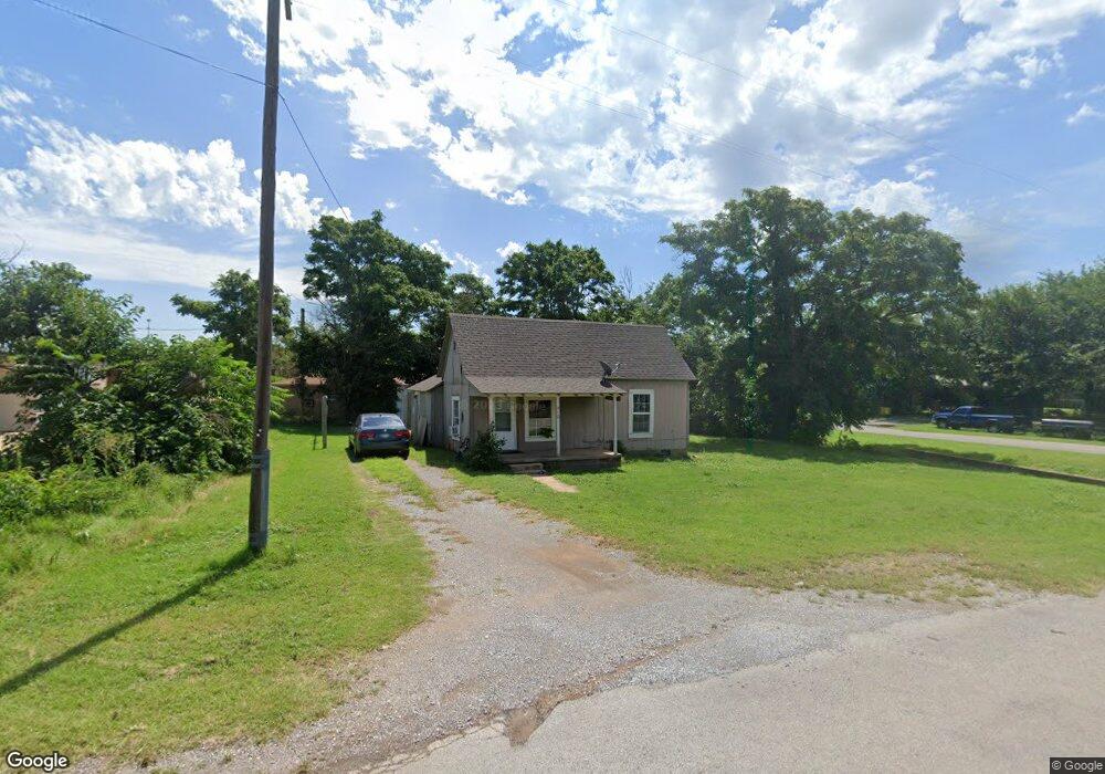
410 N Locust St Apache, OK 73006
Estimated Value: $44,180 - $75,000
2
Beds
1
Bath
988
Sq Ft
$54/Sq Ft
Est. Value
About This Home
This home is located at 410 N Locust St, Apache, OK 73006 and is currently estimated at $53,045, approximately $53 per square foot. 410 N Locust St is a home with nearby schools including Apache Elementary School, Apache Middle School, and Apache High School.
Ownership History
Date
Name
Owned For
Owner Type
Purchase Details
Closed on
Sep 20, 2019
Sold by
Trippe Clara A
Bought by
Powell Marcus A and Powell Laura J
Current Estimated Value
Home Financials for this Owner
Home Financials are based on the most recent Mortgage that was taken out on this home.
Original Mortgage
$24,000
Outstanding Balance
$20,930
Interest Rate
3.6%
Mortgage Type
Future Advance Clause Open End Mortgage
Estimated Equity
$32,115
Purchase Details
Closed on
Jul 25, 2017
Sold by
Claborn Jamie Sue
Bought by
Trippe Clara A
Home Financials for this Owner
Home Financials are based on the most recent Mortgage that was taken out on this home.
Original Mortgage
$31,083
Interest Rate
3.89%
Mortgage Type
USDA
Purchase Details
Closed on
Dec 30, 2016
Sold by
Smith Rod and Smith Janie C
Bought by
Claborn Jamie Sue
Purchase Details
Closed on
Sep 1, 1993
Purchase Details
Closed on
Apr 1, 1992
Create a Home Valuation Report for This Property
The Home Valuation Report is an in-depth analysis detailing your home's value as well as a comparison with similar homes in the area
Purchase History
| Date | Buyer | Sale Price | Title Company |
|---|---|---|---|
| Powell Marcus A | $31,500 | None Available | |
| Trippe Clara A | $28,000 | None Available | |
| Claborn Jamie Sue | $26,000 | None Available | |
| -- | $4,500 | -- | |
| -- | $3,500 | -- |
Source: Public Records
Mortgage History
| Date | Status | Borrower | Loan Amount |
|---|---|---|---|
| Open | Powell Marcus A | $24,000 | |
| Previous Owner | Trippe Clara A | $31,083 |
Source: Public Records
Tax History
| Year | Tax Paid | Tax Assessment Tax Assessment Total Assessment is a certain percentage of the fair market value that is determined by local assessors to be the total taxable value of land and additions on the property. | Land | Improvement |
|---|---|---|---|---|
| 2025 | $353 | $3,722 | $409 | $3,313 |
| 2024 | $354 | $4,212 | $168 | $4,044 |
| 2023 | $411 | $4,011 | $168 | $3,843 |
| 2022 | $350 | $3,820 | $168 | $3,652 |
| 2021 | $421 | $3,639 | $168 | $3,471 |
| 2020 | $348 | $3,465 | $168 | $3,297 |
| 2019 | $23 | $2,226 | $121 | $2,105 |
| 2018 | $25 | $2,226 | $121 | $2,105 |
| 2017 | $233 | $2,226 | $168 | $2,058 |
| 2016 | $235 | $2,200 | $168 | $2,032 |
| 2015 | $175 | $2,200 | $168 | $2,032 |
| 2014 | $182 | $2,200 | $168 | $2,032 |
Source: Public Records
Map
Nearby Homes
- 301 E Mckinley Ave
- TBD Highway 281
- TBD U S Highway 62
- 105 London Dr
- TBD 2580
- TBD NE King Rd
- 1100 NE King Rd
- 207 N Hillside Rd
- 124 Ellsworth Dr
- 116 N Lakeside Dr
- 115 N Brookdale
- TBD Hilltop Rd
- 120 NE Kiowa Rd
- 13145 NE Clearwater Cir
- 40001 U S 281
- 21168 County Road 1480
- 7655 Northgate Dr
- 344 NE Wichita Meadows Ln
- 104 London Dr
- 13473 NE Tony Creek Rd
- 303-1/2 E Wallace Ave
- 403 N Locust
- 403 N Locust
- 401 N Locust St
- 415 N Locust St
- 325 N Locust St
- 700 E Lorrist Ave
- 716 E Lorrist Ave
- 613 Lorrist Ave
- 618 E Lorrist Ave
- 317 N Locust St
- 232 Elm St
- 402 S Elm St
- 614 E Lorrist Ave
- 707 E Anderson Ave
- 713 E Anderson St
- 715 E Anderson St
- 605 E Anderson St
- 717 Elm Aka 8152 Cr 1470
- 601 E Anderson St
Your Personal Tour Guide
Ask me questions while you tour the home.