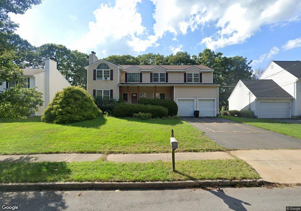
410 Stevenson Rd New Haven, CT 06515
Westville NeighborhoodEstimated Value: $595,000 - $721,782
4
Beds
3
Baths
2,789
Sq Ft
$234/Sq Ft
Est. Value
About This Home
This home is located at 410 Stevenson Rd, New Haven, CT 06515 and is currently estimated at $652,196, approximately $233 per square foot. 410 Stevenson Rd is a home located in New Haven County with nearby schools including Elm City Montessori School and Hopkins School.
Ownership History
Date
Name
Owned For
Owner Type
Purchase Details
Closed on
Apr 13, 2009
Sold by
Witemeyer Hazen
Bought by
Hamilton Robert
Current Estimated Value
Home Financials for this Owner
Home Financials are based on the most recent Mortgage that was taken out on this home.
Original Mortgage
$344,000
Outstanding Balance
$217,463
Interest Rate
4.94%
Estimated Equity
$434,733
Purchase Details
Closed on
Jul 25, 2005
Sold by
Miller David B and Miller Deborah R
Bought by
Hamilton Robert A and Witemeyer Hazen A
Home Financials for this Owner
Home Financials are based on the most recent Mortgage that was taken out on this home.
Original Mortgage
$359,000
Interest Rate
5.59%
Purchase Details
Closed on
Sep 29, 1999
Sold by
Browning Marvin and Browning Regina
Bought by
Miller David B and Miller Deborah R
Purchase Details
Closed on
Jun 4, 1998
Sold by
Nesi Nicholas R
Bought by
Browning Marvin and Browning Regina
Purchase Details
Closed on
Apr 20, 1998
Sold by
Nesi Nicholas R
Bought by
Browning Marvin and Browning Regina
Create a Home Valuation Report for This Property
The Home Valuation Report is an in-depth analysis detailing your home's value as well as a comparison with similar homes in the area
Home Values in the Area
Average Home Value in this Area
Purchase History
| Date | Buyer | Sale Price | Title Company |
|---|---|---|---|
| Hamilton Robert | $17,000 | -- | |
| Hamilton Robert A | $450,000 | -- | |
| Miller David B | $255,968 | -- | |
| Browning Marvin | $20,000 | -- | |
| Browning Marvin | $20,000 | -- |
Source: Public Records
Mortgage History
| Date | Status | Borrower | Loan Amount |
|---|---|---|---|
| Open | Browning Marvin | $344,000 | |
| Previous Owner | Browning Marvin | $359,000 | |
| Previous Owner | Browning Marvin | $282,400 |
Source: Public Records
Tax History Compared to Growth
Tax History
| Year | Tax Paid | Tax Assessment Tax Assessment Total Assessment is a certain percentage of the fair market value that is determined by local assessors to be the total taxable value of land and additions on the property. | Land | Improvement |
|---|---|---|---|---|
| 2025 | $13,644 | $346,290 | $67,970 | $278,320 |
| 2024 | $13,332 | $346,290 | $67,970 | $278,320 |
| 2023 | $12,882 | $346,290 | $67,970 | $278,320 |
| 2022 | $13,765 | $346,290 | $67,970 | $278,320 |
| 2021 | $11,555 | $263,340 | $44,170 | $219,170 |
| 2020 | $11,555 | $263,340 | $44,170 | $219,170 |
| 2019 | $11,318 | $263,340 | $44,170 | $219,170 |
| 2018 | $11,318 | $263,340 | $44,170 | $219,170 |
| 2017 | $10,186 | $263,340 | $44,170 | $219,170 |
| 2016 | $11,093 | $266,980 | $45,850 | $221,130 |
| 2015 | $11,093 | $266,980 | $45,850 | $221,130 |
| 2014 | $11,093 | $266,980 | $45,850 | $221,130 |
Source: Public Records
Map
Nearby Homes
- 195 Stevenson Rd
- 690 Forest Rd Unit 793
- 690 Forest Rd Unit 702
- 690 Forest Rd Unit 392
- 690 Forest Rd Unit 511
- 11 Priscilla Rd
- 809 Edgewood Ave
- 303 Central Ave
- 119 Brooklawn Cir
- 55 Marvel Rd
- 80 W Rock Ave
- 50 Morris Ave
- 20 Maplewood Rd
- 52 Highview Ave
- 360 Fountain St Unit 6
- 360 Fountain St Unit 5
- 56 Highview Ave
- 51 Fountain Terrace
- 61 Anthony St
- 133 Fountain St Unit A3
- 420 Stevenson Rd
- 400 Stevenson Rd
- 430 Stevenson Rd
- 370 Stevenson Rd
- 374 Stevenson Rd
- 25 Spencer Place
- 15 Spencer Place
- 390 Stevenson Rd
- 360 Stevenson Rd
- 435 Stevenson Rd
- 440 Stevenson Rd
- 35 Spencer Place
- 5 Spencer Place
- 445 Stevenson Rd
- 455 Stevenson Rd
- 446 Stevenson Rd
- 415 Stevenson Rd
- 45 Spencer Place
- 375 Stevenson Rd
- 465 Stevenson Rd