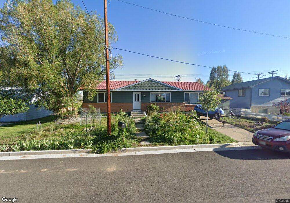
410 Tincup Dr Unit (With Access to Gunn Gunnison, CO 81230
Estimated Value: $612,000 - $674,000
4
Beds
2
Baths
1,188
Sq Ft
$531/Sq Ft
Est. Value
About This Home
This home is located at 410 Tincup Dr Unit (With Access to Gunn, Gunnison, CO 81230 and is currently estimated at $631,086, approximately $531 per square foot. 410 Tincup Dr Unit (With Access to Gunn is a home located in Gunnison County with nearby schools including Gunnison Elementary School, Gunnison Middle School, and Crested Butte Community School.
Ownership History
Date
Name
Owned For
Owner Type
Purchase Details
Closed on
Jul 13, 2013
Sold by
Hunter Allen and Hunter Angela
Bought by
Drendel Aaron D and Drendel Krista J
Current Estimated Value
Home Financials for this Owner
Home Financials are based on the most recent Mortgage that was taken out on this home.
Original Mortgage
$179,685
Outstanding Balance
$135,121
Interest Rate
4.75%
Mortgage Type
FHA
Estimated Equity
$495,965
Purchase Details
Closed on
Apr 13, 2000
Sold by
Hildreth David S
Bought by
Hunter Allen
Purchase Details
Closed on
Jul 31, 1998
Sold by
Howard Robert
Bought by
Hildreth David
Purchase Details
Closed on
Jul 26, 1994
Purchase Details
Closed on
Oct 4, 1991
Create a Home Valuation Report for This Property
The Home Valuation Report is an in-depth analysis detailing your home's value as well as a comparison with similar homes in the area
Home Values in the Area
Average Home Value in this Area
Purchase History
| Date | Buyer | Sale Price | Title Company |
|---|---|---|---|
| Drendel Aaron D | $183,000 | None Available | |
| Hunter Allen | $140,000 | -- | |
| Hildreth David | $120,000 | -- | |
| -- | $92,000 | -- | |
| -- | $58,000 | -- |
Source: Public Records
Mortgage History
| Date | Status | Borrower | Loan Amount |
|---|---|---|---|
| Open | Drendel Aaron D | $179,685 |
Source: Public Records
Tax History Compared to Growth
Tax History
| Year | Tax Paid | Tax Assessment Tax Assessment Total Assessment is a certain percentage of the fair market value that is determined by local assessors to be the total taxable value of land and additions on the property. | Land | Improvement |
|---|---|---|---|---|
| 2024 | $1,664 | $35,640 | $13,560 | $22,080 |
| 2023 | $1,664 | $31,960 | $12,160 | $19,800 |
| 2022 | $1,589 | $26,590 | $5,670 | $20,920 |
| 2021 | $1,589 | $27,360 | $5,830 | $21,530 |
| 2020 | $1,469 | $26,490 | $5,600 | $20,890 |
| 2019 | $1,436 | $26,490 | $5,600 | $20,890 |
| 2018 | $1,006 | $17,990 | $4,960 | $13,030 |
| 2017 | $1,018 | $17,990 | $4,960 | $13,030 |
| 2016 | $946 | $16,770 | $3,430 | $13,340 |
Source: Public Records
Map
Nearby Homes
- 21 Vulcan St
- 316 Van Tuyl Cir
- 302 Van Tuyl Cir Unit E
- TBD Spencer & Pine
- 520 W Elizabeth Ave
- Lot 3 W Denver Ave
- 614 N Pine St
- 510 N Pine St
- 1005 W Denver Ave Unit G-4
- 1021 W Denver Ave Unit 4
- 410 N 11th St
- 416 N Main St
- 404 N Main St
- 306 N 9th St Unit 1B
- 304 N 9th St Unit 3A
- 401 N 7th St
- 717 W Virginia Ave
- 0 Rainbow Acres Ln Unit 826591
- 216 N Taylor St
- 240 Crest View Dr
- 410 Tincup Dr
- 408 Tincup Dr
- 412 Tincup Dr
- 414 Tincup Dr
- 0 Hall 4 Hall No 4 Tincup Unit 793865
- 124 Tincup Dr
- 416 Tincup Dr
- 122 Floresta St
- 19 Vulcan St
- 186 County Road 13
- 120 Floresta St
- 418 Tincup Dr
- 123 Floresta St
- 1212 Vulcan St
- 1210 Vulcan St
- 17 Vulcan St
- 184 County Road 13
- 121 Floresta St
- 118 Floresta St
- 420 Tincup Dr