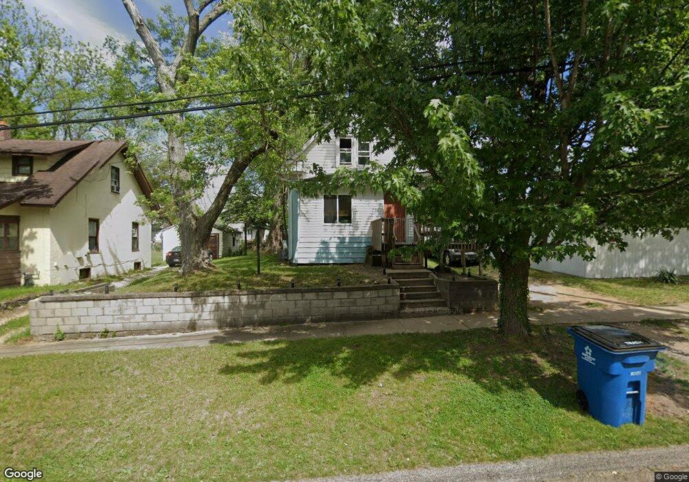
410 Wood St N Battle Creek, MI 49037
North Central NeighborhoodEstimated Value: $87,556 - $121,000
2
Beds
1
Bath
890
Sq Ft
$117/Sq Ft
Est. Value
About This Home
This home is located at 410 Wood St N, Battle Creek, MI 49037 and is currently estimated at $104,389, approximately $117 per square foot. 410 Wood St N is a home located in Calhoun County with nearby schools including Dudley School, Northwestern Middle School, and Battle Creek Central High School.
Ownership History
Date
Name
Owned For
Owner Type
Purchase Details
Closed on
Sep 16, 2016
Sold by
Lytle Terrence Daquawn
Bought by
Lytle Terrence Daquawn and The Living Trust Of Terrence D
Current Estimated Value
Purchase Details
Closed on
Jan 27, 2015
Sold by
Lytle Terrence D and Lytle Erica Monique
Bought by
The Terrence Daquawn Lytle & Erica Moniq
Purchase Details
Closed on
Jan 29, 2014
Sold by
Freeze Jocelyn D and Middlebrook Ada M
Bought by
Lytle Terence D and Randall Erica
Purchase Details
Closed on
Jan 24, 1991
Sold by
Smith Patricia A
Bought by
Smith Smith P and Smith Hill,J D
Create a Home Valuation Report for This Property
The Home Valuation Report is an in-depth analysis detailing your home's value as well as a comparison with similar homes in the area
Home Values in the Area
Average Home Value in this Area
Purchase History
| Date | Buyer | Sale Price | Title Company |
|---|---|---|---|
| Lytle Terrence Daquawn | -- | Attorney | |
| Lytle Terrence Daquawn | -- | None Available | |
| The Terrence Daquawn Lytle & Erica Moniq | -- | None Available | |
| Lytle Terence D | $5,000 | None Available | |
| Smith Smith P | -- | -- | |
| Smith Patricia A | -- | -- |
Source: Public Records
Tax History Compared to Growth
Tax History
| Year | Tax Paid | Tax Assessment Tax Assessment Total Assessment is a certain percentage of the fair market value that is determined by local assessors to be the total taxable value of land and additions on the property. | Land | Improvement |
|---|---|---|---|---|
| 2025 | -- | $25,500 | $0 | $0 |
| 2024 | $646 | $21,319 | $0 | $0 |
| 2023 | $822 | $18,278 | $0 | $0 |
| 2022 | $584 | $16,007 | $0 | $0 |
| 2021 | $781 | $12,031 | $0 | $0 |
| 2020 | $815 | $12,698 | $0 | $0 |
| 2019 | $833 | $12,296 | $0 | $0 |
| 2018 | $833 | $12,673 | $503 | $12,170 |
| 2017 | $900 | $13,413 | $0 | $0 |
| 2016 | $915 | $14,223 | $0 | $0 |
| 2015 | $430 | $15,179 | $2,456 | $12,723 |
| 2014 | $430 | $11,790 | $2,456 | $9,334 |
Source: Public Records
Map
Nearby Homes
- 435 Kendall St N
- 5 Beglin Ct
- 188 Roseneath Ave
- 52 Roseneath Ave
- 224 Hubbard St
- 216 Kendall St N
- 129 Fox Ave
- 161 Wilds Ave
- 253 Greenwood Ave
- 706 Washington Ave N
- 89 Somerset Ave
- 125 Oaklawn Ave
- 60 Graves Ave
- 69 Jordan St
- 46 Walter Ave
- 000 5 Mile Rd
- 562 Van Buren St W
- 35 Hubbard St
- 0 W Vanburen 027 St Unit 22040287
- 0 W Vanburen 025 St Unit 22040286