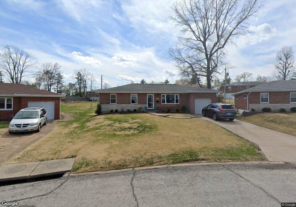
4100 Fabian Dr Saint Louis, MO 63125
Lemay NeighborhoodEstimated Value: $213,350 - $254,000
3
Beds
1
Bath
1,107
Sq Ft
$213/Sq Ft
Est. Value
About This Home
This home is located at 4100 Fabian Dr, Saint Louis, MO 63125 and is currently estimated at $236,088, approximately $213 per square foot. 4100 Fabian Dr is a home located in St. Louis County with nearby schools including Bierbaum Elementary School, Margaret Buerkle Middle School, and Mehlville High School.
Ownership History
Date
Name
Owned For
Owner Type
Purchase Details
Closed on
Feb 27, 2025
Sold by
Fiala Patricia L and Ofallon Lawrence M
Bought by
Ofallon Lawrence J
Current Estimated Value
Purchase Details
Closed on
Aug 19, 2002
Sold by
Ofallon Lawrence M and Ofallon Louise J
Bought by
Trustees Of Lawrence M & Louise J Ofallo
Create a Home Valuation Report for This Property
The Home Valuation Report is an in-depth analysis detailing your home's value as well as a comparison with similar homes in the area
Home Values in the Area
Average Home Value in this Area
Purchase History
| Date | Buyer | Sale Price | Title Company |
|---|---|---|---|
| Ofallon Lawrence J | -- | None Listed On Document | |
| Trustees Of Lawrence M & Louise J Ofallo | -- | -- |
Source: Public Records
Tax History
| Year | Tax Paid | Tax Assessment Tax Assessment Total Assessment is a certain percentage of the fair market value that is determined by local assessors to be the total taxable value of land and additions on the property. | Land | Improvement |
|---|---|---|---|---|
| 2025 | $2,466 | $37,850 | $16,170 | $21,680 |
| 2024 | $2,466 | $33,480 | $8,890 | $24,590 |
| 2023 | $2,466 | $33,480 | $8,890 | $24,590 |
| 2022 | $2,070 | $27,590 | $8,890 | $18,700 |
| 2021 | $1,900 | $27,590 | $8,890 | $18,700 |
| 2020 | $1,982 | $27,250 | $9,710 | $17,540 |
| 2019 | $1,977 | $27,250 | $9,710 | $17,540 |
| 2018 | $1,791 | $21,950 | $6,840 | $15,110 |
| 2017 | $1,786 | $21,950 | $6,840 | $15,110 |
| 2016 | $1,701 | $20,050 | $5,130 | $14,920 |
| 2015 | $1,603 | $20,050 | $5,130 | $14,920 |
| 2014 | $1,741 | $21,700 | $5,360 | $16,340 |
Source: Public Records
Map
Nearby Homes
- 1928 Simba Cir
- 1841 Mansard Dr
- 4259 Burnett Walk Unit 4259
- 9924 Bunker Hill Dr Unit G
- 3755 Park Crest Dr
- 9047 Villaridge Ct Unit A
- 9070 Villaridge Ct Unit 38
- 10031 Echoridge Ln Unit A
- 9925 Bunker Hill Dr Unit F
- 10069 N Bunker Hill Dr Unit A
- 4116 Cornus Dr
- 3641 Park Crest Dr
- 9105 Southview Ln
- 4733 McCorry Dr
- 9209 Reavis Barracks Rd
- 9821 Zenith Dr
- 846 Dumont Place
- 1669 Mayenne Ct Unit B
- 2460 Lampong Dr Unit 100C
- 1726 Mayenne Ct
- 1740 Ontario Dr
- 4104 Fabian Dr
- 4111 Ripa Ave
- 4107 Ripa Ave
- 4101 Ripa Ave
- 4115 Ripa Ave
- 1736 Ontario Dr
- 4108 Fabian Dr
- 4101 Fabian Dr
- 4119 Ripa Ave
- 1732 Ontario Dr
- 4109 Fabian Dr
- 4112 Fabian Dr
- 4123 Ripa Ave
- 4113 Fabian Dr
- 4100 Rutherford Dr
- 1728 Ontario Dr
- 4116 Fabian Dr
- 4108 Rutherford Dr
- 4127 Ripa Ave
Your Personal Tour Guide
Ask me questions while you tour the home.