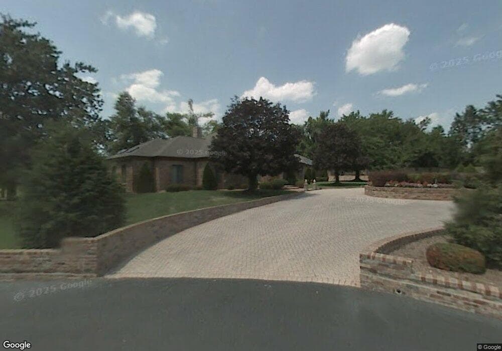
4101 E Pearson Cir Springfield, MO 65809
Southeast Springfield NeighborhoodEstimated Value: $625,000 - $1,290,000
2
Beds
4
Baths
3,905
Sq Ft
$254/Sq Ft
Est. Value
About This Home
This home is located at 4101 E Pearson Cir, Springfield, MO 65809 and is currently estimated at $992,884, approximately $254 per square foot. 4101 E Pearson Cir is a home located in Greene County with nearby schools including Hickory Hills K-8 School, Glendale High School, and Grace Classical Academy.
Ownership History
Date
Name
Owned For
Owner Type
Purchase Details
Closed on
Jul 21, 2021
Sold by
Brown Charles E and Brown Julie A
Bought by
Brown Charles E and Brown Julie A
Current Estimated Value
Purchase Details
Closed on
Apr 30, 2021
Sold by
U S Bank Na
Bought by
Brown Charles E and Brown Julie A
Purchase Details
Closed on
May 18, 2016
Sold by
Brown Harriet H and Brown Charles E
Bought by
Brown Harriet
Purchase Details
Closed on
Oct 3, 2013
Sold by
Umb Bank Na
Bought by
Brown Harriet H
Purchase Details
Closed on
Sep 2, 2010
Sold by
Bank Of America Na
Bought by
Umb Bank Na
Create a Home Valuation Report for This Property
The Home Valuation Report is an in-depth analysis detailing your home's value as well as a comparison with similar homes in the area
Home Values in the Area
Average Home Value in this Area
Purchase History
| Date | Buyer | Sale Price | Title Company |
|---|---|---|---|
| Brown Charles E | -- | None Available | |
| Brown Charles E | -- | None Available | |
| Brown Charles E | -- | None Listed On Document | |
| Brown Harriet | -- | None Available | |
| Brown Harriet H | -- | None Available | |
| Umb Bank Na | -- | None Available |
Source: Public Records
Tax History
| Year | Tax Paid | Tax Assessment Tax Assessment Total Assessment is a certain percentage of the fair market value that is determined by local assessors to be the total taxable value of land and additions on the property. | Land | Improvement |
|---|---|---|---|---|
| 2025 | $9,459 | $189,870 | $35,150 | $154,720 |
| 2024 | $9,400 | $175,200 | $35,150 | $140,050 |
| 2023 | $9,346 | $175,200 | $35,150 | $140,050 |
| 2022 | $6,493 | $154,090 | $35,150 | $118,940 |
| 2021 | $6,493 | $118,900 | $35,150 | $83,750 |
| 2020 | $6,509 | $113,980 | $35,150 | $78,830 |
| 2019 | $6,326 | $113,980 | $35,150 | $78,830 |
| 2018 | $6,337 | $114,230 | $35,150 | $79,080 |
| 2017 | $0 | $102,790 | $35,150 | $67,640 |
| 2016 | $5,633 | $102,790 | $35,150 | $67,640 |
| 2015 | $5,582 | $102,790 | $35,150 | $67,640 |
| 2014 | $5,622 | $102,790 | $35,150 | $67,640 |
Source: Public Records
Map
Nearby Homes
- 3810 E Cherry St Unit C-102
- 3810 E Cherry St Unit 32
- 850 S Mumford Dr
- 4254 E Ridgeview Dr
- 3806 E Cypress Point St
- 4504 E Spruce Dr
- Lot 97 E Cypress Point
- Lot 95 E Cypress Point
- Lot 94 E Cypress Point
- 3805 E Cypress Point
- 254 S Mumford Ct
- Lot 24 N Mumford Ct
- Lot 23 N Mumford Ct
- 3805 E Hutcheson Ave
- 3705 E Cypress St
- 957 S Mission Ave
- 3921 E Woodhue St
- 3919 E Woodhue St
- 3717 E Hutcheson Ave
- 252 S Hickory Hills Blvd
- 4102 E Pearson Cir
- 585 S Mumford Cir
- 4110 E Pearson Cir
- 4054 E Farm Road 136
- 0 S Mumford Cir
- 4127 E Churchill St
- 727 S Mumford Cir
- 4120 E Cherry Crest Ln
- 706 S Mumford Cir
- 4141 E Churchill St
- Lot 2 S Mumford
- 718 S Mumford Cir
- 3956 E Burks Place Unit L 42
- 4004 E Burks Place
- 4004 E Burks Place Unit L 43
- 4144 E Cherry Crest Ln
- 732 S Mumford Cir
- 4012 E Burks Place
- 4012 E Burks Place Unit L44
- 3937 E Saint Andrews Dr
Your Personal Tour Guide
Ask me questions while you tour the home.