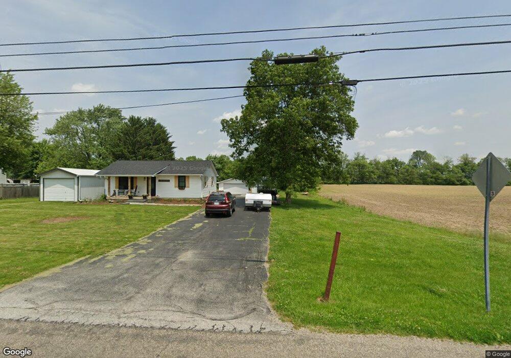
4106 E 500 N Franklin, IN 46131
Rocklane-Reds Corner NeighborhoodEstimated Value: $177,164 - $316,000
3
Beds
1
Bath
1,012
Sq Ft
$238/Sq Ft
Est. Value
About This Home
This home is located at 4106 E 500 N, Franklin, IN 46131 and is currently estimated at $241,291, approximately $238 per square foot. 4106 E 500 N is a home located in Johnson County with nearby schools including Clark Elementary School, Clark-Pleasant Middle School, and Whiteland Community High School.
Ownership History
Date
Name
Owned For
Owner Type
Purchase Details
Closed on
Apr 23, 2024
Sold by
Everett Daniel J and Everett Megan R
Bought by
Woodke Marc E and Woodke Kristine A
Current Estimated Value
Purchase Details
Closed on
Nov 17, 2023
Sold by
Sandefur Donald E and Sandefur Sandra G
Bought by
Everett Daniel J and Everett Megan R
Create a Home Valuation Report for This Property
The Home Valuation Report is an in-depth analysis detailing your home's value as well as a comparison with similar homes in the area
Home Values in the Area
Average Home Value in this Area
Purchase History
| Date | Buyer | Sale Price | Title Company |
|---|---|---|---|
| Woodke Marc E | -- | None Listed On Document | |
| Everett Daniel J | -- | None Listed On Document |
Source: Public Records
Tax History
| Year | Tax Paid | Tax Assessment Tax Assessment Total Assessment is a certain percentage of the fair market value that is determined by local assessors to be the total taxable value of land and additions on the property. | Land | Improvement |
|---|---|---|---|---|
| 2025 | $923 | $167,600 | $0 | $167,600 |
| 2024 | $923 | $127,100 | $0 | $127,100 |
| 2023 | $2,476 | $128,200 | $0 | $128,200 |
| 2022 | $1,079 | $122,900 | $0 | $122,900 |
| 2021 | $796 | $99,800 | $0 | $99,800 |
| 2020 | $684 | $94,900 | $0 | $94,900 |
| 2019 | $637 | $91,100 | $0 | $91,100 |
| 2018 | $743 | $85,800 | $0 | $85,800 |
| 2017 | $434 | $75,700 | $0 | $75,700 |
| 2016 | $568 | $70,400 | $0 | $70,400 |
| 2014 | $517 | $59,800 | $0 | $59,800 |
| 2013 | $517 | $58,800 | $0 | $58,800 |
Source: Public Records
Map
Nearby Homes
- 0 N 300 E Unit MBR21862208
- 2579 E 400 N
- 950 Saddlebrook Farms Blvd
- 30 Benfield Dr
- 930 Saddlebrook Farms Blvd
- 830 Saddlebrook Farms Blvd
- 60 Wilkins St
- 40 Wilkins St
- 50 Wilkins St
- 261 Dyson Dr
- 70 Wilkins St
- 100 Wilkins St
- 1126 Jubilee Ln
- 0 N 200 (Honey Creek Rd ) W Unit MBR21845718
- 870 Blaine Dr
- 810 Pearl St
- 1117 Winterfield Blvd
- 1111 Winterfield Blvd
- 1099 Winterfield Blvd
- 801 Blaine Dr
- 4082 E 500 N
- 4032 E 500 N
- 0 E 500 S Unit 21042097
- 0 E 500 S Unit 21148448
- 0 E 500 S Unit 21471270
- 0 E 500 S Unit MBR22001117
- 0 E 500 S Unit MBR22001077
- 4975 N Hurricane Rd
- 4975 Hurricane Rd
- 0 E 500 N
- 000 E 500 N
- 0000 E 500 N
- 00 N Hurricane Rd
- 0000 N Hurricane Rd
- 0 N Hurricane Rd
- 0 N Hurricane Rd Unit 21411925
- 0 N Hurricane Rd Unit 21430377
- 0 N Hurricane Rd Unit 21475231
- 0 N Hurricane Rd Unit 21566509
- 4957 N Hurricane Rd
Your Personal Tour Guide
Ask me questions while you tour the home.