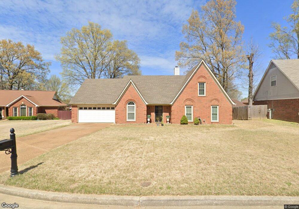
4106 Misty Forest Cove Memphis, TN 38125
Southern Shelby County NeighborhoodEstimated Value: $264,000 - $275,000
3
Beds
2
Baths
2,735
Sq Ft
$99/Sq Ft
Est. Value
About This Home
This home is located at 4106 Misty Forest Cove, Memphis, TN 38125 and is currently estimated at $269,588, approximately $98 per square foot. 4106 Misty Forest Cove is a home located in Shelby County with nearby schools including Lowrance Elementary School, Southwind High School, and Power Center Academy - Southeast.
Ownership History
Date
Name
Owned For
Owner Type
Purchase Details
Closed on
Nov 17, 2005
Sold by
Gray Andre S and Gray Emily
Bought by
Lane Terence D and Lane Calundria Y
Current Estimated Value
Home Financials for this Owner
Home Financials are based on the most recent Mortgage that was taken out on this home.
Original Mortgage
$123,200
Outstanding Balance
$71,880
Interest Rate
7.12%
Mortgage Type
Fannie Mae Freddie Mac
Estimated Equity
$197,708
Create a Home Valuation Report for This Property
The Home Valuation Report is an in-depth analysis detailing your home's value as well as a comparison with similar homes in the area
Home Values in the Area
Average Home Value in this Area
Purchase History
| Date | Buyer | Sale Price | Title Company |
|---|---|---|---|
| Lane Terence D | $154,000 | Assured Escrow & Title |
Source: Public Records
Mortgage History
| Date | Status | Borrower | Loan Amount |
|---|---|---|---|
| Open | Lane Terence D | $123,200 | |
| Closed | Lane Terence D | $30,800 |
Source: Public Records
Tax History Compared to Growth
Tax History
| Year | Tax Paid | Tax Assessment Tax Assessment Total Assessment is a certain percentage of the fair market value that is determined by local assessors to be the total taxable value of land and additions on the property. | Land | Improvement |
|---|---|---|---|---|
| 2025 | $1,616 | $64,950 | $11,400 | $53,550 |
| 2024 | $1,616 | $47,675 | $6,750 | $40,925 |
| 2023 | $1,616 | $47,675 | $6,750 | $40,925 |
| 2022 | $1,616 | $47,675 | $6,750 | $40,925 |
| 2021 | $1,645 | $47,675 | $6,750 | $40,925 |
| 2020 | $1,396 | $34,475 | $6,750 | $27,725 |
| 2019 | $1,396 | $34,475 | $6,750 | $27,725 |
| 2018 | $1,396 | $34,475 | $6,750 | $27,725 |
| 2017 | $1,417 | $34,475 | $6,750 | $27,725 |
| 2016 | $1,286 | $29,425 | $0 | $0 |
| 2014 | $1,286 | $29,425 | $0 | $0 |
Source: Public Records
Map
Nearby Homes
- 7561 Shelby Cross Cir
- 7527 Wilsford Cove
- 7579 Baysweet Dr
- 4028 Long Creek Rd
- 4294 Thunderstone Cir W
- 3912 Autumn Harvest Ln
- 4310 Coral Creek Ln
- 7296 Germanshire Ln
- 7386 Eggleston Rd
- 4056 Clovis Cove
- 7421 Richmond Rd
- 7218 Barnstable Rd
- 7266 Woodshire Rd
- 7380 Isherwood Rd
- 4350 Oak Chase Cove
- 7124 Old Dr N
- 4471 Hughes Meadow Dr
- 4316 Barry Meadows Cove
- 7286 New Britain Dr
- 4351 Spring Oak Cove
- 4110 Misty Forest Cove
- 4100 Misty Forest Cove
- 7557 Lowrance Rd
- 7565 Lowrance Rd
- 7545 Lowrance Rd
- 4115 Misty Forest Cove
- 4114 Misty Forest Cove
- 4096 Misty Forest Cove
- 4105 Misty Forest Cove
- 7573 Lowrance Rd
- 4095 Misty Forest Cove
- 7537 Lowrance Rd
- 7529 Lowrance Rd
- 7579 Lowrance Rd
- 4120 Misty Forest Cove
- 7552 Shelby Cross Cir
- 7544 Shelby Cross Cir
- 7532 Shelby Cross Cir
- 7500 Shelby Cross Cir
- 7506 Shelby Cross Cir