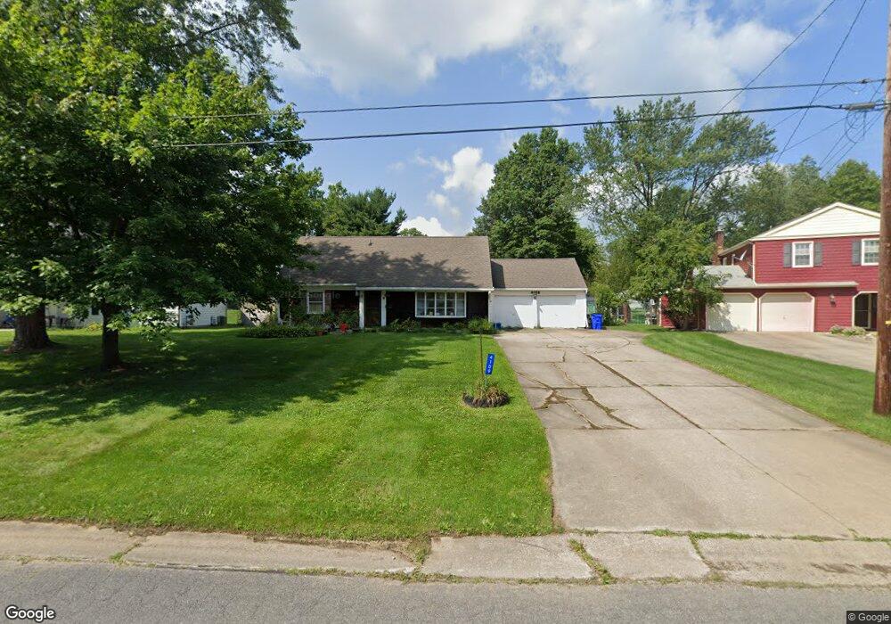
4109 Siefer Dr Rootstown, OH 44272
Estimated Value: $187,666 - $241,000
4
Beds
2
Baths
1,539
Sq Ft
$138/Sq Ft
Est. Value
About This Home
This home is located at 4109 Siefer Dr, Rootstown, OH 44272 and is currently estimated at $212,167, approximately $137 per square foot. 4109 Siefer Dr is a home located in Portage County with nearby schools including Rootstown Middle School - Schnee Building and Rootstown High School.
Ownership History
Date
Name
Owned For
Owner Type
Purchase Details
Closed on
Nov 19, 2011
Sold by
Pruchenski Frances M
Bought by
Irrevocab Galloway Katherine M and Irrevocab Frances M Pruchenski
Current Estimated Value
Purchase Details
Closed on
May 24, 2011
Sold by
Pruchenski Lawrence J
Bought by
Pruchenski Frances M
Purchase Details
Closed on
Feb 8, 2008
Sold by
Pruchenski Lawrence and Pruchenski Frances M
Bought by
Pruchenski Lawrence J and Pruchenski Frances M
Purchase Details
Closed on
Jan 1, 1990
Bought by
Pruchenski Lawrence
Create a Home Valuation Report for This Property
The Home Valuation Report is an in-depth analysis detailing your home's value as well as a comparison with similar homes in the area
Purchase History
| Date | Buyer | Sale Price | Title Company |
|---|---|---|---|
| Irrevocab Galloway Katherine M | -- | Attorney | |
| Pruchenski Frances M | -- | None Available | |
| Pruchenski Lawrence J | -- | Attorney | |
| Pruchenski Lawrence | -- | -- |
Source: Public Records
Tax History
| Year | Tax Paid | Tax Assessment Tax Assessment Total Assessment is a certain percentage of the fair market value that is determined by local assessors to be the total taxable value of land and additions on the property. | Land | Improvement |
|---|---|---|---|---|
| 2025 | $1,687 | $49,320 | $8,120 | $41,200 |
| 2024 | $1,637 | $49,320 | $8,120 | $41,200 |
| 2023 | $1,219 | $34,930 | $8,120 | $26,810 |
| 2022 | $1,211 | $34,930 | $8,120 | $26,810 |
| 2021 | $1,199 | $34,930 | $8,120 | $26,810 |
| 2020 | $1,073 | $31,220 | $8,120 | $23,100 |
| 2019 | $1,078 | $31,220 | $8,120 | $23,100 |
| 2018 | $1,064 | $29,790 | $8,120 | $21,670 |
| 2017 | $1,064 | $29,790 | $8,120 | $21,670 |
| 2016 | $1,034 | $29,790 | $8,120 | $21,670 |
| 2015 | $1,028 | $29,790 | $8,120 | $21,670 |
| 2014 | $1,047 | $29,790 | $8,120 | $21,670 |
| 2013 | $1,040 | $29,790 | $8,120 | $21,670 |
Source: Public Records
Map
Nearby Homes
- 4079 Siefer Dr
- 0 Lynn Rd Unit 5110102
- 3689 Cherry Hill
- 3701 State Route 44
- V/L 2 Lynn Rd
- V/L Lynn Rd
- 4415 Farmette Dr
- 4200 Hattrick Rd
- sub lot Lane Ave
- 0 Tallmadge Rd Unit 5189301
- 0 Tallmadge Rd Unit 5189314
- 4556 Rootstown Rd
- 4140 Sandy Lake Rd
- 4058 Bayberry Knoll Ln
- 3637 Old Forge Rd
- 5394 Juniper Ct
- 3021 Hartville Rd
- 3925 Summit Rd
- 2978 Sandy Lake Rd
- 1065 Shadowlawn Dr
Your Personal Tour Guide
Ask me questions while you tour the home.