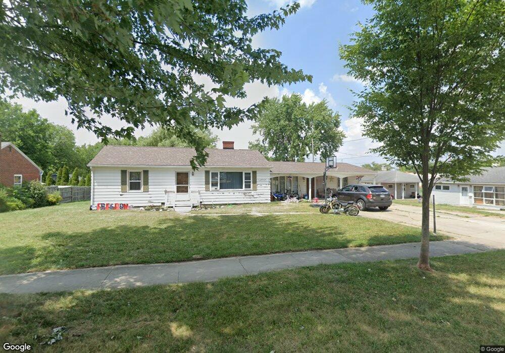
411 E Walnut St Wauseon, OH 43567
Estimated Value: $140,718 - $210,000
3
Beds
2
Baths
1,636
Sq Ft
$104/Sq Ft
Est. Value
About This Home
This home is located at 411 E Walnut St, Wauseon, OH 43567 and is currently estimated at $170,680, approximately $104 per square foot. 411 E Walnut St is a home located in Fulton County with nearby schools including Wauseon Primary School, Wauseon Elementary School, and Wauseon Middle School.
Ownership History
Date
Name
Owned For
Owner Type
Purchase Details
Closed on
Jan 1, 1990
Bought by
Sarnac Lisa
Current Estimated Value
Create a Home Valuation Report for This Property
The Home Valuation Report is an in-depth analysis detailing your home's value as well as a comparison with similar homes in the area
Home Values in the Area
Average Home Value in this Area
Purchase History
| Date | Buyer | Sale Price | Title Company |
|---|---|---|---|
| Sarnac Lisa | -- | -- |
Source: Public Records
Tax History
| Year | Tax Paid | Tax Assessment Tax Assessment Total Assessment is a certain percentage of the fair market value that is determined by local assessors to be the total taxable value of land and additions on the property. | Land | Improvement |
|---|---|---|---|---|
| 2024 | $1,948 | $39,590 | $10,290 | $29,300 |
| 2023 | $2,011 | $39,590 | $10,290 | $29,300 |
| 2022 | $1,810 | $30,280 | $8,580 | $21,700 |
| 2021 | $1,924 | $30,280 | $8,580 | $21,700 |
| 2020 | $1,781 | $30,280 | $8,580 | $21,700 |
| 2019 | $1,747 | $29,270 | $8,580 | $20,690 |
| 2018 | $1,549 | $29,270 | $8,580 | $20,690 |
| 2017 | $1,529 | $29,270 | $8,580 | $20,690 |
| 2016 | $1,501 | $25,870 | $8,580 | $17,290 |
| 2015 | $1,408 | $25,870 | $8,580 | $17,290 |
| 2014 | $1,342 | $25,870 | $8,580 | $17,290 |
| 2013 | $1,617 | $28,850 | $7,320 | $21,530 |
Source: Public Records
Map
Nearby Homes
- 351 E Walnut St
- 527 E Elm St
- 607 E Elm St
- 824 N Ottokee St
- 303 Eastwood St
- 234 W Chestnut St
- 252 W Chestnut St
- 239 W Chestnut St
- 840 Pine St
- 263 W Chestnut St
- 622 Vine St
- 420 Clover Ln
- 594 Douglas Dr
- 1066 Seneca Dr
- 1062 Seneca Dr
- Integrity 1830 Plan at Arrowhead Trails
- integrity 2280 Plan at Arrowhead Trails
- Integrity 2080 Plan at Arrowhead Trails
- 660 Parkside Dr
- 1338 N Park Ln
- 405 E Walnut St
- 510 Lammon Ct
- 448 Marshall St
- 345 Walnut St
- 443 Howard Ave
- 444 Marshall St
- 335 E Walnut St
- 440 Marshall St
- 437 Howard Ave
- 449 Marshall St
- 448 Howard Ave
- 438 Marshall St
- 433 Howard Ave
- 331 E Walnut St
- 444 Howard Ave
- 438 Howard Ave
- 430 Marshall St
- 427 Howard Ave
- 325 E Walnut St
- 437 Marshall St