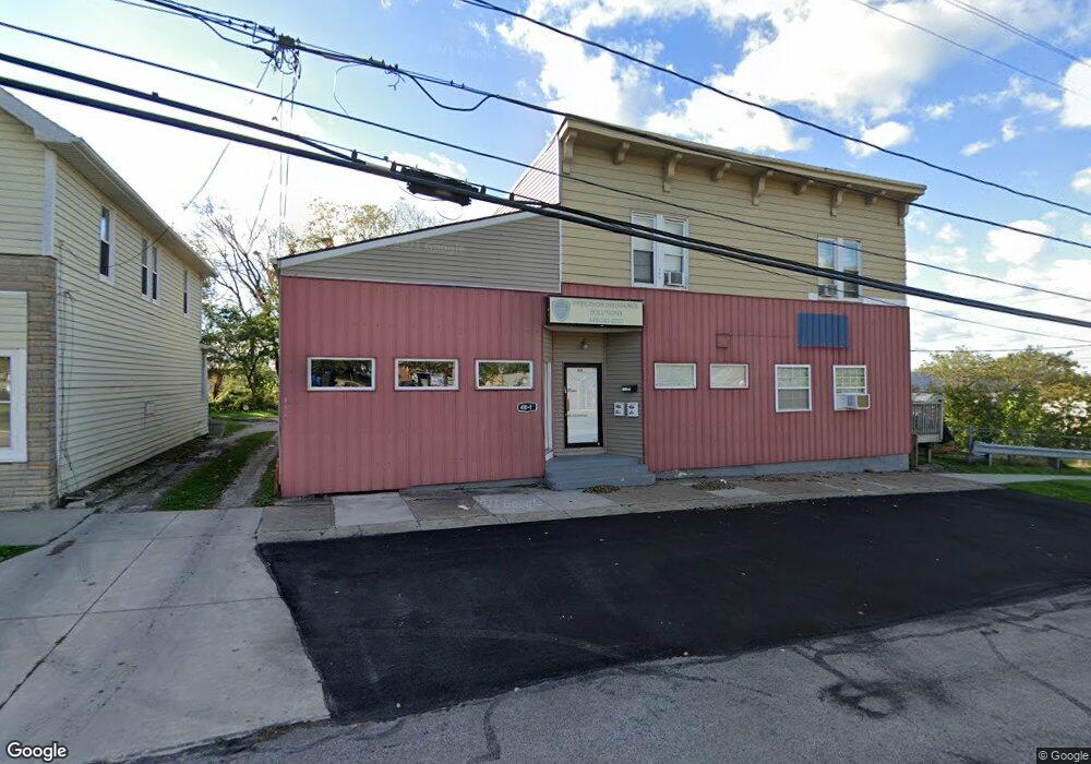
411 High St Unit 2 Fairport Harbor, OH 44077
Estimated Value: $134,607
--
Bed
3
Baths
5,899
Sq Ft
$23/Sq Ft
Est. Value
About This Home
This home is located at 411 High St Unit 2, Fairport Harbor, OH 44077 and is currently estimated at $134,607, approximately $22 per square foot. 411 High St Unit 2 is a home located in Lake County with nearby schools including McKinley Elementary School, Fairport Harding High School, and Summit Academy Community School - Painesville.
Ownership History
Date
Name
Owned For
Owner Type
Purchase Details
Closed on
Jun 4, 2021
Sold by
Lohrey Scott W and Lohrey Cheri K
Bought by
Koti Ltd
Current Estimated Value
Purchase Details
Closed on
Jan 13, 2005
Sold by
Lohrey Scott W and Lohrey Cheri K
Bought by
Lohrey Scott W and Lohrey Cheri K
Home Financials for this Owner
Home Financials are based on the most recent Mortgage that was taken out on this home.
Original Mortgage
$140,000
Interest Rate
5.77%
Mortgage Type
Commercial
Purchase Details
Closed on
Dec 19, 2003
Sold by
Levin Edward
Bought by
Lohrey Scott W
Home Financials for this Owner
Home Financials are based on the most recent Mortgage that was taken out on this home.
Original Mortgage
$105,000
Interest Rate
6.5%
Mortgage Type
Commercial
Purchase Details
Closed on
Oct 4, 1996
Sold by
Oil Chemical & Atomic Wo
Bought by
Edward Levin
Create a Home Valuation Report for This Property
The Home Valuation Report is an in-depth analysis detailing your home's value as well as a comparison with similar homes in the area
Home Values in the Area
Average Home Value in this Area
Purchase History
| Date | Buyer | Sale Price | Title Company |
|---|---|---|---|
| Koti Ltd | $101,300 | Emerald Glen Title Agcy Inc | |
| Lohrey Scott W | -- | -- | |
| Lohrey Scott W | $140,000 | Commonwealth Land Title | |
| Edward Levin | $77,900 | -- |
Source: Public Records
Mortgage History
| Date | Status | Borrower | Loan Amount |
|---|---|---|---|
| Previous Owner | Lohrey Scott W | $140,000 | |
| Previous Owner | Lohrey Scott W | $105,000 |
Source: Public Records
Tax History Compared to Growth
Tax History
| Year | Tax Paid | Tax Assessment Tax Assessment Total Assessment is a certain percentage of the fair market value that is determined by local assessors to be the total taxable value of land and additions on the property. | Land | Improvement |
|---|---|---|---|---|
| 2024 | -- | $29,870 | $7,790 | $22,080 |
| 2023 | $3,034 | $30,140 | $6,560 | $23,580 |
| 2022 | $3,021 | $30,140 | $6,560 | $23,580 |
| 2021 | $3,130 | $30,380 | $6,800 | $23,580 |
| 2020 | $3,029 | $30,380 | $6,800 | $23,580 |
| 2019 | $3,060 | $30,380 | $6,800 | $23,580 |
| 2018 | $3,217 | $32,910 | $6,800 | $26,110 |
| 2017 | $3,387 | $32,910 | $6,800 | $26,110 |
| 2016 | $3,372 | $32,910 | $6,800 | $26,110 |
| 2015 | $2,981 | $32,910 | $6,800 | $26,110 |
| 2014 | $2,946 | $32,910 | $6,800 | $26,110 |
| 2013 | $2,951 | $32,910 | $6,800 | $26,110 |
Source: Public Records
Map
Nearby Homes
- 510 2nd St
- 813 Plum St
- 713 East St
- 224 Burton St
- 216 Harbor Ridge Ln Unit C4
- 204 Everett St
- V/L Singer Ave
- 126 Wetmore Ave
- 1266 Hidden Harbor Dr Unit 68
- 1145 N Saint Clair St
- 9412 Headlands Rd
- 9385 Headlands Rd
- 604 Beacon Dr Unit 25
- 49 Blue Heron Ct
- 37 Blue Heron Ct
- 941 North Ave
- 55 Blue Heron Ct
- 30 Blue Heron Ct
- 54 Blue Heron Ct
- 36 Blue Heron Ct