Estimated Value: $161,000 - $200,771
3
Beds
2
Baths
1,728
Sq Ft
$109/Sq Ft
Est. Value
About This Home
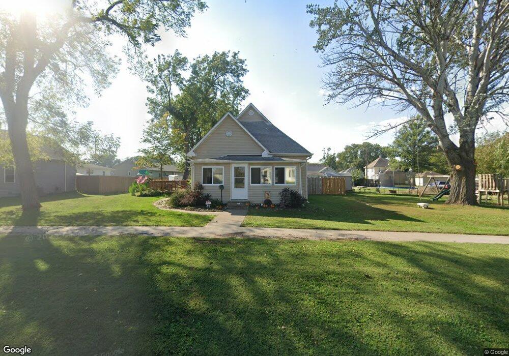
This home is located at 411 N 4th Ave, Logan, IA 51546 and is currently estimated at $187,693, approximately $108 per square foot. 411 N 4th Ave is a home located in Harrison County with nearby schools including Logan-Magnolia Elementary School and Logan-Magnolia Junior/Senior High School.
Ownership History
Date
Name
Owned For
Owner Type
Purchase Details
Closed on
Jan 25, 2024
Sold by
Leonard Brent C
Bought by
Leonard Megan L
Current Estimated Value
Create a Home Valuation Report for This Property
The Home Valuation Report is an in-depth analysis detailing your home's value as well as a comparison with similar homes in the area
Home Values in the Area
Average Home Value in this Area
Purchase History
| Date | Buyer | Sale Price | Title Company |
|---|---|---|---|
| Leonard Megan L | -- | None Listed On Document | |
| Leonard Megan L | -- | None Listed On Document |
Source: Public Records
Tax History Compared to Growth
Tax History
| Year | Tax Paid | Tax Assessment Tax Assessment Total Assessment is a certain percentage of the fair market value that is determined by local assessors to be the total taxable value of land and additions on the property. | Land | Improvement |
|---|---|---|---|---|
| 2025 | $2,582 | $161,940 | $10,500 | $151,440 |
| 2024 | $2,582 | $146,970 | $10,500 | $136,470 |
| 2023 | $2,492 | $146,970 | $10,500 | $136,470 |
| 2022 | $2,058 | $105,537 | $10,500 | $95,037 |
| 2021 | $2,058 | $105,537 | $10,500 | $95,037 |
| 2020 | $1,852 | $97,794 | $10,500 | $87,294 |
| 2019 | $1,836 | $97,794 | $10,500 | $87,294 |
| 2018 | $1,798 | $91,681 | $0 | $0 |
| 2017 | $1,798 | $91,681 | $0 | $0 |
| 2016 | $1,886 | $91,681 | $0 | $0 |
| 2015 | $1,886 | $82,595 | $0 | $0 |
| 2014 | $1,642 | $82,595 | $0 | $0 |
Source: Public Records
Map
Nearby Homes
- 721 Glen Rd
- 114 E 10th St
- 1010 Skyline Dr
- 415 Wessar Dr
- Lot 18 Mulligan Trail
- 2607 220th St
- 2144 Norton Ave
- LOT 27 Mulligan Trail
- 2484 280th St
- LOT 26 Lmvcc Estates
- 2464 Mulligan Trail
- LOT 20 Lmvcc Estates
- LOT 17 Lmvcc Estates
- Lot 17 Lmvcc Estates Trail
- LOT 15 Mulligan Trail
- 2853 Preston Place
- 2740 Whitetail Dr
- LOT D Fieldcrest Dr
- LOT E & K Fieldcrest Dr
- LOT C Fieldcrest Dr