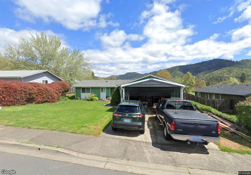
411 Nugget Dr Rogue River, OR 97537
Estimated Value: $313,611 - $335,000
3
Beds
2
Baths
1,140
Sq Ft
$285/Sq Ft
Est. Value
About This Home
This home is located at 411 Nugget Dr, Rogue River, OR 97537 and is currently estimated at $324,903, approximately $285 per square foot. 411 Nugget Dr is a home located in Jackson County with nearby schools including Rogue River Elementary School, South Valley Academy, and Rogue River Junior/Senior High School.
Ownership History
Date
Name
Owned For
Owner Type
Purchase Details
Closed on
Jul 16, 2003
Sold by
Regnaud Jon W and Regnaud Pamela Jean
Bought by
Evans James L and Evans Sharon L
Current Estimated Value
Home Financials for this Owner
Home Financials are based on the most recent Mortgage that was taken out on this home.
Original Mortgage
$122,300
Outstanding Balance
$53,037
Interest Rate
6%
Mortgage Type
Purchase Money Mortgage
Estimated Equity
$271,866
Create a Home Valuation Report for This Property
The Home Valuation Report is an in-depth analysis detailing your home's value as well as a comparison with similar homes in the area
Home Values in the Area
Average Home Value in this Area
Purchase History
| Date | Buyer | Sale Price | Title Company |
|---|---|---|---|
| Evans James L | $152,900 | First American |
Source: Public Records
Mortgage History
| Date | Status | Borrower | Loan Amount |
|---|---|---|---|
| Open | Evans James L | $122,300 | |
| Closed | Evans James L | $30,600 |
Source: Public Records
Tax History
| Year | Tax Paid | Tax Assessment Tax Assessment Total Assessment is a certain percentage of the fair market value that is determined by local assessors to be the total taxable value of land and additions on the property. | Land | Improvement |
|---|---|---|---|---|
| 2026 | $2,341 | $163,510 | -- | -- |
| 2025 | $2,267 | $158,750 | $65,640 | $93,110 |
| 2024 | $2,267 | $154,130 | $63,730 | $90,400 |
| 2023 | $2,193 | $149,650 | $61,880 | $87,770 |
| 2022 | $2,142 | $149,650 | $61,880 | $87,770 |
| 2021 | $2,081 | $145,300 | $60,070 | $85,230 |
| 2020 | $2,028 | $141,070 | $58,320 | $82,750 |
| 2019 | $1,979 | $132,990 | $54,970 | $78,020 |
| 2018 | $1,927 | $129,120 | $53,370 | $75,750 |
| 2017 | $1,884 | $129,120 | $53,370 | $75,750 |
| 2016 | $1,836 | $121,710 | $50,310 | $71,400 |
| 2015 | $1,785 | $121,710 | $47,520 | $74,190 |
| 2014 | $1,728 | $114,730 | $44,780 | $69,950 |
Source: Public Records
Map
Nearby Homes
- 2661 Wards Creek Rd
- 182 Wards Creek Rd
- 105 Brolin Ct
- 707 Wards Creek Rd
- 101 Cedar Ridge Terrace
- 5525 Red Tail Ln
- 5500 Red Tail Ln
- 904 Broadway St Unit 503
- 949 Wards Creek Rd
- 111 Cedar St
- 512 Pine St
- 970 Wards Creek Rd
- 207 Madrone St
- 214 Berglund St
- 815 Pine St
- 815 Pine St Unit 10
- 442 Tenney Dr
- 4529 E Evans Creek Rd
- 208 W Main St
- 210 W Main St
Your Personal Tour Guide
Ask me questions while you tour the home.